

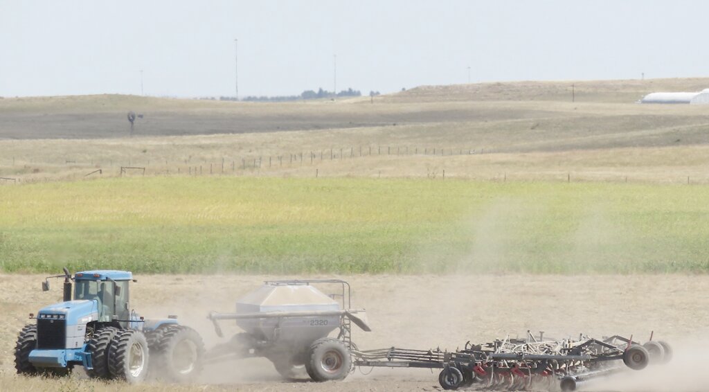
The warmth and sunshine were beneficial to crop maturation and harvest activities. Although many crops had a late start this year and it’s been a cooler than average summer across the region, late season conditions are rapidly advancing crop maturation and drydown.
This item is available in full to subscribers.
To continue reading, you will need to either log in to your subscriber account, or purchase a new subscription.
If you are a current print subscriber, you can set up a free website account and connect your subscription to it by clicking here.
If you are a digital subscriber with an active, online-only subscription then you already have an account here. Just reset your password if you've not yet logged in to your account on this new site.
Otherwise, click here to view your options for subscribing.
Please log in to continue |
KIMBALL – Conditions were generally sunny and warm with scattered and fairly localized precipitation across the tri-state region of southeast Wyoming, northeast Colorado, and the Panhandle of Nebraska over the past week. Most of the regional precipitation came from afternoon and evening thunderstorms in Colorado and Wyoming. For the most part the Nebraska Panhandle remained dry.
The warmth and sunshine were beneficial to crop maturation and harvest activities. Although many crops had a late start this year and it’s been a cooler than average summer across the region, late season conditions are rapidly advancing crop maturation and drydown.
Well managed pastures and rangeland continue to provide abundant browse for cattle and other livestock across the region. Much of this year’s grass is taller in stature than average, and after the first hard freeze should provide plenty of standing, stem-cured grazing throughout autumn and perhaps late into the winter. The abundance of standing grass should also mean good snow capture, and if we see average snowfall this year at least some of that moisture should percolate into the soil profile, providing part of the initial moisture required for greenup in the spring.
Celestial summer will end in the very early morning of September 23 (tonight) with the arrival of the Autumnal Equinox at 12:49 a.m.
Regional Forecast and Conditions
As of Tuesday morning (September 19), the temperature at sunrise was 58 degrees under clear skies. Winds were west at 7 mph and the barometer was rising through 29.96 inches of mercury.
The September 19 NWS forecast for today’s weather (Friday, September 22) anticipates mostly sunny skies with a high of about 71 and a 40 percent chance of showers and thunderstorms after 3 p.m. Tonight will be mostly clear with a low of about 43 and a 30 percent chance of showers and thunderstorms before midnight. Day length will be 12 hours and 12 minutes, night length 11 hours and 48 minutes.
Saturday will be sunny and breezy with a high of about 69 and a slight chance of precipitation. Saturday night will be mostly clear and breezy with a low of about 40.
Sunday will be sunny with a high of about 70. Sunday night will be mostly clear with a low of about 42.
Monday is expected to be sunny with a high of about 78. Monday night should be mostly clear with a low of about 43. Due to the dynamic nature of weather, forecasts beyond 48-72 hours are inexact.
At Kimball the September 12-18 daytime high averaged 77 degrees, the same as last week. The weekly high temperature was 86 degrees on September 17. Overnight lows averaged 43.86, about 3.14 degrees cooler than last week. The weekly low temperature was 39 degrees on September 16. The weekly mean temperature at Kimball was 60.43 degrees, about 1.57 degrees cooler than last week and 0.27 degrees cooler than the September average of 60.7. The 130-year month-to-date (September 1-22) average daily temperature is 61.5. The highest September 1-22 daily average was 70.5 degrees in 1914, with the lowest 54.4 in 1965. The 130-year average high and low temperatures at Kimball for September are 77.0 and 44.4, respectively.
Total liquid precipitation at Kimball over the September 12-18 period was zero inches.
Winds near Kimball averaged southerly and generally mild over the September 12-18 period. Gusts for the week averaged 22.0 mph. High gust for the week was 28 mph on September 18.
Historic climate data
Here’s an overview of September 22 temperature and precipitation highs, lows, and averages over the preceding 130 years at Kimball. Data is taken from the High Plains Regional Climate Center (1893-2016, www.hprcc.unl.edu), and precision weather monitoring on the EJE Ranch south of Kimball (2008-present).
Last year (September 22, 2022): Daily high temperature 50 degrees, overnight low 44 degrees, average temperature 47.0 degrees. Precipitation 1.14 inches, snowfall zero inches, snow depth zero inches.
The warmest September 22 on record was 92 degrees in 1958. The coolest September 22 high temperature was 36 degrees in 2021. The coldest September 22 overnight low was 18 degrees in 1983. The warmest September 22 overnight low was 54 degrees in 1910. Over the years since 1893 the high temperature on September 22 has averaged 74.0 degrees, the overnight low 41.0 degrees, the daily average 57.3 degrees, precipitation has averaged 0.04 inches, snowfall 0.1 inches, snow depth zero inches.
The highest September 22 precipitation total was 1.14 inches (rain) in 2022. Highest snowfall was a trace in 1995, highest snow depth zero inches since 1893.
USDA Weekly Crop Reports, September 18
Nebraska – For the week ending September 17, 2023, there were 5.9 days suitable for fieldwork. Topsoil moisture supplies rated 29 percent very short, 31 percent short, 39 percent adequate, and 1 percent surplus. Subsoil moisture supplies rated 32 percent very short, 33 percent short, 34 percent adequate, and 1 percent surplus.
Corn condition rated 11 percent very poor, 16 percent poor, 23 percent fair, 39 percent good, and 11 percent excellent. Corn dented was 95 percent, near 92 percent for both last year and the five-year average. Mature was 57 percent, ahead of 50 percent last year and 46 percent average. Harvested was 7 percent, near 5 percent both last year and average.
Soybean condition rated 11 percent very poor, 17 percent poor, 25 percent fair, 37 percent good, and 10 percent excellent. Soybeans dropping leaves was 72 percent, ahead of 62 percent last year and 59 percent average. Harvested was 4 percent, equal to both last year and average.
Winter wheat planted was 22 percent, ahead of 16 percent last year, but near 25 percent average.
Sorghum condition rated 5 percent very poor, 8 percent poor, 26 percent fair, 31 percent good, and 30 percent excellent. Sorghum coloring was 95 percent, ahead of 90 percent last year, and near 91 percent average. Mature was 27 percent, near 23 percent last year, and equal to average. Harvested was 2 percent, near 3 percent last year, and equal to average.
Dry edible bean condition rated 3 percent very poor, 6 percent poor, 28 percent fair, 52 percent good, and 11 percent excellent. Dry edible beans dropping leaves was 57 percent, behind 69 percent last year. Harvested was 20 percent, near 23 percent last year.
Pasture and range conditions rated 12 percent very poor, 19 percent poor, 37 percent fair, 24 percent good, and 8 percent excellent.
Wyoming – A combination of varying temperatures and moderate rainfall, along with 6.1 days suitable for field work allowed for steady harvesting progress across Wyoming during the week. Temperatures slightly, ranging from 6 degrees below average to 4 degrees above average. Rainfall was scattered and total accumulations varied, ranging from a trace to as much as 3 inches. Some areas received no measurable rainfall. The U.S. Drought Monitor reported the State drought free.
Reports from Goshen County indicated the heavy rain received slowed down hay and corn silage harvest activities.
Lincoln County reporters noted a good week for haying, and starting additional small grain harvesting, with cool days and freezing nights during the week.
Reports from Campbell County indicated that reservoirs were drying up and subsoil moisture levels were low.
Platte County reporters noted starting corn for silage chopping and cooler temperatures over the last week.
Stock water supplies across Wyoming were rated 1 percent very short, 12 percent short, 86 percent adequate, and 1 percent excellent, compared with 1 percent very short, 14 percent short, and 85 percent adequate last week. Irrigation water supplies were rated 10 percent fair, and 90 percent good, compared with last week’s 9 percent fair, and 91 percent good.
Colorado – Most of the State received moisture last week, although totals varied greatly. Widespread precipitation was reported Friday and Saturday, with most of the State receiving 0.25 inches or more. Counties in the central and southern portion of the State received upwards of three inches in some areas. The U.S. Drought Monitor reported drought conditions prevalent in western and southwestern counties. Just over 15 percent of the State was experiencing abaveragely dry conditions and 13 percent of the State was rated in moderate drought. Three percent of the State was rated in severe drought, equal to last week. Cooler than average temperatures were widespread across the State last week, with some south-central counties experiencing daytime high temperatures more than 12 degrees cooler than average.
Winter wheat seeding continued across the eastern portion of the State.
Reports from the San Luis Valley noted potato harvest was progressing well. Livestock were in good shape, and pastures were maturing as average for the season.
Statewide, third cutting of alfalfa was 70 percent harvested, behind last year at 79 percent and the 5-year average of 78 percent. Fourth cutting is at 9 percent harvested, compared with a 5-year average of 23 percent.
Barley harvest was almost complete, with 95 percent harvested, ahead of last year but slightly behind the 5-year average.
The corn crop continued to mature, with 71 percent of the crop dented, behind the 5-year average of 78 percent, and 14 percent of the crop in the mature stage, behind the 5-year average of 24 percent. Corn harvested for silage continues to progress slowly, with 34 percent of the crop harvested.
Proso millet harvest is at 36 percent, behind the 5-year average of 52 percent.
Potato harvest continued its slow start in the San Luis Valley last week, with 11 percent of the acreage harvested.
Stored feed supplies were rated 1 percent very short, 4 percent short, 89 percent adequate, and 6 percent surplus. Cattle death loss was 1 percent heavy, 68 percent average, and 31 percent light. Sheep death loss was 1 percent heavy, 91 percent average, and 8 percent light.
USDA Weekly Weather Bulletin, September 19
Rain (locally 2 to 4 inches or more) across the southern half of the Plains slowed fieldwork but boosted soil moisture for rangeland, pastures, immature summer crops, and recently planted winter grains. Showers extended to other areas, including the central and southern Rockies. Rainfall was spotty in most other areas of the country, including the Midwest, where corn and soybeans continued to mature at an ahead-of-average pace, especially from the Mississippi Valley westward. Completely dry weather prevailed from the Pacific Coast States to the northern Rockies and northern High Plains. Elsewhere, showers dotted the East.
Meanwhile, the temperature regime featured warmer than-average weather surrounding cool conditions, with weekly readings averaging more than 5 degrees above average in parts of southern Texas, New England, and the Northwest. In contrast, temperatures broadly averaged at least 5 degrees below average across portions of the central and southern Plains, as well as the mid-South and lower Midwest. Elsewhere, temperatures were, surprisingly, average.
U.S. Drought Monitor
USDM reports derive averages from only the most recent 30 year period. Temperature and precipitation predictions derive from National Weather Service (NWS) and National Oceanic and Atmospheric Administration (NOAA) forecasts.
Current drought status for the Nebraska Panhandle, Southwest Wyoming, and Northeast Colorado. Drought Categories: D0 – average dryness. D1 – moderate drought. D2 – severe drought. D3 – extreme drought. D4 – exceptional drought.
(September 12, 2023) Widespread precipitation amounts of 0.5 to 2 inches (locally more) were observed across much of the Great Plains, Upper Mississippi Valley, and East. Improvements were made to areas that received the heaviest amounts. In the wake of a cold front, 7-day (September 5 to 11) temperatures averaged near to slightly below average for the Northern Great Plains and Upper Midwest. Farther to the south, above-average temperatures continued across the southern Great Plains and western Gulf Coast. Since early August, persistent excessive heat coupled with a lack of adequate rainfall led to a rapid onset and intensification of drought from Texas eastward to the Lower Mississippi Valley and parts of the Southeast. Monsoon rainfall began to decrease throughout the Four Corners region and Southwest during early September, while seasonal dryness prevailed along the West Coast.
High Plains: Heavy rainfall (1.5 to 3 inches, locally more) prompted a 1-category improvement to southwestern Kansas along with parts of Nebraska. Also, NDMC’s drought blends were a factor in these improvements. Conversely, 30-day SPEI and soil moisture supported small degradations across eastern parts of Kansas. Worsening soil moisture indicators led to an expansion of severe drought (D2) across northeastern North Dakota.
West: Much of the West was status quo this week as Monsoon rainfall begins to decrease during September and this is a drier time of year for California and the Pacific Northwest. However, low 28-day streamflows and SPEI at various time scales led to an expansion of severe drought (D2) across coastal Washington and northwestern Oregon.
Near-term forecast: Looking ahead through September 23, the NWS Climate Prediction Center (CPC) favors above-average precipitation across the Great Plains and northern to central Rockies. Below-average precipitation is most likely across the Northeast, Mid-Atlantic, eastern Corn Belt, and Tennessee Valley. Increased below-average temperature probabilities are forecast for the central (western) U.S., while 5-day temperatures are likely to ramge close to average throughout the East.
Terminology: EDDI – Evaporative Demand Drought Index. This is an experimental model for drought prediction, using nationwide data from 1980-present. SPI – Standardized Precipitation Index, correlating present month/year precipitation with 30-plus year historical data. SPEI – Standardized Precipitation Evapotranspiration Index. SWE – Snow Water Equivalent.
For more information on the U.S. Drought Monitor, including an explanation of terminology, visit: http://droughtmonitor.unl.edu


