Summery conditions prevail across Tri-State region
Shaun Everston
Posted 6/9/17
Summer-like conditions arrived in the Tri-State region last week, bringing clear, sunny skies, warm daytime temperatures and scattered, light--to-moderate afternoon and evening thunderstorms.
This item is available in full to subscribers.
Attention subscribers
To continue reading, you will need to either log in to your subscriber account, or purchase a new subscription.
If you are a current print subscriber, you can set up a free website account and connect your subscription to it by clicking here.
If you are a digital subscriber with an active, online-only subscription then you already have an account here. Just reset your password if you've not yet logged in to your account on this new site.
Otherwise, click here to view your options for subscribing.
Please log in to continue
Need an account?
Print subscribers
If you're a print subscriber, but do not yet have an online account, click here to create one.
Non-subscribers
Click here to see your options for becoming a subscriber.
Summery conditions prevail across Tri-State region
Posted
Shaun Everston
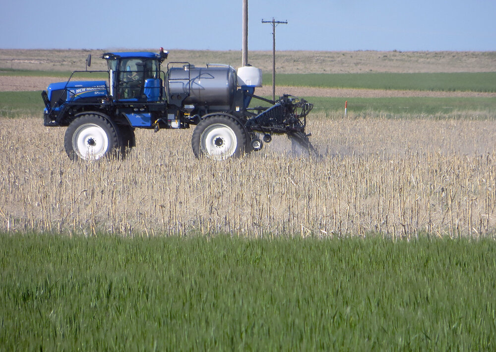
KIMBALL – Summer-like conditions arrived in the Tri-State region last week, bringing clear, sunny skies, warm daytime temperatures and scattered, light--to-moderate afternoon and evening thunderstorms.
Sunshine and warmth dried the land, allowing producers to get back in the field and to work. These conditions also boosted crop growth for winter wheat and other already planted summer crops.
In general, well maintained pastures and rangeland continued to show excellent condition.
Regional Forecast and Conditions Tuesday, June 6
Conditions at Kimball were sunny and clear and expected to remain so through the weekend and into the middle of next week.
Daytime highs through Wednesday, June 14 are expected to range in the mid-80’s with overnight lows falling into the lower 50’s. Skies are expected to be mostly sunny and clear with typical springtime chance of scattered, localized thunderstorms.
Air temperatures warmed across the region last week. At Kimball the May 31 – June 5 daytime high averaged 78.71 degrees, about 10 degrees warmer than the previous week. The weekly high temperature was 85 degrees on June 5. Overnight lows averaged 48.0 degrees, about 6 degrees warmer than the previous week. The weekly low temperature was 43 degrees
on May 30.
The weekly mean temperature was 63.35 degrees, about 8 degrees warmer than the previous week, and about 1.5 degrees cooler than the June average of 65.2 degrees. The long-term average high and low temperatures at Kimball for June are 80.3 and 50.1 degrees.
Precipitation was reported at nine of 13 Panhandle stations over the May 31 – June 5 period. Totals ranged from 1.5 inches at Gordon to just a trace at Harrison and Hemingford. Panhandle precipitation averaged 0.2 inches compared to 0.51 inches last week.
Soil temperatures warmed last week, ranging from 8.8 to 10.9 degrees warmer across
the Panhandle.
May 31 – June 5 soil temperatures (this week/last week/change): Alliance 66.4/57.1 (+9.3) degrees; Gordon 67.7/58.1 (+9.6) degrees; Mitchell 66.1/57.3 (+8.8) degrees; Scottsbluff 66.8/56.2 (+10.6); and Sidney 69.0/58.1 (+10.9) degrees.
Weather Almanac June 9
Overview of temperature and precipitation highs, lows, and averages over the preceding 123 years at Kimball:
June 9, 2016: Daily high 87 degrees, overnight low 51 degrees, average temperature 69.0 degrees. Precipitation zero, snowfall zero, snow depth zero.
U.S. Drought Monitor
June 2
The High Plains: Objective short term blends indicated conditions quickly deteriorating in the Dakotas and eastern Montana. Less than one half inch of precipitation has fallen, 50 percent of normal, during the last 30 days and percentiles were in the D1 D3 range. This prompted the expansion of both D0 and D1 in the area. Based on USDA’s crop progress report released on May 30, North Dakota’s pasture and range conditions are rated 21 percent poor to very poor with topsoil rated at 36 percent poor and subsoil at 23 percent. South Dakota’s pasture and range conditions are rated 26 percent poor to very poor and subsoil were rated at 38 percent and 39 percent. Pasture and range conditions across Montana are rated 17 percent poor to very poor, topsoil, 34 percent, subsoil 20 percent.
Cooler temperatures have slowed Colorado snow melt, causing less than average stream flow in the Yampa, White and Colorado rivers. The remaining snowpack across the region remains above normal across the Upper Colorado River Basins and eastern Colorado for this time of year. The small pocket of abnormal dryness in central Colorado is reflective of drier than normal areas of vegetation and soils.
U.S. Conditions and Weather Report
Most of the Midwest experienced mild, dry weather for the period ending June 6, allowing soybean planting to advance and corn planting to near completion.
Showers extended as far west as the central and southern Plains, with early-season winter wheat harvesting proceeded with few delays. Mostly dry weather across the northern Plains increased stress on rangeland, pastures and spring-sown crops.
Early June temperatures briefly approached or reached 100 degrees as far north as the Dakotas while warm, dry weather dominated the West, melting high-elevation snowpack and promoting a rapid pace of fieldwork and crop development. Temperatures averaged as much as 10 degrees above normal across the interior Northwest.
Cool conditions dominated the nation’s midsection, with weekly temperatures averaging at least 5 degrees below normal across a broad area centered across the upper Midwest. Patchy freezes continued to affect portions of the northern Plains, especially from May 21 – 24.
Areas west of the Rockies experienced a full week of dry weather, promoting a rapid fieldwork pace. In the Far West, very warm weather not only favored crop development but also melted high-elevation snowpack and left some rivers running high.
USDA Weekly Weather and Crop Reports
Colorado
Warmer weather across the state last week accelerated fieldwork. Increased heat units helped push crop development with emergence and growth picking up for several crops.
Isolated severe weather occurred across the state, with localized precipitation received.
Reporters noted that while wheat stripe rust continues to be observed in eastern counties, aerial applications were being done this past week to mitigate.
Livestock are doing well on improved pasture conditions, although insect pests are now becoming a concern for livestock producers.
Winter wheat was beginning to turn color, just behind last year and the average, with 48 percent rated good to excellent statewide, compared with 69 percent good to excellent last year.
Stored feed supplies were rated 1 percent short, 90 percent adequate, and 9 percent surplus.
Sheep death loss was 5 percent heavy, 73 percent average and 22 percent light. Cattle death loss was 1 percent heavy, 76 percent average, and 23 percent light.
Nebraska
For the week ending June 4, 2017, temperatures averaged near normal.
The western half of the panhandle received half an inch to an inch of rain; however, the rest of State remained relatively dry.
Topsoil moisture supplies rated 1 percent very short, 16 short, 81 adequate, and 2 surplus. Subsoil moisture supplies rated 1 percent very short, 12 short, 83 adequate, and 4 surplus.
The warm and dry weather aided planting and spraying activities. There were 6.4 days suitable for fieldwork.
Corn condition rated 0 percent very poor, 2 poor, 19 fair, 70 good, and 9 excellent. Emerged was 91 percent, near 88 last year, and equal to the five year average.
Soybeans planted was 91 percent, near 88 last year and 90 average. Emerged was 62 percent, near 60 last year, but behind 67 average.
Winter wheat condition rated 1 percent very poor, 9 poor, 38 fair, 44 good, and 8 excellent. Winter wheat headed was 96 percent, ahead of 84 last year, and well ahead of 74 average. Coloring was 8 percent, near 9 last year.
Sorghum planted was 71 percent, behind 81 last year, and near 75 average. Emerged was 40 percent, near 38 last year and 37 average.
Oats condition rated 0 percent very poor, 1 poor, 23 fair, 67 good, and 9 excellent. Oats jointed was 90 percent, well ahead of 68 last year. Headed was 62 percent, well ahead of 33 both last year and average.
Alfalfa condition rated 0 percent very poor, 1 poor, 18 fair, 70 good, and 11 excellent. Alfalfa first cutting was 53 percent, behind 59 last year, but ahead of 46 average.
Dry edible beans planted was 13 percent, well behind 43 last year and 37 average.
Proso millet planted was 12 percent.
Pasture and range conditions rated 0 percent very poor, 1 poor, 20 fair, 69 good, and 10 excellent.
Stock water supplies rated 0 percent very short, 2 short, 95 adequate, and 3 surplus.
Wyoming
Wyoming experienced warmer than normal temperatures for the week. Twenty-five out of thirty-four stations reported above average temperatures for the week with the high temperature of 92 degrees recorded at Greybull and a low of 28 degrees at Lake Yellowstone and Shirley Basin.
Seven stations reported no precipitation and Sundance had the most precipitation with 0.19 inches. All thirty-four stations had less than average precipitation.
A reporter from North Central Wyoming indicted that winter wheat looks good.
A reporter from Northeast Wyoming that precipitation is needed. Another reporter from Northeast Wyoming indicated that the grass is drying up. They also indicated that the hay crop does not look good.
A reporter from Western Wyoming indicated that the weather was sunny and warm and the rivers are still swollen from the snow melt. They also indicated that rangeland looked good.
A reporter from South Central Wyoming commented that they have had a lot of cheatgrass infestation affecting pastures and the hay crop.
A reporter from Southeastern Wyoming noted that conditions are quickly drying out. Another reporter from Southeastern Wyoming stated that they have gotten very little precipitation, first cutting of hay is taking place, and things still look green. Another reporter from Southeast Wyoming reported that they have gotten regular rain showers with hail which has slowed field work. They also noted that some of the wheat looks to have hail and freeze damage and some corn had to be replanted as it froze.
Stock water supplies across Wyoming were rated 3 percent very short, 4 percent short, 83 percent adequate, and 10 percent surplus.