

The last few days of calendar spring featured cooler temperatures and widespread rain as a slow moving weather system flowed through the tri-state region.
This item is available in full to subscribers.
To continue reading, you will need to either log in to your subscriber account, or purchase a new subscription.
If you are a current print subscriber, you can set up a free website account and connect your subscription to it by clicking here.
If you are a digital subscriber with an active, online-only subscription then you already have an account here. Just reset your password if you've not yet logged in to your account on this new site.
Otherwise, click here to view your options for subscribing.
Please log in to continue |
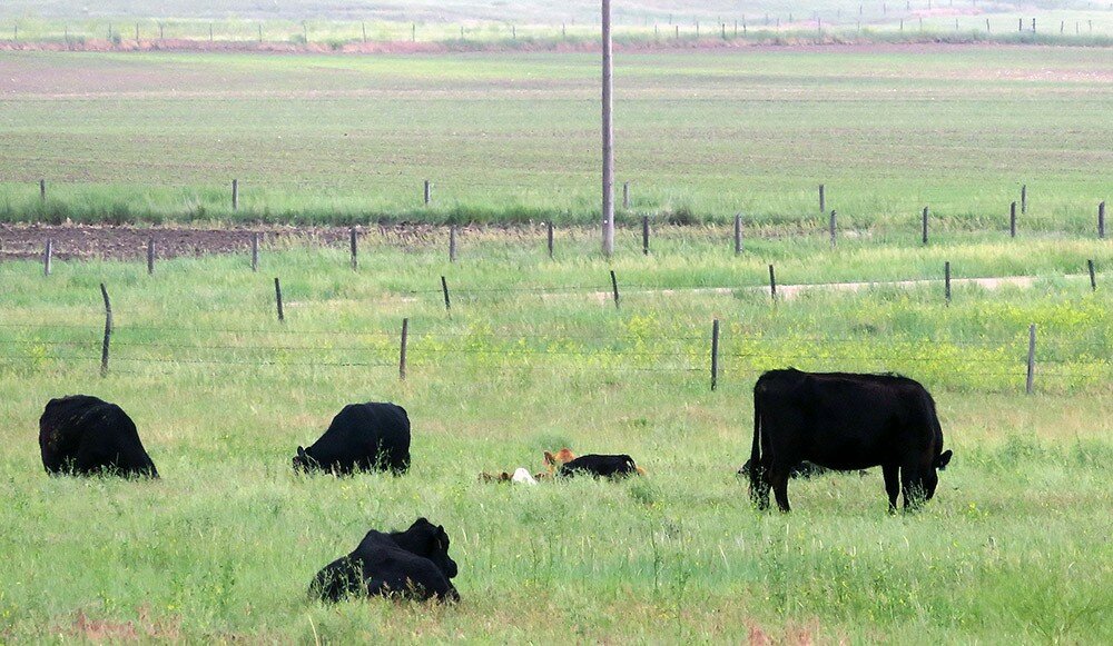
KIMBALL, Neb. – The last few days of calendar spring featured cooler temperatures and widespread rain as a slow moving weather system flowed through the tri-state region.
Once again, rainfall idled fieldwork due to wet soil but also recharged soil moisture.
Pastures and rangeland continued to show and abundance of grass production as warm season grasses settled into rapid growth phase.
The abundance of grass continued to fuel rapid growth of calves and to put cows into prime re-breeding condition.
First day of summer
Calendar and celestial summer arrived early yesterday morning (4:07 a.m., June 21) when the sun, which hadn’t yet popped above the eastern horizon, halted its northward progress and immediately began moving south again. This marked the Summer Solstice and the first day of summer.
The first day of summer is also the longest day and shortest night of the year here in the northern hemisphere. At Kimball the sun rose at 5:22 a.m. and set at 8:31 p.m., making the day 15 hours and nine minutes long. Simple subtraction tells us that the night was therefore eight hours and 51 minutes long.
In six months time, on Friday, Dec. 21, the winter solstice will arrive at 3:23 p.m. At that moment the sun will stop moving south and immediately begin moving north once again. As you might have guessed, Dec. 21 will be the first day of calendar/celestial winter. That day will also feature the shortest day and longest night of the year. The sun will rise at 7:17 a.m. on that frosty morn, and set at 4:28 p.m., yielding a day length of nine hours and 12 minutes and a night length of 14 hours and 48 minutes.
Regional Forecast and Conditions
As of Tuesday morning (June 19), the temperature at sunrise was 56 degrees with fog and mist. Winds were northerly at 7 mph, and the barometer was steady at 30.11 inches of mercury (in/Hg).
Today’s weather (Friday, June 22) is expected to be mostly sunny and warm. The temperature is expected to rise to 80 degrees before falling off to an overnight low of 55. Saturday should be mostly sunny with a slight chance of afternoon and evening thunderstorms and a high of 77 degrees, falling to an overnight low of 52. Sunday is expected to be partly cloudy and slightly cooler with a high of 74 and a chance of showers. Sunday’s overnight low is expected to fall to 50 degrees.
Monday through Wednesday are expected to be similar to the weekend with highs in the mid-70’s and overnight lows falling to near 50 degrees and a continued chance of afternoon and evening thunderstorms.
Despite a cool, wet period over the last four days of spring,24- hour average air temperatures warmed slightly across the region last week. At 13 selected stations across the Panhandle 24-hour temperatures averaged 72.1 degrees, about 1 degree warmer than the previous week. At Kimball the June 12-18 daytime high averaged 82.42 degrees, about 3.5 degrees cooler than the previous week. The weekly high temperature was 96 degrees on June 14. Overnight lows averaged 55.42 degrees, about 1 degree warmer than the previous week. The weekly low temperature was 49 degrees on June 12. The weekly mean temperature at Kimball was 68.92 degrees, about 1.5 degrees warmer than the previous week, and about 3.7 degrees warmer than the June average of 65.2 degrees. The long term average high and low temperatures at Kimball for June are 80.3 and 50.1, respectively.
Eleven of 13 selected Panhandle stations reported rain over the June 12-18 period. Rainfall totals ranged from 2.89 inches at Harrison to 0.17 at Bridgeport. Big Springs and Hemingford did not report precipitation for the week. Across the Panhandle rainfall averaged 0.76 inches, compared to 0.38 inches last week.
Soil temperature changes ranged from -2.8 to +2.9 degrees across the Panhandle over the June 12-18 period: (this week/last week/change): Alliance 73.7/75.3 (-1.6) degrees; Gordon 71.7/73.4 (-1.7) degrees; Mitchell 75.3/73.1 (+2.2) degrees; Scottsbluff 74.4/75.2 (-0.8); and Sidney 74.7/77.6 (-2.9) degrees.
Winds near Kimball averaged easterly and generally mild over the June 12-18 period. Gusts for the week averaged 29.85 mph. High gust for the week was 43 mph on June 16.
June 22 Weather Almanac
Here’s an overview of June 22 temperature and precipitation highs, lows, and averages over the preceding 125 years at Kimball. Data is taken from the High Plains Regional Climate Center (www.hprcc.unl.edu), where you can easily find and track data for your own particular location.
Last year: Daily high temperature 81 degrees, overnight low 60 degrees, average temperature 70.5 degrees. Precipitation 0.20 inches, snowfall zero inches, snow depth zero inches.
The warmest June 22 on record was 102 degrees in 1922. The coolest June 22 high temperature was 57 degrees in 1948. The coldest June 22 overnight low was 35 degrees in 1908. The warmest June 22 overnight low was 65 degrees in 1937. Over the years since 1893 the high temperature on June 22 has averaged 81 degrees, the overnight low 52 degrees, the daily average 66.5 degrees, precipitation has averaged 0.09 inches, snowfall zero inches, snow depth zero inches.
The highest June 22 precipitation total was 1.34 inches liquid equivalent in 2006. There is no record of snowfall or snow depth on June 22 over the last 125 years.
Snow has fallen on June 22 at Kimball zero times over the last 125 years.
U.S. Drought Monitor
National Summary: Over the last week, dry conditions continued in the Desert Southwest and in parts of the Central Rockies, leading to drought persistence and degradation in these areas. Farther east across the Great Plains, scattered thunderstorms led to some areas improving or staying out of drought, while some areas that missed the rain were degraded. In the Upper Midwest and Northern Plains, precipitation patterns also dictated areas which experienced degrading and improving conditions. Near normal or wetter than normal conditions occurred over most of the eastern United States, where few changes to the USDM depiction were made.
High Plains: Significant rainfall fell in parts of the High Plains region, while most of the mountainous areas remained dry. Thunderstorms in northeast Colorado, Nebraska, and northwest and eastern Kansas delivered between 0.5 and 3 inches of rain, helping to prevent additional drying caused by the high temperatures.
Similar rainfall totals in southwest Kansas were enough to lessen precipitation deficits and result in an improvement from extreme to severe drought.
Aside from the Black Hills, much of the Dakotas saw rainfall amounts over a half inch, with some areas exceeding 2 inches. This rainfall led to the removal of abnormal dryness in some areas west of the Missouri River in South Dakota and far southern North Dakota. Recent rainfall also helped decrease moderate drought in northwest South Dakota, though if recent hot weather and a high atmospheric demand for moisture continues, a reversion back to moderate drought conditions may occur.
Severe drought was reduced in coverage in north-central North Dakota, where precipitation deficits over multiple time scales had decreased sufficiently for an improvement.
Meanwhile, over the central Rockies, continued warm, dry weather exacerbated longer term precipitation deficits leading to an expansion of drought and abnormal dryness in north-central Colorado and south-central Wyoming.
West: During the past week, precipitation fell in the mountainous areas of western Washington and Oregon, northern and central Idaho, and parts of western Montana. The highest amounts, with isolated spots in the 2 to 3 inch range, fell in western Washington, western Oregon, southwest Montana, and the southern Idaho Panhandle. Precipitation, some heavier, also fell over the high plains of Montana.
Elsewhere across the region, conditions were quite dry, aside from some isolated precipitation south of Tucson. In the drier areas of central Washington and north-central Oregon, abnormal dryness developed as 1 to 2 month precipitation deficits increased.
Severe drought crept south in southwest and south-central New Mexico due to increasing short- and medium-term precipitation.
Relatively cool conditions occurred in most of central and northern California and in much Oregon and Washington, while above normal temperatures were found in eastern Montana, parts of Idaho, Utah, most of Nevada, and Arizona.
The warmest areas, primarily in New Mexico and Utah, had temperatures reach at least 6 degrees above normal for the weekly average, while the coolest areas saw mercury drop 4 to 8 degrees below normal.
For more information on the U.S. Drought Monitor visit: http://droughtmonitor.unl.edu
U.S. Conditions and Weather Report
Heat in the nation’s midsection boosted weekly temperatures at least 10 degrees above normal across the central Plains and southwestern Corn Belt. A much broader area, stretching from California to the southern Atlantic States, experienced mostly above normal temperatures. Cooler-than-normal conditions were limited to northern sections of the Rockies and High Plains and parts of the Northeast.
Despite mostly above-normal temperatures, showers remained active across much of the North, Southeast, and Midwest. In the rain-affected areas, many summer crops continued to thrive and rapidly develop.
Rainfall was spotty for much of the week across the central and southern Plains, the western Gulf Coast region, and the mid-South, favoring winter wheat maturation and harvesting but increasing stress on summer crops.
At week’s end, Southwestern showers associated with the remnants of eastern Pacific Hurricane Bud provided local drought relief and aided wildfire containment efforts. Some of the late-week showers spilled across the southern High Plains.
Elsewhere, seasonably dry weather prevailed in California and the Great Basin, while cool, showery conditions dominated northern sections of the Rockies and High Plains.
USDA Weekly Weather and Crop Reports
Colorado
Colorado experienced some soil moisture depletion due to very hot and dry conditions last week, although beneficial weekend moisture was received in several areas.
Reporters in northeastern counties noted crops and livestock in areas that received moisture were doing well. A reporter noted dryland crop and rangeland conditions remained a concern for producers in areas that were drier. A reporter also noted some irrigated corn stands were uneven due to earlier dry field conditions.
East central county reporters noted sporadic precipitation was received last week, but the majority of localities remained dry. Above normal temperatures and dry weather continued to deteriorate crop and pasture conditions.
Some southwestern counties received much needed moisture at week’s end, with over an inch reported in areas. However, all conditions remained dire and affected by prolonged extreme drought. Early last week, the San Juan National Forest closed due to fires, affecting livestock producers with grazing permits.
In the San Luis Valley, isolated rain was received but rangeland remained stressed from prolonged dry conditions. A reporter noted the alfalfa crop looked better with harvest moving along. Potatoes were noted to be growing fast and barley was in good shape.
Southeastern counties received limited moisture with isolated hail observed last week. Livestock producers were reported to be putting out supplemental feed and liquidating herds due to drought and limited rangeland grass production. A reporter noted regrowth on alfalfa after harvest was poor due to lack of moisture.
Statewide, winter wheat was rated 51 percent good to excellent, compared with 41 percent good to excellent last year.
Stored feed supplies were rated 7 percent very short, 18 percent short, 73 percent adequate, and 2 percent surplus.
Sheep death loss was 56 percent average and 44 percent light. Cattle death loss was 77 percent average and 23 percent light.
Nebraska
No report published since mid-May.
Wyoming
Wyoming experienced above normal temperatures for the week. Twenty-one of the 33 reporting stations reported above average temperatures for the week with the high temperature of 100 degrees recorded at Torrington and a low of 24 degrees at Yellowstone.
Below normal moisture was reported at 17 of the 32 reporting stations. Two stations (Newcastle and Chugwater) reported no precipitation. Yellowstone reported the most moisture with 2.33 inches.
A reporter from North Central Wyoming noted crops remain behind due to a late spring. Another reporter from North Central Wyoming indicated the moisture situation is mixed and livestock are faring well.
A reporter from Northeastern Wyoming indicated very warm temperatures and wind have taken a toll on cool season grasses with many stands totally cured out.
A reporter from Western Wyoming indicated they got lots of rain over the weekend which has shut down haying for a while but was a welcome relief to the dry conditions in the area.
A reporter from South Western Wyoming stated while they have received some moisture it has not been enough to relieve the overall dry conditions. They also indicated irrigation water is plentiful but the rangeland and non-irrigated pasture is drying out.
A reporter from South Central Wyoming indicated the warm temperatures, sustained winds, and dry conditions has resulted in poor grass growth.
A reporter from Southeastern Wyoming stated good moisture over the weekend slowed the hay harvest.
Irrigation water supply across Wyoming was rated 1 percent poor, 6 percent fair, 88 percent good, and 5 percent excellent.
Stock water supplies across Wyoming were rated 3 percent very short, 8 percent short, and 89 percent adequate.


