

Spring greenup continued apace across the tri-state region over the last week.
This item is available in full to subscribers.
To continue reading, you will need to either log in to your subscriber account, or purchase a new subscription.
If you are a current print subscriber, you can set up a free website account and connect your subscription to it by clicking here.
If you are a digital subscriber with an active, online-only subscription then you already have an account here. Just reset your password if you've not yet logged in to your account on this new site.
Otherwise, click here to view your options for subscribing.
Please log in to continue |
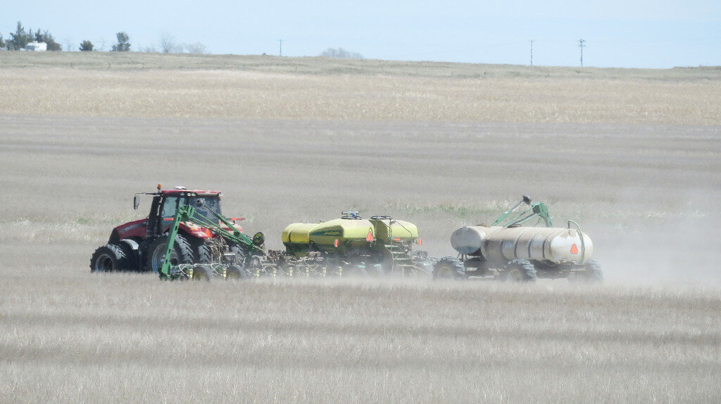
KIMBALL – Spring greenup continued apace across the tri-state region over the last week. Many producers were in the field with tillage and planting operations as daytime sir temperatures ranged in the mid-80s and sunshine prevailed. Scattered afternoon and evening thunderstorms delivered much appreciated rainfall to many locations, further reducing drought pressure which had been considerably eased with the May 1-2 rain and snow event.
Speaking of snow, however, a moisture-bearing cold front was expected to move into the region late yesterday (Thursday) bringing sharply cooler air temperatures, rain, and even snow. As of Wednesday morning forecasters predicted a 40 percent chance of rain and snow showers across the south Panhandle from Thursday evening through Saturday night. Daytime highs were expected to stay below 50 degrees and overnight lows could plunge to as low as 25 degrees Friday and Saturday night.
Depending on the duration of sub-30 degree air temps, this freeze could adversely affect winter wheat stands across the region, many of which are very near the critical flowering stage. The cold snap could also affect tender garden plants.
Regional Forecast and Conditions
As of Tuesday morning (May 17), the temperature at sunrise was 50 degrees under partly cloudy skies. Winds were northwesterly at 8 mph and the barometer was rising at 29.92 inches of mercury (in/Hg).
Today’s weather (Friday, May 20) forecast to be cool, damp, and breezy with a chance of rain and snow. The high will be about 48 degrees. Friday night will be quite cool and blustery with a significant chance of rain and snow showers and a low temperature of about 25 degrees. Day length will be 14 hours and 38 minutes, night length 9 hours and 22 minutes.
Saturday will also be cool and damp with a chance of rain/snow showers early. The daytime high will be about 54 and the mercury will fall to about 30 overnight under partly cloudy skies.
Sunday is expected to be sunny, warmer, and breezy, with daytime highs reaching about 64 and an overnight low of about 39 with a chance of sprinkles.
The Monday-Wednesday forecast calls for mostly sunny skies and breezy conditions. Daytime highs are expected to range in the mid- to upper-60s with overnight lows falling into the mid-40s.
At Kimball the May 10-16 daytime high averaged 73.42 degrees, about nine degrees warmer than last week. The weekly high temperature was 84 degrees on May 16. Overnight lows averaged 41.28 degrees, about 2.43 degrees warmer than last week. The weekly low temperature was 30 degrees on May 10. The weekly mean temperature at Kimball was 57.35 degrees, about 5.71 degrees warmer than last week and 2.35 degrees warmer than the May average of 55.0 degrees. The long term average high and low temperatures at Kimball for May are 69.3 and 40.7, respectively.
Kimball received 0.26 inches of rain on May 16, which was the total for the May 10-16 period.
Winds near Kimball averaged west-southwesterly and occasionally breezy over the May 10-16 period. Gusts for the week averaged 33.14 mph. High gust for the week was 52 mph on May 12.
Historic climate data
Here’s an overview of May 20 temperature and precipitation highs, lows, and averages over the preceding 129 years at Kimball. Data is taken from the High Plains Regional Climate Center where you can find and track data for your own particular location.
Last year (May 20, 2021): Daily high temperature 79 degrees, overnight low 47 degrees, average temperature 63.0 degrees. Precipitation .125 inches, snowfall zero inches, snow depth zero inches.
The warmest May 20 on record was 96 degrees in 1925. The coolest May 20 high temperature was 41 degrees in 2015. The coldest May 20 overnight low was 22 degrees in 1931. The warmest May 20 overnight low was 57 degrees in 1991. Over the years since 1893 the high temperature on May 20 has averaged 69.3 degrees, the overnight low 40.7 degrees, the daily average 55.0 degrees, precipitation has averaged 0.10 inches, snowfall zero inches, snow depth zero inches.
The highest May 20 precipitation total was 1.74 inches (rain) in 1897. Highest snowfall was a trace in 2017, highest snow depth was a trace in 2017.
USDA Weekly Weather Bulletin
An early-season spell of hot, dry Midwestern weather promoted an acceleration of fieldwork, including corn and soybean planting. Weekly temperatures averaged at least 10 to 15 degrees above normal from the southern Plains into the Great Lakes region. Warmth also spilled into northern New England, where temperatures generally averaged 5 to 10 degrees above normal. During the second half of the week, however, scattered showers and thunderstorms returned across the Midwest, with parts of the western Corn Belt experiencing a damaging derecho (widespread, long duration wind storm) on May 12.
Meanwhile, cool, showery weather prevailed in the Northwest, with frost occurring in some areas between precipitation events. In fact, below-normal temperatures covered the West except the southern Rockies and the northern High Plains. Readings averaged more than 10 degrees below normal at scattered locations in the western Great Basin and interior Northwest. Some of the week’s most significant precipitation fell in the Pacific Northwest, as well as eastern Montana, Minnesota, and the Dakotas. Farther south, however, seasonably dry weather persisted in the Southwest.
Elsewhere, widely scattered showers and thunderstorms provided negligible drought relief on the central and southern Plains but resulted in only minor fieldwork delays in the South and East. Field conditions were slightly less favorable in portions of the middle and southern Atlantic States, where occasional showers accompanied cool, cloudy, breezy weather
USDA Crop Progress Reports
Nebraska – For the week ending May 15, 2022, there were 5.1 days suitable for fieldwork. Topsoil moisture supplies rated 10 percent very short, 27 percent short, 62 percent adequate, and 1 percent surplus. Subsoil moisture supplies rated 18 percent very short, 42 percent short, 40 percent adequate, and 0 percent surplus.
Corn planted was 62 percent, well behind 84 percent last year, and behind 77 percent for the five-year average. Emerged was 19 percent, behind 31 percent last year and 32 percent average.
Soybeans planted was 44 percent, well behind 68 percent last year, and behind 51 percent average. Emerged was 8 percent, behind 14 percent last year, and near 11 percent average.
Winter wheat condition rated 13 percent very poor, 18 percent poor, 41 percent fair, 26 percent good, and 2 percent excellent. Winter wheat headed was 10 percent, near 7 percent last year and 11 percent average.
Sorghum planted was 4 percent, behind 15 percent last year and 17 percent average.
Oats condition rated 10 percent very poor, 21 percent poor, 25 percent fair, 41 percent good, and 3 percent excellent. Oats planted was 94 percent, behind 99 percent last year, but near 93 percent average. Emerged was 72 percent, behind 88 percent last year and 79 percent average
Pasture and range conditions rated 17 percent very poor, 24 percent poor, 46 percent fair, 13 percent good, and 0 percent excellent.
Wyoming – For the week ending May 15, 2022, temperatures were below normal for the majority of Wyoming. In some areas of the northwest, temperatures ran as much as 8.0 degrees below normal. In some parts of the east, however, temperatures were above normal. Once again, most areas received below normal amounts of precipitation, though remote areas of the eastern part of the State received 1.5 inches of moisture, while remote areas of the northwest received 1.1 inches of moisture.
According to the U. S. Drought Monitor for May 12, the amount of land rated as abnormally dry was 7.2 percent, up from 5.9 percent last week. Moderate drought was found in 41.5 percent of the state compared to 38.4 percent last week. Severe drought fell slightly to 45.6 percent compared to 47.6 percent last week. Extreme drought fell to 5.7 percent compared to 8.1 percent the previous week.
A report from Big Horn County indicated that much needed rain was received, though the north end of the county was still extremely dry.
Pastures improved with the moisture received in Goshen County, though resulting field conditions delayed corn planting.
The Spring warming trend continued in Lincoln County and irrigation water was being regulated.
Emerging crops and pastures benefitted from the moisture received in Platte County, though southern portions of the County remained dry. Farmers hoped for ongoing weekly rains to keep pastures in condition for grazing.
Across the state, barley planting was 93 percent complete, compared to 88 percent last week. Sugarbeet planting was 88 percent complete, compared to 60 percent last week. Corn planting was reportedly 34 percent complete, compared to 43 percent planted this time last year. Irrigation water supplies were rated 23 percent poor, 57 percent fair, and 20 percent good, compared to 3 percent very poor, 28 percent poor, 52 percent fair, and 17 percent good last week.
Stock water supplies across Wyoming were rated 21 percent very short, 27 percent short, 51 percent adequate, and 1 percent surplus, compared to 25 percent very short, 32 percent short, 42 percent adequate, and 1 percent surplus last week.
Cattle death loss was rated as 10 percent heavy, 51 percent average, and 39 percent light. Sheep death loss was rated as 8 percent heavy, 62 percent average, and 30 percent light.
Colorado – For the week ending May 15, 2022, warm weather helped fieldwork and crop emergence. According to the U.S. Drought Monitor, 92 percent of the State is under drought conditions, up 1 percentage point from last week. Fifty-seven percent of the State is experiencing severe to exceptional drought conditions, up 9 percentage points from last week. Extreme drought conditions are affecting 6 percent of the State, up 2 percentage points from the previous week.
In northeastern and east central counties, reporters noted that wheat conditions and growth rate vary greatly due to continued winds and lack of moisture.
Counties continued to experience strong winds throughout the week, with the northeastern corner of the state experiencing gusts above 50 miles per hour.
Counties in eastern districts saw temperatures more than 10 degrees above average last week.
In Southwestern counties, dry weather and winds continue to deteriorate crop conditions. A county reporter noted that many producers have finished planting spring crops, but some fields have been replanted due to winds blowing seed away.
In the San Luis Valley, potato planting progressed quickly, and some barley fields are being replanted due to high winds. County reports noted fields are starting to green up, but the alfalfa crop was setback by a late frost.
The southeastern counties continue to experience high winds. Above average temperatures and dry conditions throughout the region continue to worsen crop and pasture conditions.
As of May 8, 2022, snowpack in Colorado was 55 percent measured as percent of median snowfall, down 17 percentage points from the previous week. The Southwest and San Luis Valley were 6 and 2 percent, respectively, both down greatly from the previous week.
Stored feed supplies were rated 12 percent very short, 26 percent short, 61 percent adequate, and 1 percent surplus. Sheep death loss was 79 percent average and 21 percent light. Cattle death loss was 1 percent heavy, 83 percent average, and 16 percent light.
U.S. Drought Monitor
USDM reports derive normals/averages from the most recent 30 year period, though longer timescale data are used where available. The USDM generally reports on current drought conditions and offers a comprehensive history of drought across the Continental U.S. Nearterm temperature and precipitation predictions derive from National Weather Service (NWS) and National Oceanic and Atmospheric Administration (NOAA) forecasts.
Current drought status for the Nebraska Panhandle, Southwest Wyoming, and Northeast Colorado. Drought Categories: D0 – abnormally dry. D1 – moderate drought. D2 – severe drought. D3 – extreme drought. D4 – exceptional drought.
(May 10, 2022) This week saw continued improvements on the map across the Pacific Northwest and the northern Plains in response to another round of unsettled weather. In the Pacific Northwest, Northern California, and the northern half of the Intermountain West, a series of disturbances starting last weekend brought cold temperatures and significant snowfall accumulations to the higher elevations of the Cascades, Klamath Mountains, Sierra Nevada, ranges of the northern Great Basin, and the Northern Rockies. Storm totals ranged from 6 to 18+ inches, providing a much-needed boost to mountain snowpack levels. In Northern California, recent storms and cooler temperatures helped to temporarily delay further deterioration of the already shallow snowpack
In the Southwest, unseasonably warm, dry, and windy conditions exacerbated fire-weather conditions where nine large fires are currently impacting the region, including the Hermits Peak Fire in the southern Sangre de Cristo Range, northeast of Santa Fe, New Mexico.
In the northern and central Plains isolated showers and thunderstorm activity led to continued modest improvements in drought-related conditions.
Across the southern Plains and Texas, the first heat wave of the season brought 90-110 degree temperatures. In eastern portions of the southern Plains, isolated heavy rainfall accumulations helped to ease drought conditions. However, drought-stricken areas of western Kansas and Oklahoma largely missed out on recent storm events.
In the Midwest, light to moderate rainfall accumulations (1 to 5 inches) were observed in the southern and western portion of the region this week with most of the region remaining drought-free.
High Plains: On this week’s map, improvement in drought conditions continued in areas of eastern Kansas, Nebraska and eastern South Dakota where another round of storms helped to alleviate short-term deficits as well as provide a modest boost to soil moisture levels and streamflows. However, the longer-term impacts of the drought in western portions of the region are still causing impacts including areas with poor pasture and rangeland conditions and low stock pond levels. In eastern Colorado, conditions degraded in response to continued dryness over the past several months with reports of little new growth of grasses, blowing sand and dust, and very dry soils as well as crops being abandoned in some areas.
For the week, average temperatures were above normal across most of the region with positive departures ranging from 2 to 8 degrees and the greatest departures observed in eastern portions of Colorado and Montana. According to NOAA NCEI, North Dakota logged its second wettest April on record. Likewise, precipitation in South Dakota and Montana was also both above normal for April. In contrast, April was very dry in Kansas and Colorado.
West: Another round of Pacific storms impacted northern portions of the region with beneficial late-season snowfall observed in the Cascades, Klamath Mountains, Sierra Nevada, ranges of the northern Great Basin, and the central and northern Rockies. In response, improvements were made on the map in Oregon, Washington, Idaho, and Montana. In Northern California, precipitation has been above normal during the past 30-day period. However, the recent precipitation did little to make up for significant shortfalls observed since January 1 as well as in the broader longer-term context with 20-plus inch precipitation deficits during the past 24-month period.
Looking at the latest region-level snowpack data across the West, the NRCS SNOTEL network reported the following median SWE levels: Pacific Northwest 124 percent, Missouri 96 percent, Souris-Red-Rainy 113 percent, California 68 percent, Great Basin 61 percent, Upper Colorado 66 percent, Arkansas-White-Red 30 percent, Lower Colorado 10 percent, and Rio Grande 18 percent.
According to NRCS National Water and Climate Center’s reservoir summary report, statewide reservoir storage levels remained below normal across all western states with the exception of Washington state. In the Colorado River Basin, Lake Powell was at 24 percent of capacity and Lake Mead 30 percent of capacity on May 10. In the Rio Grande Basin, New Mexico’s Elephant Butte Reservoir was 13 percent full and Caballo Reservoir 10 percent full. In Arizona, the Salt River system was 76 percent full while the Verde system was 33 percent full with the total system at 71 percent full down two percent from a year ago.
Near-term forecast: The 6-10 day outlook calls for a moderate-to-high probability of above-normal temperatures across the lower two-thirds of the conterminous U.S., while below-normal temperatures are expected across the Pacific Northwest and the Upper Midwest. Below-normal precipitation is expected across Northern California, much of the Intermountain West and Southwest, South, and the Upper Great Lakes region. Conversely, above-normal precipitation is forecasted for portions of the Pacific Northwest and the northern Plains.


