

Widespread but generally light snowfall visited the tri-state region last Friday.
This item is available in full to subscribers.
To continue reading, you will need to either log in to your subscriber account, or purchase a new subscription.
If you are a current print subscriber, you can set up a free website account and connect your subscription to it by clicking here.
If you are a digital subscriber with an active, online-only subscription then you already have an account here. Just reset your password if you've not yet logged in to your account on this new site.
Otherwise, click here to view your options for subscribing.
Please log in to continue |
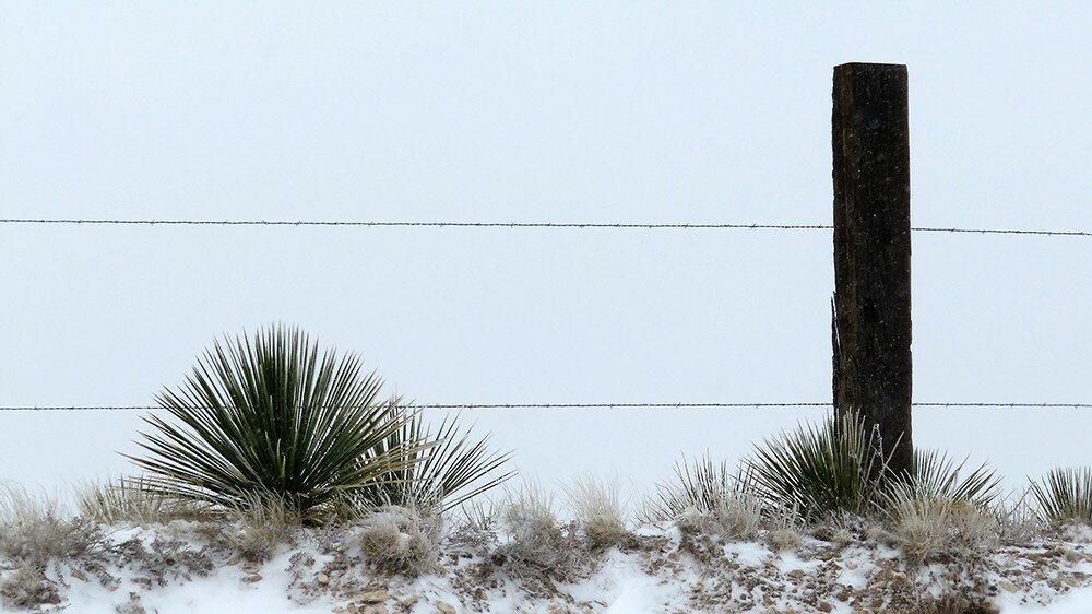
KIMBALL, Neb. – Widespread but generally light snowfall visited the tri-state region last Friday. Temperatures began to fall just after midnight, and by sunrise at Kimball the mercury stood at 15 degrees and light snow was falling. By noon about three inches had accumulated with a liquid moisture content of about 0.33 inches. The sun came out but temperatures remained frigid throughout the day and into Saturday morning.
As the weather front passed, brisk northerly winds set in. Temperatures warmed throughout the early part of the week though the winds remained a constant daytime presence. On Monday morning overcast skies delivered very light rainfall near Kimball, amounting to about 0.05 inches. Farther west, about an inch of morning snow fell along the I-80 corridor near Cheyenne.
Despite the cold temperatures Friday and Saturday springtime green-up continued. Cool season grasses were gaining ground, particularly winter annual grasses like downy brome and winter wheat.
Some of the better wheat stands appeared to be filling in in a few thin spots, but other fields showed more bare patches from winterkill and thin stands from dry conditions and
winter stress.
Pastures and rangeland were greening nicely. Many rangeland forbs were greening as well, and deathcmas and larkspur were greening in abundance in some areas.
Cattle and young calves seemed to weather the snow and cold quite well.
Regional Forecast and Conditions
As of Tuesday morning (April 10), the temperature at sunrise was 36 degrees. The morning was fair and breezy with a northwest wind at 14 mph. The barometer was slowly rising at 30.14 inches of mercury (in/Hg). The day was expected to remain sunny and breezy. Air temperatures were expected to reach 69 degrees before falling to an overnight low of 39 degrees. Warming and breezy conditions were expected to persist through Thursday evening, when forecasters anticipate the arrival of a weather system bringing cooling air temperatures and a good chance of widespread but light rain and rain/snow mix overnight and lingering throughout the day today (Friday).
Today’s weather is expected to be overcast, cool, and windy with a high of 39. A 40 percent chance of snow throughout the day will lessen as evening arrives. The temperature is expected to fall to 19 degrees overnight with a continued but reduced chance of snow. Saturday is expected to be mostly sunny and windy but slightly warmer, with a daytime high of 42 degrees and an overnight low of 22 degrees. Sunday’s forecast calls for continued sunny skies, less wind, and warmer. Sunday’s high should reach 54 degrees before falling off to 26 degrees overnight.
Monday through Wednesday are expected to be sunny, with daytime air temperatures ranging in the 50’s and overnight lows in the 30’s. As of April 10, there was no precipitation forecast for the Monday-Wednesday period.
Daytime air temperatures warmed very slightly across the region last week. At Kimball the April 3-9 daytime high averaged 51.57 degrees, about 0.4 degrees warmer than the previous week. The weekly high temperature was 63 degrees on April 5. Overnight lows warmed about one-half degree, averaging 23.71. The weekly low temperature was 15 degrees on April 7. The weekly mean temperature was 37.64 degrees, about 0.5 degrees warmer than the previous week, and 7.56 degrees cooler than the April average of 45.2 degrees. The long-term average high and low temperatures at Kimball for April are 59.6 and 30.9, respectively.
Widespread snow visited much of the region last week. Over the April 3-9 period 11 of 13 Panhandle stations reported snow with quantities ranging from a trace at Sidney to 3.5 inches at Chadron. Liquid equivalent moisture ranged from a trace at Sidney to 0.47 inches at Gordon. Big Springs and Dalton reported zero precipitation. Snowfall averaged 1.8 inches and liquid equivalent precipitation averaged 0.18 inches. Last week’s averages were 2.8 inches and 0.31 inches respectively.
With the exception of Gordon, which warmed slightly, soil temperatures cooled slightly across the Panhandle over the April 3-9 period: (this week/last week/change): Alliance 38.9/39.5 (-0.6) degrees; Gordon 39.1/38.8 (+0.3) degrees; Mitchell 40.5/42.0 (-1.5) degrees; Scottsbluff 40.9/42.1 (-1.2); and Sidney 41.1/41.5 (-0.4) degrees.
Winds near Kimball averaged west-southwesterly and occasionally breezy over the April 3-9 period. Gusts for the week averaged 36.14 mph. High gust for the week was 52 mph on April 4.
Weather Almanac
Here’s an overview of April 13 temperature and precipitation highs, lows, and averages over the preceding 125 years at Kimball. Data is taken from the High Plains Regional Climate Center (www.hprcc.unl.edu), where you can easily find and track data for your own particular
location.
Last year (April 13, 2017): Daily high temperature 69 degrees, overnight low 28 degrees, average temperature 48.5 degrees. Precipitation zero inches, snowfall zero inches, snow depth zero inches.
The warmest April 13 on record was 85 degrees in 1908. The coolest April 13 high temperature was 30 degrees in 1997. The coldest April 13 overnight low was 7 degrees in 1997. The warmest April 13 overnight low was 48 degrees in 1898. Over the years since 1893 the high temperature on April 13 has averaged 57 degrees, the overnight low 30 degrees, the daily average 43.2 degrees, precipitation has averaged 0.06 inches, snowfall 0.2 inches, snow depth zero inches.
The highest April 13 precipitation total was 0.90 inches liquid equivalent (4.0 inches snow) in 1993. The greatest snowfall was 5.0 inches in 1927. Greatest snow depth was 6.0 inches in 1955.
Snow has fallen on April 13 at Kimball 13 times over the last 125 years, with quantities ranging from a trace to 5.0 inches.
U.S. Drought Monitor
(April 3) National Summary: With a blocking ridge of high pressure anchored over the Southwest, a series of cold fronts tracked across the eastern two-thirds of the Nation. The fronts, however, slowed their southeastward advance across the South and Southeast, and after picking up Gulf moisture, produced numerous and widespread showers and thunderstorms with heavy precipitation (more than 2 inches) from the southern Great Plains northeastward into the northern Appalachians. This was similar to the weather pattern back in mid- to late February when the lower Mississippi, Tennessee, and Ohio Valleys were deluged.
Lighter precipitation occurred across the northern halves of the Rockies and Plains, the upper Midwest, Great Lakes region, western New England, the central Gulf Coast States, and along the Pacific Northwest Coast.
Little or no precipitation fell on the remainder of the Far West, Southwest, southern halves of the Rockies and High Plains, western Corn Belt, along the eastern Gulf and Atlantic Coasts, and most of Alaska.
Weekly temperatures averaged below normal in the northern Rockies, northern and central Plains, Midwest, mid-Atlantic, and Carolinas, and above-normal in the Far West, Southwest, southern Plains, along the Gulf Coast, and in northern New England. In Alaska, readings were much-above normal in western and northern sections and near to below normal in southern and eastern portions. Most of Hawaii and Puerto Rico observed showery weather.
High Plains: In Nebraska, moderate snows fell across southern sections of the state, but D0 was kept as subsoil dryness lingered due to frozen ground earlier in the year that limited infiltration of melting snow or rain. As conditions thaw and additional storms occur, infiltration should increase.
The persistent fall and winter pattern of above-normal precipitation and subnormal temperatures continued this week across Montana, Wyoming, and the western Dakotas, building up the existing snow cover and gradually providing additional relief from long-term drought.
In eastern Montana, SPIs out to 9-months were wet except in the extreme northeastern part of the state (Daniels and Sheridan counties) where D2 lingered. Similarly in extreme western Dakotas and northeastern Wyoming, additional precipitation allowed for a slight nudge of the D0-D2 areas to the east (improvement). However, since this drought goes back to 12-15 months ago, it will take more precipitation to remove these long-term deficits (6-10 inches) and subsoil impacts where D1 and D2 are currently depicted, hopefully during the upcoming wet season (April-July).
In central and eastern North Dakota where the drought was short-term, snow totals of 1-2 inches in the central and 4-6 inches in the east added to 90-day surpluses. Even though soil moisture conditions are less than desired (ground barely frozen at 4” depth), 90-day percent of normal precipitation has shown significant improvement. Therefore, some D1 was improved to D0 in central parts of the state while D0 was erased from eastern areas
In Kansas little or no precipitation meant another week of growing deficits, and based upon indices going out to a year, D3 conditions were common in central and northeastern portions of the state; therefore, D3 was expanded northeastward.
West: After a very wet March and prior week in California, tranquil weather (mild and dry) enveloped the state and much of the West, with only light precipitation falling on western Washington and Oregon, northern Idaho, most of Montana, northern and eastern Wyoming, and northern Colorado.
Fortunately for California, March provided several welcome slugs of moisture to the Sierra Nevada snowpack after one of the driest months of February on record, bumping April 1 statewide SWE readings to 52 percent of normal, up from 23 percent on March 1, but still below the average. Major state reservoirs were at or above normal April 1 averages largely due to last winter’s bountiful precipitation.
In Oregon, last week’s precipitation was also enough to keep status-quo during this week’s dry weather, although April 1 NRCS average basin numbers were still below normal (75-87 percent precipitation, 44-64 percent SWE). WYTD precipitation and SWE statistics are better toward the north and east, with northern Oregon, Washington, most of Idaho, northeastern Nevada, Montana, and Wyoming at or above normal.
Unfortunately, the trend of the Southwest missing significant precipitation during the winter has extended into the spring, with NRCS average basin (especially the Four Corners region states) precipitation and SWE running at 20-70 percent and 0-60 percent of normal, respectively. With most WYTD tools depicting D2-D4 conditions, along with reported impacts, some deterioration was made in northwest Arizona (D2 expansion in Mohave County); north-central Utah (D2 into Salt Lake County, D3 increase in Utah County); southern Colorado (D2 in Pueblo County, D3 into eastern Las Animas, eastern Otero, and western Bent Counties); and a slight southward extension of D3 into west-central and east-central New Mexico. As the spring season continues, temperatures will rise and precipitation normally decreases, so the short-term outlook is not favorable for any improvement based strictly on climatology.
For more information on the U.S. Drought Monitor visit: http://droughtmonitor.unl.edu
U.S. Conditions
and Weather Report
(April 10) Periods of late-season snow continued to fall from the northern Plains into the Midwest and Northeast, while another round of heavy rain perpetuated soggy conditions across the lower Midwest.
Cold air remained firmly entrenched across the Plains, Midwest, and Northeast, holding weekly temperatures more than 20 degrees below normal in parts of Montana, Minnesota, and the Dakotas. Due to the combination of rain, snow, and cold weather, nearly all spring fieldwork remained on hold across the northern half of the country.
At various times during the week, some of the lowest April temperatures on record were observed across the Plains, Midwest, and midSouth. In Illinois, for example, monthly record lows were established on April 2 in locations such as Lincoln (-1) and Quincy (9). Five days later, on April 7, a freeze in Oklahoma and northern Texas threatened jointing winter wheat, much of which has already been adversely affected by drought. By April 8, producers across the interior Southeast monitored temperature-sensitive crops such as ornamentals, winter wheat, blooming fruits, and emerged summer crops, for signs of freeze injury.
Significant rain (locally 2 inches or more) fell in the Mississippi Delta and environs. In contrast, warm, mostly dry weather persisted across southern Florida, while extraordinarily dry conditions maintained severe stress on rangeland, pastures, and winter grains on the southern High Plains.
Dry weather extended into the Southwest, where warmth prevailed, but stormy conditions returned to the Pacific Coast States as far south as the Sierra Nevada. Weekly temperatures averaged at least 10 degrees above normal from southern California to western New Mexico. Late in the week, rain and snow spread farther inland across northern
and central Rockies.
USDA Weekly Weather and Crop Reports
Colorado
(April 9) Fieldwork continued to progress last week despite minor precipitation events across the state. Some areas received scattered moisture last week, but others remained dry and much of the state continued to see adverse effects due to widespread drought conditions.
In northwestern counties, the northern mountains saw heavy snow in areas and some rain at lower elevations. A reporter noted that producers were kept out of fields due to rain and melting snow.
Reporters in northeastern counties noted continued dry weather remained a key concern for rangeland and fall planted crop conditions going forward. Irrigation supplies were noted as adequate, with some perennial hay crops receiving irrigation water as well as pre-irrigation of other fields.
East central and southeastern reporters noted some moisture was received in area counties, while others remained dry and severe drought along with dropping snowpack was a concern. A reporter noted that high winds early in the week in Kiowa county damaged the growing winter wheat crop, which was already stressed due to a continued lack of moisture. Other counties reported multiple rangeland fires and that fire danger remained high due to dry and windy weather.
In southwestern counties, welcome moisture was reported late in the week, but extreme drought conditions persisted.
In the San Luis Valley, reporters noted conditions were ideal for barley planting to begin in earnest.
As of April 9, 2018, snowpack in Colorado was 71 percent measured as percent of median snowfall. The Southwest and San Luis Valley were 42 and 43 percent, respectively.
Stored feed supplies were rated 2 percent very short, 19 percent short, 76 percent adequate, and 3 percent surplus.
Sheep death loss was 53 percent average and 47 percent light. Cattle death loss was 79 percent average and 21 percent light.
Nebraska
(April 9) No report published.
Wyoming
(April 9) Wyoming experienced cooler than normal temperatures for the week. Thirty-two of the 34 reporting stations reported below average temperatures for the week with the high temperature of 64 degrees recorded at Douglas, and a low of 16 degrees below zero at Yellowstone.
Below normal moisture was reported at 18 of the 34 reporting stations with three stations reporting no precipitation. Yellowstone reported the most moisture with 1.57 inches.
A reporter from Northwest Wyoming indicated that two inches of snow stopped any farm progress.
A reporter from North Central Wyoming stated that harsh wind and snow was hard on livestock and no field work had been done yet.
A reporter from Western Wyoming indicated that last week was cold and wet which made the ground too wet to farm and was tough on calving and lambing.
A reporter from South Central Wyoming indicated that they have gotten some moisture but the wind took most of it. Another South Central reporter stated that they had cold and windy weather.
A reporter from Southeast Wyoming indicated that temperatures have been highly variable and just enough moisture to make field work difficult. Another reporter from Southeast Wyoming indicated that below normal temperatures has made pasture green up slow.
Hay and roughage supplies for Wyoming were rated 6 percent very short, 22 percent short, 67 percent adequate, and 5 percent surplus. Stock water supplies across Wyoming were rated 4 percent very short, 11 percent short, 84 percent adequate, and 1 percent surplus.


