

The first two days of Autumn, Sept. 22-23, were quite warm and still, with temperatures nearing 90 degrees under generally cloudless but smoke-filled skies.
This item is available in full to subscribers.
To continue reading, you will need to either log in to your subscriber account, or purchase a new subscription.
If you are a current print subscriber, you can set up a free website account and connect your subscription to it by clicking here.
If you are a digital subscriber with an active, online-only subscription then you already have an account here. Just reset your password if you've not yet logged in to your account on this new site.
Otherwise, click here to view your options for subscribing.
Please log in to continue |
KIMBALL, Neb. – The first two days of Autumn, Sept. 22-23, were quite warm and still, with temperatures nearing 90 degrees under generally cloudless but smoke-filled skies. As usual in late September, the setting sun ushered in rapid evening cooling.
Temperatures dipped last Thursday night, bringing first frost to a number of mid- and northern-Panhandle locations. Friday afternoon and evening a band of thunderstorms flowed across the tri-state region on a southwest-northeast track, delivering widespread, mostly light rainfall. On Monday a similar storm system passed through the region, once again delivering widespread precipitation which was mostly light, albeit fairly heavy in a few locations.
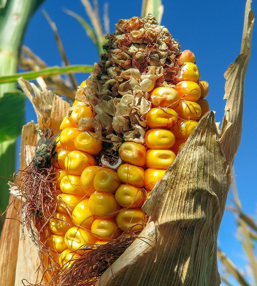
Summer crops continued to mature and dry down toward harvest last week. Beans were being combined across the North Platte Valley, and early-harvest sugarbeets were rolling toward receiving stations in some areas.
Late-season cool season and winter annual grasses continued to produce palatable green browse across well managed pastures and rangeland, and cattle were making good use of the Sept. grass.
Regional Forecast and Conditions
As of Tuesday morning, the temperature at sunrise was 39 degrees under clear skies. Winds were northwesterly at 6 mph and the barometer was rising at 30.23 inches of mercury (in/Hg).
Today’s weather (Friday, Sept. 28) is expected to be mostly sunny following a chance of morning showers. Daytime air temperatures should top out at 56 degrees before falling off to 34 overnight. Saturday and Sunday should be mostly sunny and progressively warmer, with Saturday’s high reaching 65 and Sunday’s high 76. Overnight lows are forecast at 39 and 42, respectively. No precipitation is forecast for Saturday or Sunday.
Monday-Wednesday is expected to be similar to the weekend; mostly sunny with highs in the mid-70’s and lowd in the upper 30’s. No precipitation is forecast through mid-week.
Despite a couple of hot days, average air temperatures cooled across the region last week. At 13 selected stations across the Panhandle, 24-hour temperatures averaged 63.6 degrees, about 6.3 degrees cooler than the previous week. High temperature for the week was 95 degrees at Chadron. Low temperature for the week was 29 degrees at Agate.
At Kimball the Sept. 18-24 daytime high averaged 79.71 degrees, about 11 degrees cooler than the previous week. The weekly high temperature was 89 degrees on Sept. 22-23. Overnight lows averaged 47.28 degrees, about 3.25 degrees cooler than the previous week. The weekly low temperature was 36 degrees on Sept. 21. The weekly mean temperature at Kimball was 63.5 degrees, about 6.75 degrees cooler than last week, and about 3 degrees warmer than the Sept. average of 60.7 degrees. The long-term average high and low temperatures at Kimball for Sept. are 77 and 44.4, respectively.
Twelve of 13 selected Panhandle stations reported rain over the Sept. 18-24 period, ranging from 0.72 inches at Big Springs to 0.03 inches at Scottsbluff. Bridgeport reported zero precipitation. Across the Panhandle rainfall averaged 0.20 inches, compared to 0.07 inches last week.
Reported soil temperatures generally cooled across the Panhandle over the Sept. 18-24 period, although Alliance and Scottsbluff warmed: (this week/last week/change): Alliance 76.4/70.4 (+6.0) degrees; Gordon 66.0/75.8 (-9.2) degrees; Mitchell 71.2/74.3 (-3.1) degrees; Scottsbluff 73.4/72.0 (+1.4) degrees; and Sidney 69.1/72.5 (-3.4) degrees.
Winds near Kimball averaged south-southeasterly and occasionally brisk Sept. 18-24 period. Gusts for the week averaged 26.57 mph. High gust for the week was 33 mph on Sept. 20.
Weather Almanac
Overview of Sept. 28 temperature and precipitation highs, lows, and averages over the preceding 125 years at Kimball. Data from the High Plains Regional Climate Center (www.hprcc.unl.edu), where you can easily find and track data for specific locations.
Last year: Daily high temperature 55 degrees, overnight low 48 degrees, average temperature 51.5 degrees. Precipitation 0.03 inches, snowfall zero inches, snow depth zero inches.
The warmest Sept. 28 on record was 91 degrees in 2001. The coolest Sept. 28 high temperature was 39 degrees in 1984. The coldest Sept. 28 overnight low was 20 degrees in 1895. The warmest Sept. 28 overnight low was 54 degrees in 1956. Over the years since 1893 the high temperature on Sept. 28 has averaged 69 degrees, the overnight low 38 degrees, the daily average 53.6 degrees, precipitation has averaged 0.04 inches, snowfall 0.01 inches, snow depth zero inches.
The highest Sept. 28 precipitation total was 0.9 inches (6 inches snow) liquid equivalent in 1902.
Snow has fallen on Sept. 28 at Kimball three times over the last 125 years, with 6 inches in 1945 and and a trace in 1984 and 1985.
U.S. Drought Monitor
National Summary: Three tropical systems drenched three separate drought areas this past week; Hurricane Florence affecting the Carolinas with record rainfall, a low pressure system in the western Gulf of Mexico bringing rain to parts of Texas and Louisiana, and Tropical Storm Olivia bringing yet more rain to Hawaii. Drought conditions improved or were alleviated across these regions.
Some showers and thunderstorms were seen across the Plains, but not enough to improve drought conditions. Unfortunately, many areas experiencing severe to exceptional drought saw little to no rainfall, with the dryness often accompanied by warmer-than-normal temperatures for this time of year, exacerbating conditions. Notably, eastern Oregon, northern Utah, and western Colorado all saw expansion of extreme or exceptional drought.
High Plains: No changes were made this week to the depictions in Nebraska as agricultural conditions in the state are good as the season ends and maturation is ahead of schedule.
A small patch of D0 from west central Kansas farther west into eastern Colorado improved to normal, where rainfall has been average to above average over the past 1 to 3 months. In east central Colorado, D1 was extended into northern Elbert County, where virtually all crops in this county were rated very poor this year. Additionally, D0 was expanded slightly eastward in southern Wyoming and eastern Colorado. Exceptional drought (D4) was added to southeast and central Mesa County, and Delta County in western Colorado. Record low snowpack this winter and near-record high evaporative demand this summer have led to rapidly depleting water supplies.
Moderate drought was expanded to central Sweetwater County, Wyoming, where hot, dry conditions have prevailed through much of the warm season and precipitation for the water-year-to-date is below normal.
Generally dry conditions continued in northwestern North Dakota, where precipitation over the past two months has been less than 30 percent of normal. Moderate (D1) and severe (D2) drought were expanded westward in this area. In the southwest, D1 was expanded slightly in Hettinger County, where precipitation has been just 20 percent of normal for the same period. However, conditions were better to the east, and normal conditions returned to northern Brant and much of western Morton Counties.
In western South Dakota, Haakon County experienced an area of severe droughty. Local reports indicate many crops have been cut for feed due to drought, with low yields predicted in fields left standing. Winter wheat planting in the region is starting out dry.
Moderate drought was expanded where rainfall has been less than 25 percent of normal over the past two months. Both moderate and severe drought were expanded in north central and northeastern part of the state. Impacts here include early chopping of corn for silage instead of growing for grain harvest, low corn and soybean yields and test weights, and early harvest due to drought. Abnormal dryness and moderate drought were also expanded in central South Dakota. Pierre has received less than 25 percent of its average rainfall over the past two months.
With little to no rain and temperatures reaching into the upper 80s, drought conditions deteriorated toward the south/southwest in eastern Kansas.
West: According to the most recent USDA statistics released on Sept. 16, the extent of topsoil and subsoil rated short or very short of moisture (poor or very poor conditions) was 93 and 92 percent, respectively, for Oregon. Extreme drought (D3) conditions were extended southward in Malheur and Harney Counties in the eastern part of the state. Streamflow along the Owyhee River in this area is near the historical low. Additionally, the area of moderate drought (D1) was expanded northward over most of eastern Morrow, Umatilla, and Union Counties, and severe drought (D2) northward over most of western Morrow, Gilliam, and Sherman Counties. In the latter area, several wildland fires burned extensive acreage in July and August due to extreme dry and hot conditions.
In Utah, D3 was introduced to an area east of the Great Salt Lake, encompassing part of the Wasatch-Cache National Forest. There has been little to no rainfall in this region over the past week with temperatures reaching the upper 80s and 90 degrees. No changes were made this week across the remainder of the west.
Near-term forecast: The Climate Prediction Center’s 6-10-day outlook through the end of September favors below-average temperatures over central California and the Northwest eastward to northern Minnesota, and central and northern New England. while above-average temperatures are forecast for most of the rest of the contiguous U.S. The likelihood of warmer than average temperatures is highest in the Southeast and Alaska, with cooler than average temperature chances greatest across Montana. The probability of more than average precipitation is greatest over the northern U.S. from Oregon to Michigan and through the Plains into the deep South.
For more information on the U.S. Drought Monitor visit: http://droughtmonitor.unl.edu
U.S. Conditions and Weather Report
(Sept. 25) The interaction between a cold front and moisture associated with the remnants of a tropical depression contributed to heavy rainfall in the south central U.S.
Weekly rainfall totaled 4 to 8 inches or more across parts of the southeastern Plains, with a much larger area from the southern Rockies into the Tennessee Valley receiving heavy showers.
Heavy rain, locally in excess of 4 inches, also soaked parts of the upper Midwest, halting fieldwork and triggering significant flooding in northwestern Iowa and environs.
The slow-moving remnants of Hurricane Florence sparked additional flooding in the southern Mid-Atlantic region before the storm finally accelerated northeastward. Runoff from heavy rainfall resulted in prolonged river flooding in eastern North Carolina and southeastern South Carolina.
Weekly temperatures averaged at least 5 degrees above normal in a broad area covering the Southwest, the central Plains, and much of the eastern half of the country. The protracted late-season warm spell boosted weekly temperatures as much as 10 degrees above normal in some locations, particularly in the Ohio and Tennessee Valleys. In contrast, cooler-than-normal conditions dominated northern California and the Pacific Northwest, as well as the northernmost Plains.
Elsewhere, little or no rain fell across the lower Southeast and from the central Plains into the eastern Corn Belt, while much of the West remained completely dry. Through week’s end, year-to-date U.S. wildfires had burned about 7.4 million acres of vegetation, roughly 25 percent more than the annual average over the last 10 years.
USDA Weekly Weather and Crop Reports
Colorado
(Sept. 24) In Colorado last week, hot and dry weather was widespread with reported isolated precipitation across the state.
In northeastern counties, winter wheat planting progressed well despite dry soil conditions. Livestock were reportedly in good condition, with producers marketing calves to alleviate using forage.
Northeastern and east central counties noted winter wheat being seeded into dry topsoil.
In southwestern counties, hot and dry temperatures provided no relief from exceptional drought conditions, and very little winter wheat has been planted.
In the San Luis Valley, potato harvest picked up last week as well as producers starting the third cutting of alfalfa.
Stored feed supplies were rated 7 percent very short, 18 percent short, 71 percent adequate, and 4 percent surplus.
Sheep death loss was 70 percent average and 30 percent light. Cattle death loss was 75 percent average and 25 percent light.
Nebraska
No report published since mid-May.
Wyoming
(Sept. 24) Wyoming experienced warmer than normal temperatures for the week. Twenty-two of 32 reporting stations reported above average temperatures for the week with the high temperature of 94 degrees recorded at Old Fort Laramie and a low of 20 degrees at Jackson Hole.
Below normal moisture was reported at 31 of the 34 reporting stations. Twelve reporting stations had no moisture. Gillette reported the most moisture with 0.63 inches.
A reporter from North Central Wyoming indicated that they have had nice fall weather, the livestock look good, and the fields are being prepared for fall planting.
A reporter from Western Wyoming reported that it has been very dry and smoky from the fires. They also report that producers are hauling water for livestock and the rivers are dry.
A reporter from South Central Wyoming noted that it has continued to be dry with stock water and dry range conditions becoming a problem.
A reporter from Southeastern Wyoming stated that little to no moisture has been received and wheat is emerging but does not look great.
Irrigation water supply across Wyoming was rated 1 percent very short, 3 percent short, 11 percent fair, and 85 percent good.
Stock water supplies across Wyoming were rated 14 percent very short, 24 percent short, and 62 percent adequate.


