

Spring warmup has been slightly slower and just slightly cooler
This item is available in full to subscribers.
To continue reading, you will need to either log in to your subscriber account, below, or purchase a new subscription.
Please log in to continue |
KIMBALL – Spring warmup has been slightly slower and just slightly cooler over the last two years. Mean daily air temperatures last month were about 2.36 degrees cooler than the 129-year average. There were also two consecutive days of hard freeze. Cool season grasses are only now hitting their rapid growth phase and many shrubs and wildflowers are only now unfurling leaves and blossoms. The slow warmup is only slow when compared to the long-term average, however, and is merely a feature of natural weather pattern variability. On a strongly positive note, so far as agriculturalists are concerned, abundant precipitation in May has recharged the soil moisture profile after 18 months of very dry conditions.
Despite one 90-degree day over the last week conditions were on the cool and cloudy side with scattered and intermittent light rain and locally heavy thunderstorms. The cool and damp conditions slowed spring fieldwork somewhat, but producers were getting tillage and planting accomplished as conditions allowed.
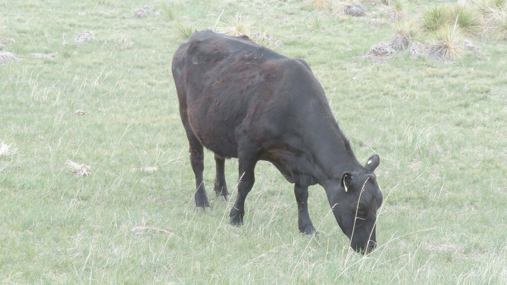
Pasture and rangeland greenup were beginning to hit full stride across the south Panhandle last week as cool season grasses entered their rapid growth windows with adequate moisture, and cattle certainly appeared to be relishing new green grass.
A limited follow-up survey of winter wheat fields south of Kimball revealed some developing grain head capture in less mature stands while more mature stands are fully headed and appear to have avoided damage. The next week or so should reveal whether heading and flowering takes place as normal.
Regional Forecast and Conditions
As of Tuesday morning (May 31), the temperature at sunrise was 47 degrees under increasingly cloudy skies. Winds were Northwesterly at 13 mph and the barometer was rising at 30.02 inches of mercury (in/Hg).
Today’s weather (Friday, June 3) is expected to be sunny and with a high temperature of 76 degrees and a 40 percent chance of afternoon and evening thunderstorms. Skies will be mostly cloudy overnight and the low will fall to about 45 degrees. Day length will be 14 hours and 58 minutes, night length 9 hours and 2 minutes.
Saturday and Sunday are expected to be near duplicates with sunny skies, air temperatures reaching about 77, and a 50 percent chance of afternoon and evening thunderstorms. Saturday and Sunday night should see temperatures dropping to just under 50 degrees under mostly cloudy skies.
Monday is forecast to be similar to the weekend but somewhat breezy. Skies should be sunny, and the air temperature should climb to about 76 before falling off to about 50 overnight. The chance of afternoon and evening thunderstorms is once again about 50 percent.
The remainder of the week may see the arrival of another slow moving, moisture bearing cold front. Skies will likely be cloudy and there is a solid chance of rain showers developing. Daytime highs should reach into the 70’s with overnight lows falling to between 45 and 50 degrees.
At Kimball the May 24-30 daytime high averaged 72.14 degrees, about 8.86 degrees warmer than last week. The weekly high temperature was 90 degrees on May 27. Overnight lows averaged 41.28 degrees, about six degrees warmer than last week. The weekly low temperature was 32 degrees on May 25. The weekly mean temperature at Kimball was 56.71 degrees, about 7.43 degrees warmer than last week and 1.71 degrees warmer than the May average of 55.0 degrees. The long-term average high and low temperatures at Kimball for May are 69.3 and 40.7, and for June, 80.3 and 50.1, respectively.
Kimball received just over 0.19 inches of rain May 29-30 which was the total for the May 17-23 period.
Winds near Kimball averaged northwesterly and gusty during periods of thunderstorm activity during the May 24-30 period. Gusts for the week averaged 32.57 mph. High gust for the week was 60 mph on May 29.
May weather almanac
Average 7 a.m. conditions: temperature 44.54 degrees, winds southerly at 8.16 mph, barometer 32.06 inches of mercury (in/Hg).
Average daily high temperature 66.83 degrees (129-year average 69.3). Average daily low temperature 38.45 degrees (129YA 40.7). Daily average temperature 52.64 degrees (129YA 55.0). Total liquid precipitation 3.77 inches (129YA 2.78). Year to date (YTD) precipitation 8.96 inches (129YA 3.71). Total snowfall 8.5 inches (129YA 1.1). YTD snow 47.68 inches (129YA 26.4).
Departures: Daily High, -2.47 degrees; Daily Low, -2.25 degrees; Daily Average, -2.36 degrees; Total Liquid Precipitation, +0.99 inches; YTD precipitation +5.25 inches. Total Snow +7.4 inches, YTD snow +21.28 inches.
USDA crop progress reports
Nebraska – For the week ending May 29, 2022, there were 4.5 days suitable for fieldwork. Topsoil moisture supplies rated 12 percent very short, 26 percent short, 59 percent adequate, and 3 percent surplus. Subsoil moisture supplies rated 17 percent very short, 37 percent short, 46 percent adequate, and 0 percent surplus.
Corn planted was 95 percent, near 97 percent last year and 94 percent for the five-year average. Emerged was 73 percent, behind 81 percent last year, and near 77 percent average.
Soybeans planted was 87 percent, behind 93 percent last year, but near 83 percent average. Emerged was 55 percent, behind 65 percent last year, but near 52 percent average.
Winter wheat condition rated 16 percent very poor, 17 percent poor, 38 percent fair, 25 percent good, and 4 percent excellent. Winter wheat headed was 50 percent, near 46 percent last year and 49 percent average.
Sorghum planted was 55 percent, ahead of 43 percent last year, and near 52 percent average.
Oats condition rated 12 percent very poor, 14 percent poor, 28 percent fair, 39 percent good, and 7 percent excellent. Oats emerged was 93 percent, near 96 percent last year and 92 percent average.
Dry edible beans planted was 21 percent, near 18 percent last year, and ahead of 12 percent average.
Pasture and range conditions rated 15 percent very poor, 23 percent poor, 42 percent fair, 18 percent good, and 2 percent excellent.
Wyoming – For the week ending May 29, 2022, temperatures were mostly at or below normal for the majority of Wyoming. The exception was in northeastern Wyoming, where temperatures ran as much as four degrees above normal in isolated areas. Precipitation levels varied. Portions of the west and northeast received above normal levels of moisture, while in the central and eastern areas of the State precipitation levels were at or somewhat below normal. According to the U.S. Drought Monitor for May 26, 2022, the amount of land rated as abnormally dry was 7.4 percent, unchanged from last week. Moderate drought was found in 45.4 percent of the State, down slightly from 45.5 percent last week. Severe drought fell to 39.1 percent compared to 41.4 percent last week. Extreme drought increased to 8.1 percent, compared to 2.4 percent last week.
A report from Goshen County indicated crops were in good shape and recovered well after hard freezes occurred last week.
The week began with good weather in Lincoln County, but colder conditions ensued with rain and snow as the week ended. Conditions were adversely cold for the last week of May.
Soils benefitted from the light rains received in Platte County but not enough to help pasture lands or emerging crops. Temperatures remained below normal and grasses were not growing as expected. Warmer days were needed for good growth and pivots were running in some areas.
A report from Weston County indicated last weekend was the first time this season that the entire county received moisture. A late frost damaged or killed some alfalfa fields. Wildlife were returning to their normal grazing behaviors and additional livestock losses were reported from the April storm.
Irrigation water supplies were rated 15 percent poor, 60 percent fair, and 25 percent good, compared to 19 percent poor, 64 percent fair, 16 percent good, and 1 percent excellent last week.
Stock water supplies across Wyoming were rated 8 percent very short, 20 percent short, 69 percent adequate, and 3 percent surplus, compared to 12 percent very short, 24 percent short, 60 percent adequate, and 4 percent surplus last week.
U.S. drought monitor
USDM reports derive normals/averages from the most recent 30-year period, though longer timescale data are used where available. The USDM generally reports on current drought conditions and offers a comprehensive history of drought across the Continental U.S. Nearterm temperature and precipitation predictions derive from National Weather Service (NWS) and National Oceanic and Atmospheric Administration (NOAA) forecasts.
Current drought status for the Nebraska Panhandle, Southwest Wyoming, and Northeast Colorado.
A strong upper-level trough moved across the contiguous U.S. (CONUS) during the week of May 18-24. Surface low pressure systems and cold fronts were associated with this complex trough. They tapped Gulf of Mexico moisture to spread above-normal precipitation across parts of the Plains, Midwest, Southeast, and Mid-Atlantic Coast, and locally heavy snow across parts of Colorado. One of the fronts moved very slowly across the southern Plains near the end of the week, dumping locally heavy rain on parts of Oklahoma and Texas. Precipitation also fell across parts of the Pacific Northwest, North Dakota, and western Great Lakes. Most of the West was drier than normal, with much of the area from Oregon to California and southern Idaho to New Mexico receiving little to no precipitation. Weekly temperatures averaged below normal behind the fronts from the Pacific Northwest to Great Lakes and from the northern Rockies to Mid-Mississippi Valley. Temperatures averaged warmer than normal across the eastern third of the CONUS and from California to Texas.
High Plains: Two inches or more of precipitation fell across southern and eastern parts of Kansas, central Colorado, and northeast Nebraska, while half an inch or more was widespread across North Dakota. Parts of Nebraska, northeast Colorado, Wyoming, South Dakota, and eastern Montana received less than half an inch of precipitation. In Colorado, moderate to extreme drought contracted where it was wet, while severe and extreme drought expanded where it was dry. Abnormal dryness and moderate to extreme drought shrank in parts of Kansas. The rain ate a hole into severe drought in northeast Nebraska. Abnormal dryness and moderate drought were trimmed in western North Dakota. On the other hand, it was a dry week in western Wyoming with D3 expanding in Teton County.
Near-term forecast: The 6–10-day outlook favors above-normal precipitation in the Pacific Northwest, Great Plains, Southeast, and most of Alaska, but below-normal precipitation for the Midwest to Northeast and California to southern Nevada. Warmer-than-normal temperatures are likely for May 31-June 4 across most of Alaska and the eastern half of the CONUS, while odds favor cooler-than-normal temperatures from the Great Basin to northern Plains.


