
Sugarbeet harvest was in full swing in and around Kimball County and across much of the tri-state region this week.
This item is available in full to subscribers.
To continue reading, you will need to either log in to your subscriber account, below, or purchase a new subscription.
Please log in to continue |
KIMBALL – Sugarbeet harvest was in full swing in and around Kimball County and across much of the tri-state region this week. Conditions were warmer than usual which is less than ideal for sugarbeet harvest, but nowhere near warm enough to halt harvest activities. Yields have been quite good and sugar content is also reported as generally good.
The first significant hard freeze (28 degrees or less) arrived at Kimball in the early morning hours of Saturday, October 14, one week after the first frost/freeze of the season. While the mercury touched 28 degrees before dawn on October 7, it only did so for 20 minutes, and even though the air temperature was at or below 32 for six hours, residual ground heat generally prevented or sharply limited frost damage to plants.
The story was significantly different on October 14. Air temperature fell to 32 at 8:15 p.m. on Friday evening and stayed at or below the freezing mark for 12 hours and 40 minutes, or until 8:55 a.m. the next morning. During that period the temperature fell to 26 degrees at 0:55 a.m. and remained at or below that mark (the overnight low was 23 degrees) until 7:35 a.m., a period of 7 hours and 20 minutes. This temperature profile meets a reasonable definition for hard freeze. Factors which continue to mitigate freeze damage to plants include ongoing sunshine and warmth and residual ground heat. Although freeze damage was mitigated to some extent by these factors, most crops and forbs sustained considerable foliar disruption as intracellular ice formed and disrupted cell walls. For all intents and purposes, crops and nearly all prairie forbs are finished for the season as annuals die off and perennials enter dormancy.
Historically, the earliest hard freeze at Kimball was on August 25, 1910 (26 degrees), while the latest was on October 29, 1940 (26 degrees). Since 1893 the mean date of first hard freeze has been October 4.
Most prairie grasses not already in late-stage senescence will continue to photosynthesize to some extent throughout the fall and winter, so long as they have sun exposure. At present, in and around Kimball County, many warm- and cool-season grasses remain green, in part due to recent rainfall and in part due to continuing sunshine, balmy air temperatures, and residual ground warmth.
While the hard freeze essentially ended plant biomass production for the year, sunshine and seasonably warm daytime temperatures allowed harvest activities to continue apace.
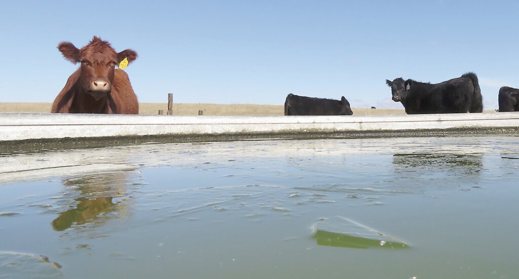
Well managed pastures and rangeland continued to hold up well with lots of early-autumn greening from cool- and warm-season grasses as well as winter annual grasses. Plentiful standing forage generally has the capacity to carry cattle for quite some time so long as heavy snow events don’t break down and cover the standing grasses. Should heavy snows occur, as they did last year, the grass cover should capture and hold a great deal of snow, which would likely provide beneficial moisture for springtime greenup.
Regional Forecast and Conditions
As of Tuesday morning (October 17), the temperature at sunrise was 43 degrees under clear skies. Winds were west at 13 mph and the barometer was slowly falling through 30.04 inches of mercury.
The October 17 NWS forecast for today’s weather (Friday, October 20) anticipates sunny skies with a high of about 80. Tonight will be partly clear with a low of about 45. Day length will be 10 hours and 57 minutes, night length 13 hours and 3 minutes.
Saturday will be sunny and high of about 73. Saturday night will be partly cloudy with a low of 39.
Sunday will be sunny with a high of about 70. Sunday night will be partly cloudy with a low of about 38.
Monday is expected to be mostly sunny with a high of about 69. Monday night should be partly cloudy with a low of about 39 and a chance of showers. Due to the dynamic nature of weather, forecasts beyond 48-72 hours are inexact.
At Kimball the October 10-16 daytime high averaged 62, about 3.43 degrees cooler than last week. The weekly high temperature was 77 degrees on October 10. Overnight lows averaged 31 degrees, about 5.29 degrees cooler than last week. The weekly low temperature was 23 degrees on October 14. The weekly mean temperature at Kimball was 46 degrees, about 4.86 degrees cooler than last week and 0.26 degrees warmer than the October average of 48.6. The 130-year month-to-date (October 1-20) average daily temperature is 48.6. The highest October 1-20 daily average was 59.7 degrees in 1947, with the lowest 39.8 in 1969. The 130-year average high and low temperatures at Kimball for October are 64.3 and 32.8, respectively.
Total liquid precipitation at Kimball over the October 10-16 period was 0.72 inches from rain on October 11-12. There was a trace of snow on October 12.
Winds near Kimball averaged southerly and generally mild over the October 10-16 period. Gusts for the week averaged 23.71 mph. High gust for the week was 43 mph on October 12.
Historic climate data
Here’s an overview of October 20 temperature and precipitation highs, lows, and averages over the preceding 130 years at Kimball. Data is taken from the High Plains Regional Climate Center (1893-2016, www.hprcc.unl.edu), and precision weather monitoring on the EJE Ranch south of Kimball (2008-present).
Last year (October 20, 2022): Daily high temperature 80 degrees, overnight low 31 degrees, average temperature 55.5 degrees. Precipitation zero inches, snowfall zero inches, snow depth zero inches.
The warmest October 20 on record was 91 degrees in 2003. The coolest October 20 high temperature was 32 degrees in 1906. The coldest October 20 overnight low was 14 degrees in 1976. The warmest October 20 overnight low was 48.0 degrees in 1963. Over the years since 1893 the high temperature on October 20 has averaged 60.0 degrees, the overnight low 29.0 degrees, the daily average 44.5 degrees, precipitation has averaged 0.04 inches, snowfall zero inches, snow depth zero inches.
The highest October 20 precipitation total was 0.78 inches (rain) in 1963. Highest snowfall was 1.5 inches in 1949, highest snow depth 1.0 inches in 1936.
USDA Weekly Crop Reports, October 16
Nebraska – For the week ending October 15, 2023, there were 5.0 days suitable for fieldwork. Topsoil moisture supplies rated 23 percent very short, 27 percent short, 43 percent adequate, and 7 percent surplus. Subsoil moisture supplies rated 30 percent very short, 32 percent short, 35 percent adequate, and 3 percent surplus.
Corn condition rated 12 percent very poor, 16 percent poor, 21 percent fair, 38 percent good, and 13 percent excellent. Corn mature was 98 percent, near 94 percent for both last year and the five-year average. Harvested was 44 percent, equal to last year, and ahead of 36 percent average.
Soybeans harvested was 70 percent, near 73 percent last year, but ahead of 62 percent average.
Winter wheat condition rated 7 percent very poor, 13 percent poor, 41 percent fair, 30 percent good, and 9 percent excellent. Winter wheat planted was 96 percent, near 93 percent last year and 92 percent average. Emerged was 84 percent, ahead of 70 percent last year and 71 percent average.
Sorghum condition rated 5 percent very poor, 9 percent poor, 27 percent fair, 31 percent good, and 28 percent excellent. Sorghum mature was 94 percent, ahead of 85 percent last year, and near 91 percent average. Harvested was 35 percent, near 31 percent last year and 36 percent average.
Dry edible beans harvested was 80 percent, near 83 percent last year.
Pasture and range conditions rated 7 percent very poor, 11 percent poor, 30 percent fair, 42 percent good, and 10 percent excellent.
Wyoming – A combination of varying temperatures and abundant rainfall, led to 5.8 days suitable for field work which slowed down the harvesting progress across Wyoming during the week. Temperatures across the State were varied, with the northern part of the State recording average temperatures as many as 9 degrees above average. The southern part of the State saw temperatures as many as 6 degrees below average. Many counties saw temperatures near average. Rainfall was heavy and total accumulations varied, ranging from a trace to over five inches during the week. Some areas received no measurable rainfall. According to the U.S. Drought Monitor Wyoming had no area categorized under severe (D2) drought or worse, although 1 percent of Wyoming was categorized in a moderate drought (D1), and 4 percent of Wyoming was categorized as dry (D0). Drought-free conditions were at 95 percent.
Reports from Goshen County indicated the heavy rainfall received slowed their harvesting, but helped the soil moisture profile.
Lincoln County reporters noted their cows were off the summer ranges, while their sheep were headed off to their winter range. Additionally, producers were wrapping up their second alfalfa hay, and their small grain harvesting.
Stock water supplies across Wyoming were rated 1 percent very short, 15 percent short, and 84 percent adequate, compared with 1 percent very short, 6 percent short, and 93 percent adequate last week. Irrigation water supplies were rated 16 percent fair and 84 percent good, compared with last week’s 7 percent fair and 93 percent good.
Colorado – Moisture was prevalent in northwestern counties, while the rest of the State remained primarily dry. Several northwestern counties received over an inch of moisture last week, while southeastern counties remained dry. Areas of the high country received over two inches of moisture. According to the U.S. Drought Monitor drought conditions remained prevalent in western and southwestern counties and continued to spread last week. Almost 20 percent of the State was experiencing dry conditions, and 17 percent of the State was rated in moderate drought. Over four percent of the State was rated in severe drought, up from to last week. Temperatures were mixed across the State last week, with eastern counties 2 to 6 degrees above average and some western counties 2 to 8 degrees below average.
Northwestern counties received the first snowfall last week and pastures were in good condition. Reporters noted cattle producers were selling and shipping calves. Northeastern counties experienced some windy conditions late in the week. Freezing nighttime temperatures in the San Luis Valley potentially damaged potatoes that remained unharvested. The third cutting of alfalfa in the area was almost complete, and forage quality in pastures was reported as average for the time of year.
Third cutting alfalfa is virtually complete, with 97 percent harvested. Warm, dry conditions allowed fourth cutting alfalfa to make significant progress, with 65 percent harvested, jumping ahead of the 5-year average of 64 percent.
The corn crop continued to mature, with 83 percent of the crop in the mature stage. Corn harvested for grain advanced well last week, with 33 percent of the acreage harvested.
Sugarbeet harvest advanced quickly in northeastern counties with 63 percent of the crop harvested.
Harvest of the sunflower crop progressed ahead of the previous year and 5-year average, with 34 percent of the acreage harvested.
Potato harvest progressed quickly in the San Luis Valley last week, with 90 percent of the acreage harvested.
Stored feed supplies were rated 3 percent very short, 10 percent short, 83 percent adequate, and 4 percent surplus. Cattle death loss was 1 percent heavy, 67 percent average, and 32 percent light. Sheep death loss was 1 percent heavy, 96 percent average, and 3 percent light.
USDA Weekly Weather Bulletin, October 10
Although much of the country experienced dry weather, significant areas of precipitation affected the North and the Deep South. In the north, a Pacific storm system reached the Northwest before crossing the central Plains and the Great Lakes States. That system produced its heaviest rain (locally 2 inches or more) from Wyoming to near Lake Michigan. The Southern rain, locally totaling 2 to 4 inches or more and accompanied by a few severe thunderstorms, was indirectly related to tropical activity over the eastern Pacific Ocean. In contrast, dry weather prevailed in other areas of the country, including a broad area stretching from central and southern California to the southern half of the Plains and the midSouth. The dryness favored fieldwork, including summer crop harvesting and winter wheat planting, but reduced topsoil moisture and maintained Mississippi Valley shipping concerns due to low river levels.
Weekly temperatures averaged as much as 10 degrees below average in the southern Atlantic region, excluding Florida’s peninsula, while readings ran at least 5 degrees below average in a broader area extending as far west as the central Gulf Coast and as far north as the Great Lakes region. Elsewhere, significantly warmer weather was limited to the Northwest, where temperatures averaged more than 5 degrees above average across northern sections of the Rockies and High Plains.
U.S. Drought Monitor
USDM reports derive averages from only the most recent 30 year period. Temperature and precipitation predictions derive from National Weather Service (NWS) and National Oceanic and Atmospheric Administration (NOAA) forecasts.
Current drought status for the Nebraska Panhandle, Southwest Wyoming, and Northeast Colorado. Drought Categories: D0 – average dryness. D1 – moderate drought. D2 – severe drought. D3 – extreme drought. D4 – exceptional drought.
(October 10, 2023) A strong cold front resulted in moderate to heavy precipitation across the Great Plains, Ozarks, and western Gulf Coast during the first week of October. The most widespread improvements were made to southern Arkansas, northwestern Louisiana, southeastern Oklahoma, and eastern to central Texas. Following warmth across the central U.S. to start October, the cold front ushered in much cooler temperatures from October 5 to 7. The first frost or freeze of the fall affected the Northern to Central Great Plains on October 7. As the cold front progressed eastward rainfall overspread parts of Illinois, northern Indiana, southern Michigan, and western New York. Following a wet September, minor improvements were warranted for parts of Washington.
High Plains: A 1-category improvement was made to northwestern North Dakota and northeastern South Dakota where more than 1 inch of precipitation fell this past week. Small improvements were also made in central Nebraska with the wet start to October, and parts of eastern Nebraska also received heavier precipitation. Dryness (D0) was expanded across the southwestern corner of Nebraska. Sixty-day SPI, soil moisture, and NDMC’s short-term blend supported an increase in D0 and the addition of D1 across southern Wyoming. There was also an expansion of D2 in southwestern Colorado, while increasing short-term dryness led to increasing D0 coverage across northwestern Colorado.
West: A 1-category improvement was made to northeastern Montana where more than 1 inch of precipitation fell this past week. Precipitation during the past two weeks supported the removal of extreme drought (D3) in north-central Montana. Severe drought (D2) was added to eastern Arizona while there was an expansion of moderate drought (D1) in western Arizona. Improving stream flows and other data manipulation led to a 1-category improvement for the Puget Sound of Washington along with southeastern parts of the state. Dryness (D0) was expanded across northeastern Utah due to increasing short-term dryness during the past one to three months and this was also consistent with changes made to adjacent Colorado and Wyoming.
Near-term forecast: Looking ahead through October 21, the NWS Climate Prediction Center (CPC) favors near to below-average precipitation throughout much of the contiguous U.S. with above-average precipitation most likely across southeastern Alaska. Increased probabilities for above-average temperatures are forecast across the West and Northern to Central Great Plains, while below-average temperatures are likely for the Mid-Atlantic and Southeast.
Terminology: EDDI – Evaporative Demand Drought Index. This is an experimental model for drought prediction, using nationwide data from 1980-present. SPI – Standardized Precipitation Index, correlating present month/year precipitation with 30-plus year historical data. SPEI – Standardized Precipitation Evapotranspiration Index. SWE – Snow Water Equivalent.
For more information on the U.S. Drought Monitor, including an explanation of terminology, visit: http://droughtmonitor.unl.edu


