

The first day of winter was very different than the last day of Autumn. At Kimball on Dec. 20, the day was clear and sunny with a high of 63 degrees and a low of 28.
This item is available in full to subscribers.
To continue reading, you will need to either log in to your subscriber account, or purchase a new subscription.
If you are a current print subscriber, you can set up a free website account and connect your subscription to it by clicking here.
If you are a digital subscriber with an active, online-only subscription then you already have an account here. Just reset your password if you've not yet logged in to your account on this new site.
Otherwise, click here to view your options for subscribing.
Please log in to continue |
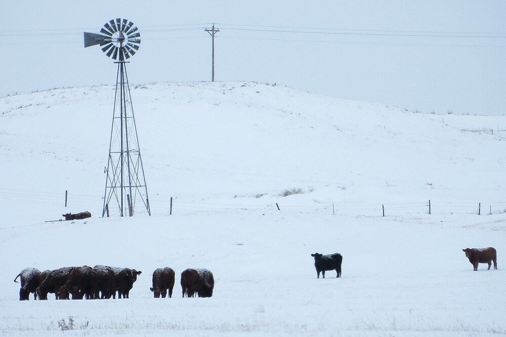
KIMBALL, Neb. – The first day of winter was very different than the last day of Autumn. At Kimball on Dec. 20, the day was clear and sunny with a high of 63 degrees and a low of 28. Breezes were mild and it was a pleasant day all around; warm and mild enough to open a window or two in the afternoon.
It was a completely different story on Dec. 21, when the daily high of 28 degrees came just after midnight, and the mercury fell below zero before the day was finished. Snow began falling just before 6 a.m. and continued well into the afternoon. The snowfall was mostly light, and only about an inch accumulated, but it was driven before a stiff northerly breeze that produced sub-zero wind chill values throughout the day.
Conditions remained cold and occasionally snowy through Boxing Day, Dec. 26. Temperatures averaged in the teens or below with mostly sub-zero wind chill readings, and 7-8 inches of new snow accumulated.
The sudden transition from autumnal warmth to winter cold may have been very hard on the 2018 winter wheat crop. Little of this fall-seeded wheat had achieved dormancy by the time the mercury fell and it was susceptible to cold injury and mortality. Only time will tell.
In general, livestock seemed to weather the change well. Snow cover has slowed or halted grazing so producers are feeding hay and working hard to keep stock tanks open and water available.
Regional Forecast and Conditions
As of Tuesday morning (Dec. 26), the temperature at sunrise was -2 degrees with calm winds under clear skies. The day was expected to remain clear and cold with mild winds and the air temperature climbing only to about 6 degrees.
A cooling trend with an attendant chance of more widespread snowfall was expected to slowly move into the region beginning on Friday (today). Air temperatures were expected to top out at nearly 40 degrees today, but rise only to 26 tomorrow and 18 on Sunday. Overnight lows were forecast to fall to about 5 degrees tonight and tomorrow night and to -5 degrees on Sunday night. Saturday and Saturday nights may bring widespread but light snowfall. Winds throughout the weekend are expected to be breezy.
New Year’s Day through Wednesday is expected to be slightly warmer and breezier. Daytime temperatures are expected to range in the 20’s with overnight lows falling into the single digits. There is little chance of precipitation in the forecast during this period.
Daytime air temperatures cooled sharply across the region last week. At Kimball the Dec. 19-25 daytime high averaged 31.28, about 18.4 degrees cooler than the previous week. The weekly high temperature was 63 degrees on Dec. 20. Overnight lows cooled sharply as well, averaging 8.0 degrees, about 13.5 degrees cooler than the previous week. The weekly low temperature was -4 degrees on Dec. 24. The weekly mean temperature was 19.64 degrees, about 16 degrees cooler than the previous week, and about 9 degrees cooler than the December average of 28.4 degrees. The long term average high and low temperatures at Kimball for December are 41.7 and 15.0 degrees, respectively.
Widespread but spotty snowfall visited much of the region, with nine of 13 Panhandle stations reporting precipitation during the Dec. 19-25 period. Hemingford reported the most snowfall at 14.5 inches. Kimball reported the most liquid equivalent moisture at 0.71 inches. Liquid equivalent precipitation averaged 0.22 inches for the Panhandle, while snowfall averaged 4.49 inches. Last week’s totals were 0.0 and 0.0 inches respectively.
Soil temperatures cooled from 0.0-4.2 degrees across the Panhandle over the Dec. 19-25 period: (this week/last week/change): Alliance 33.1/37.3 (-4.2) degrees; Gordon 32.7/32.7 (0.0) degrees; Mitchell 35.1/37.0 (-1.9) degrees; Scottsbluff 34.5/35.2 (-0.8); and Sidney 32.1/35.8 (-3.7) degrees.
Winds near Kimball averaged south-southeasterly and generally mild over the Dec. 19-25 period. Gusts for the week averaged 23.85 mph. High gust for the week was 41 mph on Dec. 20.


