

A weather front brought cold air temperatures to much of the tri-state region Last Friday and Saturday.
This item is available in full to subscribers.
To continue reading, you will need to either log in to your subscriber account, or purchase a new subscription.
If you are a current print subscriber, you can set up a free website account and connect your subscription to it by clicking here.
If you are a digital subscriber with an active, online-only subscription then you already have an account here. Just reset your password if you've not yet logged in to your account on this new site.
Otherwise, click here to view your options for subscribing.
Please log in to continue |
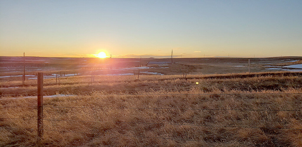
KIMBALL – A weather front brought cold air temperatures to much of the tri-state region Last Friday and Saturday. At Kimball the mercury plunged to 2 degrees Saturday night.
Calendar winter arrived with the winter solstice just before 9 a.m. on Tuesday, December 21. The solstice arrived just as warmer temperatures were flowing back into the region accompanied by seasonal breeziness. In fact, temperatures began rising just after midnight after falling to 20 degrees early Monday evening. By 3 a.m. the mercury touched 48 degrees on the way to a daily high of 58.
Regional Forecast and Conditions
As of Tuesday morning (December 21), the temperature at sunrise was 37 degrees under mostly cloudy skies. Winds were westerly at 14 mph and the barometer was slowly rising at 29.95 inches of mercury (in/Hg).
Today’s weather (Friday, December 24) is expected to be mostly sunny and breezy. Daytime air temperatures should top out at 57 degrees before falling off to 25 overnight. Saturday and Sunday should be mostly sunny and breezy, with the Christmas Day high reaching 51 and Sunday’s high 45. Overnight lows are forecast at 20 and 15, respectively. No precipitation is forecast for Saturday or Sunday.
A weather front is forecast to arrive late on Sunday, bringing cooler temperatures and continued breeziness. Conditions Monday-Wednesday are expected to be cooler while continuing mostly sunny; daytime highs should touch low-to mid-30’s with lows falling into the teens. No precipitation is forecast through mid-week.
At Kimball the December 14-20 daytime high averaged 46.71 degrees, slightly cooler than last week. The weekly high temperature was 62 degrees on December 14. Overnight lows averaged 15.28 degrees, about three degrees cooler than last week. The weekly low temperature was 2 degrees on December 18. The weekly mean temperature at Kimball was 33.71 degrees, about 5.31 degrees warmer than the December average of 28.4 degrees. The long term average high and low temperatures at Kimball for December are 41.7 and 15.0, respectively.
There was no precipitation at Kimball last week.
Winds near Kimball averaged west-southwesterly and breezy over the December 14-20 period. Gusts for the week averaged 32 mph. High gust for the week was 60 mph on December 15.
Here’s an overview of December 24 temperature and precipitation highs, lows, and averages over the preceding 128 years at Kimball. Data is taken from the High Plains Regional Climate Center (www.hprcc.unl.edu), where you can easily find and track data for your own particular location.
Last year (December 24, 2020): Daily high temperature 46 degrees, overnight low 21 degrees, average temperature 33.5 degrees. Precipitation zero inches, snowfall zero inches, snow depth zero inches.
The warmest December 24 on record was 64 degrees in 1905. The coolest December 24 high temperature was 0 degrees in 1983. The coldest December 24 overnight low was -19 degrees in 1983. The warmest December 24 overnight low was 33 degrees in 1961. Over the years since 1893 the high temperature on December 24 has averaged 39 degrees, the overnight low 13 degrees, the daily average 25.8 degrees, precipitation has averaged 0.01 inches, snowfall 0.2 inches, snow depth zero inches.
The highest December 24 precipitation total was 0.77 inches (6 inches snow) liquid equivalent in 1985.
U.S. Drought Monitor
This report derives normals/averages from the most recent 30 year period, dating back to 1988.
(December 14) High Plains: On this week’s map, eastern Wyoming, eastern Montana, central North Dakota, southern South Dakota, and northwestern Nebraska saw improvements based on short-term precipitation (30 to 90-day period). This included beneficial snowfall in southern portions of South Dakota where observed totals ranged from 6 to 18 inches with the highest totals in southwestern South Dakota. In these areas, soils have yet to freeze throughout the soil column and melting snows are infiltrating and helping to improve soil moisture levels. Snow coverage in the Upper Midwest Region (includes portions of Wisconsin, Minnesota, the Dakotas, eastern Montana, and northwestern Wyoming) is currently at 52.5% with an average depth of 1.5 inches and a maximum depth of 28.8 inches. Despite some improvements on the map, it is noteworthy that average temperatures across the High Plains region have been well above normal since September. This includes numerous high-temperature records that were recently broken across the region during the first week of December when high temperatures soared into the 70s.
West: Out West, a weak-to-moderate atmospheric river made landfall in the Pacific Northwest on Saturday and moved southeastward bringing coastal and valley rains as well as heavy mountain snowfall accumulations across California and the Pacific Northwest. For the week, rainfall accumulations along the coastal areas from Washington to California ranged from three to 13-plus inches with the highest accumulations observed in the coastal ranges of northwestern Oregon and along the Central Coast of California. In terms of snowfall during the multi-day storm event, total accumulations exceeded six feet in areas of the Central Sierra while areas in the southern Cascades received up to three feet. Further inland, areas of the Northern Rockies in Idaho and northwestern Wyoming observed snowfall totals ranging from 12 to 20 inches. Despite the beneficial nature of this week’s storm event, significant precipitation deficits (ranging from four to 20 inches) still exist across California and the state’s largest reservoirs are still at critically low levels. In other areas of the West, basin levels are well below normal, especially in New Mexico. On the map, some improvements were made in areas of Extreme Drought (D3) and Exceptional Drought (D4) in Montana, Oregon, and Utah as well as improvements in areas of Severe Drought (D2) and Moderate Drought (D1) in Idaho and Wyoming. According to NOAA, November 2021 was the second warmest on record for the West and Southwest climate regions. Moreover, California and Wyoming both recorded their warmest average minimum temperatures on record for November while Nevada, Utah, and Colorado observed their second warmest on record. In terms of precipitation, the Southwest Climate Region was notably dry, having its fifth driest November on record.
Near-term forecast: The NWS WPC 7-Day Quantitative Precipitation Forecast (QPF) calls for moderate-to-heavy liquid precipitation accumulations in the Sierra Nevada Range, Cascade Range, and Olympic Mountains. In the Intermountain West, 1-to-2-inch (liquid) accumulations are expected across the Central and Northern Rockies. Elsewhere, 1-to-5-inch (liquid) accumulations are expected in far southeastern portions of the Southern Plains as well as in the Lower Mississippi, Tennessee, and Ohio River valleys. The CPC 6-10-day Outlooks calls for a moderate-to-high probability of above-normal temperatures across the southern half of the conterminous United States excluding California and Nevada. Below-normal temperatures are expected across the remainder of the West including the Pacific Northwest and the Northern Rockies. In terms of precipitation, the wetter-than-normal pattern is expected to persist across the western U.S., while there is a low-to-moderate probability of below-normal precipitation across the Central and Northern Plains as well as across most of the South. In the eastern third, near-normal precipitation is expected.
For more information on the U.S. Drought Monitor visit: http://droughtmonitor.unl.edu.


