

Shifting upper air pressure gradients allowed moisture-bearing air to flow through the tri-state region last week.
This item is available in full to subscribers.
To continue reading, you will need to either log in to your subscriber account, or purchase a new subscription.
If you are a current print subscriber, you can set up a free website account and connect your subscription to it by clicking here.
If you are a digital subscriber with an active, online-only subscription then you already have an account here. Just reset your password if you've not yet logged in to your account on this new site.
Otherwise, click here to view your options for subscribing.
Please log in to continue |
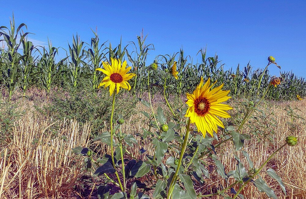
KIMBALL – Shifting upper air pressure gradients allowed moisture-bearing air to flow through the tri-state region last week. Beginning on Monday, July 23, widespread thunderstorms formed each afternoon and evening across southeast Wyoming, northeast Colorado, and the Nebraska Panhandle. While the precipitation footprints of these storms was generally localized and brief, the quantity of rain delivered was quite high. In many cases a brief 5-10 minute downpour produced an inch or more of rain. Most of these heavy storms were accompanied by high winds and hail, and in some locations crop damage from hail was significant. This pattern continued through Sunday, July 29, and over that week-long period most locations across the region had received one or more rainfall events.
On Saturday afternoon and evening (July 28), afternoon and evening storms also produced 11 confirmed tornadoes touching down. Confirmed sightings in Wyoming were 12 miles northeast of Chugwater, 5 miles southwest of Douglas, 3 miles south of Douglas, 12 miles west of Douglas, 12 miles southwest of Douglas, 15 miles west of Glendo, and 23 miles southwest of Glendo. Near Kimball in Nebraska a pair of tornadoes touched down 2 and 3 miles to the west southwest. In Colorado, tornadoes touched down near Logan Corners and 7 miles west of Sterling. None of these tornadoes caused any damage and none were therefore rated on the Fujita Scale.
The week-long period of unsettled weather brought cooler air temperatures as well, easing heat stress in livestock and slowing evapotranspiration across prairies, rangeland, and farmed ground.
Regional Forecast and Conditions
As of Tuesday morning (July 31), the temperature at sunrise was 51 degrees under fair skies. Winds were southerly at 6 mph, and the barometer was steady at 30.29 inches of mercury (in/Hg).
Today’s weather (Friday, August 3) is expected to be sunny, still, and hot. The temperature is expected to rise to 90 degrees before falling off to an overnight low of 59. Saturday and Sunday are forecast to be similar but slightly cooler and with a 10 percent chance of afternoon and evening thundershowers. Temperatures should peak at about 88 degrees with overnight lows of about 55 degrees.
Monday through Wednesday are expected to continue the trend, mostly sunny and warm, with highs in the upper 80’s and overnight lows falling into the mid-50’s. A slightly increased chance of showers is forecast for this period.
Twenty-four hour average air temperatures cooled again across the region last week. At 13 selected stations across the Panhandle 24-hour temperatures averaged 68.8 degrees, about 4.9 degrees cooler than the previous week.
At Kimball the July 24-30 daytime high averaged 79 degrees, about 9 degrees cooler than the previous week. The weekly high temperature was 90 degrees on July 24. Overnight lows averaged 56 degrees, about 3.85 degrees cooler than the previous week. The weekly low temperature was 53 degrees on July 30. The weekly mean temperature at Kimball was 67.5 degrees, about 6.5 degrees cooler than last week, and about 4.3 degrees cooler than the July average of 71.8 degrees. The long term average high and low temperatures at Kimball for July are 87.4 and 56.1, respectively.
All 13 selected Panhandle stations reported rain over the July 24-30 period, ranging from 2.19 inches at Alliance to 0.08 inches at Chadron. Across the Panhandle rainfall averaged 0.95 inches, compared to 0.98 inches last week.
Soil temperatures were up and down across the Panhandle over the July 24-30 period: (this week/last week/change): Alliance 71.7/76.4 (-4.7) degrees; Gordon 76.7/75.0 (+1.6) degrees; Mitchell 76.2/79.2 (-3.0) degrees; Scottsbluff 77.3/79.2 (-1.9); and Sidney 76.2/79.2 (-3.0) degrees.
Winds near Kimball averaged east-southeasterly and occasionally gusty over the July 24-30 period. Gusts for the week averaged 30.85 mph. High gust for the week was 46 mph on July 26.
August 3 Weather Almanac
Here’s an overview of August 3 temperature and precipitation highs, lows, and averages over the preceding 125 years at Kimball. Data is taken from the High Plains Regional Climate Center (www.hprcc.unl.edu), where you can easily find and track data for your own particular location.
Last year (August 3, 2017): Daily high temperature 71 degrees, overnight low 50 degrees, average temperature 60.5 degrees. Precipitation 0.00 inches, snowfall zero inches, snow depth zero inches.
The warmest August 3 on record was 103 degrees in 1934. The coolest August 3 high temperature was 41 degrees in 1974. The coldest August 3 overnight low was 41 degrees in 1974. The warmest August 3 overnight low was 65 degrees in 1964. Over the years since 1893 the high temperature on August 3 has averaged 85 degrees, the overnight low 57 degrees, the daily average 70.9 degrees, precipitation has averaged 0.08 inches, snowfall zero inches, snow depth zero inches.
The highest August 3 precipitation total was 1.02 inches liquid equivalent in 1985.
Snow has fallen on August 3 at Kimball zero times over the last 125 years.
U.S. Drought Monitor
(July 24) National summary: Over the period covering July 17-24, precipitation fell across a vast majority of the East, the heaviest of which flooded parts of Maryland, including the Washington D.C. area. Heavy rains also fell in parts of Florida, Kentucky and South Carolina. In the central U.S., moderate precipitation fell in parts of the High Plains while lighter rains provided little to no relief in parts of Kansas. The drought-stricken areas of Oklahoma and Texas saw little to no precipitation and triple digit temperatures, exacerbating drought conditions.
High Plains: Precipitation across this region was scattered during the USDM week. The heaviest amount, generally in the range of 2-4 inches, fell in the eastern Dakotas and parts of Nebraska.
Short- and long-term effects of drought/dryness remain along the Canadian/North Dakota border and northeast South Dakota. Recent rains in South Dakota contracted drought along the southern portion of the depiction, but expanded the abnormal dryness (D0) in the western part. Abnormal dryness was introduced in south central South Dakota.
In Nebraska, drought/dryness began to creep back into the southeast part of the state where 30-day precipitation departures were apparent.
Drought/dryness worsened in Kansas during the period, especially in the eastern half of the state where precipitation deficits have grown. Year-to-date precipitation percent of normal values were 25-50 percent across parts of east central Kansas. Exceptional drought (D4) was slightly expanded in this area and the two areas of extreme drought (D3) were connected.
Drought conditions remained unchanged for the most part In Colorado. The lone exception was a slight contraction of exceptional drought in the southeast where heavy rains recently fell. Severe drought was expanded slightly in the north central part of Colorado.
West: Drought remained entrenched in the Four Corners region but, as the monsoon season begins to ramp up, there is hope that improvement is on the way. In fact, 30-day surpluses of 2-3 inches were common near and west of Flagstaff. Year-to-date precipitation totals were now reaching the positive side. It was reported that the Eastern Rim and the White Mountains have also seen very beneficial rains. As a result of the robust start of the monsoon season, there was some contraction of D3 and D4 in Arizona.
In the Pacific Northwest, dryness in Oregon prompted the expansion of D2 across the Cascades and into the Willamette Valley. In California, persistent heat and dryness increased fire danger. As of July 24, it was reported that the Ferguson fire had burned 57 square miles in Yosemite, but was only 25 percent contained. Yosemite Park was closed for the first time in 28 years due to the fire hazard there.
Near-term forecast: The 6-10 day outlook from the Climate Prediction Center calls for an increased chance of below-normal precipitation in the drought stricken areas of Missouri as well part of the High Plains and Northwest. The probability of above-normal temperatures are highest in the Southwest and Northeast while the probability of below-normal temperatures are the highest in the Southeast.
For more information on the U.S. Drought Monitor visit: http://droughtmonitor.unl.edu
U.S. Conditions and Weather Report
(July 31) Cool but mostly dry weather overspread the Corn Belt, favoring reproductive to filling corn and soybeans— except in areas with lingering soil moisture shortages. Cool air eventually encompassed large sections of the Plains and mid-South.
Heat persisted through week’s end across much of Texas, as well as the Great Basin, Desert Southwest, and Pacific Coast States. Western weekly temperatures averaged as much as 10 degrees above normal. Including Alaska, more than 100 Western wildfires were active at the end of July, with some of the most dangerous blazes burning in the Pacific Coast States.
Significant Western rainfall was largely confined to the central and southern Rockies and parts of the Desert Southwest. Heavy showers, triggered by the interaction between cold fronts and moisture associated with the Southwestern monsoon circulation, also soaked the central High Plains and environs. Drenching rains fell in the Atlantic Coast States, where weekly totals of 4 to 8 inches or more were common from eastern North Carolina into southern New England. The Northeastern rain eased or eradicated drought but sparked flash flooding. In contrast, only light showers dotted the Midwest, while little or no rain fell from central and eastern Texas to the Mississippi Delta.
USDA Weekly Weather and Crop Reports
Nebraska
No report published since mid-May.
Wyoming
(July 23) Wyoming experienced extreme monsoon weather including tornadoes, hail, and heavy rain across much of the State last week.
Twenty-eight of the 33 reporting stations reported below normal temperatures for the week with a high temperature of 98 degrees and a low of 38 degrees, both recorded at Kaycee.
Below normal moisture was reported at 16 of the 33 reporting stations. Three reporting stations had no precipitation. Lance Creek reported the most moisture with 2.54 inches.
A reporter from Northeastern Wyoming noted extreme weather with flash flooding, hail and sleet in the higher elevations. Reports also mention that livestock are in good condition.
A reporter from Southern Wyoming indicated that hay producers have suffered from the earlier drought conditions and production is approximately 50 percent of normal.
Reports in Southeastern Wyoming also mentioned extreme weather with strong winds and flooding, however reports noted that while wheat harvest was slowed due to rain, yields are looking good.
Irrigation water supply across Wyoming was rated 1 percent poor, 5 percent fair, 86 percent good, and 8 percent excellent.
Stock water supplies across Wyoming were rated 6 percent very short, 20 percent short, 73 percent adequate, and 1 percent surplus.
Colorado
(July 23) Colorado experienced improved soil moisture with monsoon rainfall last week which was mostly concentrated in eastern districts. Statewide, winter wheat harvest was virtually complete by week’s end.
In northeastern counties, received moisture held conditions steady and provided relief to drier areas. Reduced fieldwork was noted due to adverse weather, which mostly affected the end of winter wheat harvest and hay harvest. Several reporters noted late week storms brought high winds, heavy rain, and localized hail that severely damaged crops and caused significant losses in areas. Spring crops, rangeland, and livestock were reportedly doing well aside from isolated severe weather damage.
East central counties also received beneficial moisture last week, although rainfall was spotty in areas. Reporters noted severe weather in Morgan and Washington counties brought tornadoes and hail upwards of 3 inches in diameter. Severe damage and crop losses were noted.
In southwestern counties, precipitation was minimal. Exceptional drought conditions persisted and ranchers continued to sell off stock in response. Production from first cutting alfalfa was noted to be below average.
The San Luis Valley received some scattered moisture with reports of light hail, but overall conditions remained very dry. A reporter noted aphids were observed in small grains and hay but that crop conditions remained steady. Livestock were reportedly being moved off pastures early due to water shortages.
In southeastern counties, rain was received in several areas last week, bringing some relief to dry conditions. Localized rainfall of up to 6 inches was observed along with minor flooding.
Statewide, stored feed supplies were rated 9 percent very short, 29 percent short, 61 percent adequate, and 1 percent surplus.
Sheep death loss was 64 percent average and 36 percent light. Cattle death loss was 63 percent average and 37 percent light.


