

The last week of spring was on the warm side across much of the tri-state region
This item is available in full to subscribers.
To continue reading, you will need to either log in to your subscriber account, or purchase a new subscription.
If you are a current print subscriber, you can set up a free website account and connect your subscription to it by clicking here.
If you are a digital subscriber with an active, online-only subscription then you already have an account here. Just reset your password if you've not yet logged in to your account on this new site.
Otherwise, click here to view your options for subscribing.
Please log in to continue |
KIMBALL – The last week of spring was on the warm side across much of the tri-state region as surface winds shifted to the south and hot air flowed up from Texas and the Southwest. Upper air ridges and troughs were on the move as well, bringing moisture-laden air along for the ride and spawning scattered but often locally heavy afternoon and evening thunderstorms.
Dust was becoming evident across most of the south Panhandle of Nebraska as a dearth of rain combined with sunshine, warmth and wind to dry soils.
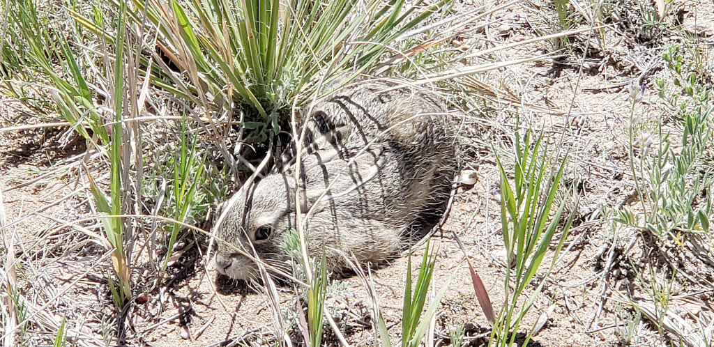
Winter wheat was beginning to turn color and in general most of the wheat fields around Kimball County were looking relatively good.
Spring seeded dryland crops were coming along after a slow start and late season freezes.
Lack of rain and heat were beginning to limit cool season grass production across pastures and rangeland as rapid growth windows were beginning to close. Warm season grasses were slowly greening but soil dryness was a limiting factor for those as well.
Regional Forecast and Conditions
As of Tuesday morning (June 21), the temperature at sunrise was 60 degrees under clear skies. Winds were Northwesterly at 9 mph and the barometer was rising at 30.34 inches of mercury (in/Hg).
Today’s weather (Friday, June 24) is expected to be sunny and warm with a high temperature of 94 degrees and a 20% chance of afternoon and evening thunderstorms. Skies will be mostly cloudy overnight and the low will fall to about 53 degrees. Day length will be 15 hours and 9 minutes, night length 8 hours and 51 minutes.
Saturday and Sunday will be partly sunny and cooler as a weather front moves through. High temperatures will range in the lower 70s with widespread showers and thunderstorms predicted after noon. Overnight lows are expected to fall to about 50.
Monday is forecast to be slightly warmer and breezy under partly cloudy skies with the high temperature reaching into the low 80s.
The remainder of the week is expected to be sunny and warmer with a continuing chance of afternoon and evening thunderstorms. Daytime highs will range in the upper-80s with overnight lows falling into the 50s.
At Kimball, the June 14-20 daytime high averaged 84.71 degrees, about 2.71 degrees cooler than last week. The weekly high temperature was 99 degrees on June 17. Overnight lows averaged 60.71 degrees, about 1 degree warmer than last week. The weekly low temperature was 53 degrees on June 14. The weekly mean temperature at Kimball was 72.71 degrees, about 4.14 degrees warmer than last week and 7.51 degrees warmer than the June average of 65.2 degrees. The long term average high and low temperatures at Kimball for June are 80.3 and 50.1, respectively.
Kimball received a trace of rain June 14, 17 and 20, totalling about 0.01 inches the June 14-20 period.
Winds near Kimball averaged south-southwesterly and occasionally breezy during the June 14-20 period. Gusts for the week averaged 37.85 mph. High gust for the week was 45 mph on June 20.
Historic climate data
Here’s an overview of June 24 temperature and precipitation highs, lows, and averages over the preceding 129 years at Kimball. Data is taken from the High Plains Regional Climate Center (www.hprcc.unl.edu), where you can find and track data for your own particular location.
Last year (June 24, 2021): Daily high temperature 85 degrees, overnight low 59 degrees, average temperature 72 degrees. Precipitation trace, snowfall zero inches, snow depth zero inches.
The warmest June 24 on record was 101 degrees in 1988. The coolest June 24 high temperature was 55 degrees in 1906. The coldest June 24 overnight low was 39 degrees in 1940. The warmest June 24 overnight low was 66 degrees in 1954. Over the years since 1893 the high temperature on June 24 has averaged 83 degrees, the overnight low 52 degrees, the daily average 67 degrees, precipitation has averaged 0.06 inches, snowfall zero inches, snow depth zero inches.
The highest June 24 precipitation total was 1.75 inches (rain) in 1954. Highest snowfall zero inches, highest snow depth zero inches.
USDA Crop Progress Reports, June 20
Nebraska – For the week ending June 19, 2022, there were 5.8 days suitable for fieldwork. Topsoil moisture supplies rated 14% very short, 30% short, 54% adequate and 2% surplus. Subsoil moisture supplies rated 16% very short, 30% short, 53% adequate, and 1% surplus.
Corn condition rated 3% very poor, 9% poor, 20% fair, 57% good and 11% excellent. Corn emerged was 98%, near 100% last year, and equal to the five-year average.
Soybean condition rated 4% very poor, 8% poor, 20% fair, 57% good and 11% excellent. Soybeans emerged was 94%, equal to last year, and near 92% average.
Winter wheat condition rated 15% very poor, 19% poor, 41% fair, 22% good and 3% excellent. Winter wheat headed was 95% near 97% last year and equal to average.
Sorghum condition rated 1% very poor, 8% poor 26% fair, 61% good and 4% excellent. Sorghum planted was 95%, near 96% last year and equal to average. Headed was 1%, equal to last year and near 2% average.
Oats condition rated 7% very poor, 13% poor, 22% fair, 52% good and 6% excellent. Oats headed was 73%, behind 81% last year, and near 77% average.
Dry edible beans planted was 87%, near 89% last year. Emerged was 60%, behind 67% last year.
Pasture and range conditions rated 10% very poor, 21% poor, 32% fair, 33% good and 4% excellent.
Wyoming – For the week ending June 19, 2022, the majority of the state received no substantial moisture. Much of central Wyoming received trace amounts registering at 0.01 inches of precipitation. Other areas received totals up to 0.3 inches or more.
According to the U.S. Drought Monitor, the amount of land that was drought free stood at 3.5%, down slightly from last week’s 3.8%. The amount of land rated as abnormally dry was 28.1%, up from 26.8% last week. Moderate drought fell to 41.1% of the state, compared to 45.5% last week. Severe drought stood at 19.0%, compared to 18.8% last week. Extreme drought sat at 4.5%, compared to 5.1% last week.
In Carbon County, some producers began hauling water to livestock.
The dryness persisted in Goshen County, but some areas benefited from localized rains.
Temperatures were cool in Lincoln County and crops were not growing well because of the cooler weather. Alfalfa had not yet grown enough for a first cutting. Some fields were affected by frost, though alfalfa escaped being damaged by a hard frost of 28 degrees one night last week.
Irrigation water supplies across the state were rated 8% poor, 55% fair, 36% good, and 1% excellent, compared to 7% poor, 64% fair, and 29% good last week.
Stock water supplies across Wyoming were rated 1% very short, 10% short and 89% adequate, compared to 2% very short, 1 % short, 84% adequate, and 3% surplus last week.
Colorado – For the week ending June 19, 2022, higher than normal temperatures across most of the state pushed fieldwork and crop advancement last week while depleting soil moisture supplies in some areas.
According to the U.S. Drought Monitor, 82% of the state is under drought conditions, down 2 percentage points from last week. Forty-three percent of the state is experiencing severe to exceptional drought conditions, unchanged from last week. Extreme drought conditions are affecting 16% of the state, up four percentage points from last week.
Northeastern and east central counties continue to face strong winds, high temperatures, and little moisture. Above average temperatures were recognized, with some areas seeing temperatures ten degrees above average.
The Southwestern counties received notable and very needed rains last week, with some areas receiving a few inches of moisture. A reporter noted that relentless windy conditions continue to affect crop conditions.
In the San Luis Valley, rainstorms last week provided some short-term relief to emerging crops and rangeland. Potato emergence continued to make significant progress last week, jumping ahead of the 5-year average emergence pace. County reports noted barley is heading in many fields and alfalfa harvest had begun prior to the rain.
The southeastern counties were primarily dry last week with little measurable moisture received. Exceptional drought conditions lessened in Baca County.
As of June 19, 2022, snowpack in Colorado was 94% measured as percent of median snowfall, up 36 percentage points from the previous week.
Stored feed supplies were rated 2% very short, 23% short and 75% adequate. Sheep death loss was 77% average and 23% light. Cattle death loss was 90% average and 10 % light.
U.S. Drought Monitor
USDM reports derive normals/averages from the most recent 30 year period, though longer timescale data are used where available. The USDM generally reports on current drought conditions and offers a comprehensive history of drought across the Continental U.S. Nearterm temperature and precipitation predictions derive from National Weather Service (NWS) and National Oceanic and Atmospheric Administration (NOAA) forecasts.
Current drought status for the Nebraska Panhandle, Southwest Wyoming and Northeast Colorado. Drought Categories: D0-abnormally dry. D1-moderate drought. D2 - severe drought. D3-extreme drought. D4-exceptional drought.
(June 21, 2022) The storm track remained active across much of the contiguous U.S. (CONUS) this week. Much of the Northern Tier states experienced beneficial rainfall and near to below-normal temperatures, predominantly leading to drought improvements from the Pacific Northwest to the Northern Plains. Storm systems and clusters of thunderstorms also resulted in some improvements from the Mississippi Valley to the East Coast. However, where the heaviest rains did not fall, there was some deterioration and slight expansion of abnormal dryness or drought conditions, particularly in parts of the Southeast and Ohio and Tennessee Valleys. Above-normal temperatures and below-normal precipitation was the main story across much of the southwestern CONUS, extending into Texas, leading to general persistence and degradation of drought conditions.
High Plains: Much of the High Plains Region has seen beneficial rainfall and temperatures averaging near to below-normal over the past 30 days. However, above-normal temperatures finally crept in this week, as temperatures ran more than three degrees above normal for much of the region. Despite the above-normal temperatures, precipitation was also above-average for many locations, warranting broad 1-category improvements in the drought depiction where more than one inch seven day surpluses were observed and where longer-term deficits were appreciably diminished. Only areas in southwestern Colorado and just east of the Front Range in Wyoming experienced some degradation, as temperature anomalies were highest in those areas (6-9 degrees above normal). Also, high winds have helped to exacerbate ongoing drought in those locations.
West: Much of the Northern Tier of the U.S. from the Pacific Northwest to the Northern Plains, has seen marked improvements in recents months due to a persistent storm track and near to below-normal temperatures. That same pattern continued this week and continued to eat away at long-term precipitation deficits and indicators, such as groundwater. Additionally, some high-elevation locations have even picked up additional snowpack and stream flows are running near to much above-normal over the past 28 days. The only exception is parts of north-central Montana. Elsewhere in the Western Region, despite the much above-normal temperatures, a general status quo depiction was warranted, the exception being Nevada and New Mexico. A slight expansion of extreme drought (D3) was warranted in central Nevada. Despite some nearby monsoon precipitation in parts of New Mexico and Arizona, accumulations were not enough to change the severe (D2) to exceptional (D4) drought depictions in areas where the rains fell. Given the temperatures were 5-10 degrees above-average, and coupled with windy conditions, additional degradations were made in parts of western and southern New Mexico.
Near-term forecast: The 6-10 day outlook favors above-normal temperatures and near to below-normal precipitation across the eastern CONUS. Below-normal temperatures and below-normal precipitation are favored across the Pacific Northwest and northern Great Basin, in the wake of a passing storm system near the start of the 6-10 day period. A surge of moisture is expected to bring increased chances of precipitation to the Four Corners region, signaling a potential early start to the Southwest Monsoon season, with probabilities of above-normal precipitation extending northeastward into portions of the Central and Northern Plains. Near to below-normal precipitation and above-normal temperatures are favored over much of California.
Terminology: EDDI-Evaporative Demand Drought Index. This is an experimental model for drought prediction, using nationwide data from 1980-present. SPE -Standardized Precipitation index, correlating present month/year precipitation with 30-plus year historical data. SPEI -Standardized Precipitation Evapotranspiration Index. SWE -Snow Water Equivalent.
For more information on the U.S. Drought Monitor, including an explanation of terminology, visit: http://droughtmonitor.unl.edu.


