

The first three days of March were quite pleasant across most of the tri-state region with abundant sunshine and warmth. Daytime air temperatures topped out in the mid-60’s and fell off into the upper 20’s overnight.
This item is available in full to subscribers.
To continue reading, you will need to either log in to your subscriber account, or purchase a new subscription.
If you are a current print subscriber, you can set up a free website account and connect your subscription to it by clicking here.
If you are a digital subscriber with an active, online-only subscription then you already have an account here. Just reset your password if you've not yet logged in to your account on this new site.
Otherwise, click here to view your options for subscribing.
Please log in to continue |
KIMBALL – The first three days of March were quite pleasant across most of the tri-state region with abundant sunshine and warmth. Daytime air temperatures topped out in the mid-60’s and fell off into the upper 20’s overnight.
Weather forecasters predicted a widespread winter storm for March 4-5, but by Saturday the predictions had been revised to predict cooling and breeziness with little or no widespread precipitation. Sunday, March 4 was generally mild, but the predicted cooling and breeziness set in late in the day as the weather
front arrived.
Monday and Tuesday, March 5-6, were quite windy across the region, with gusts touching 60 mph at Kimball.
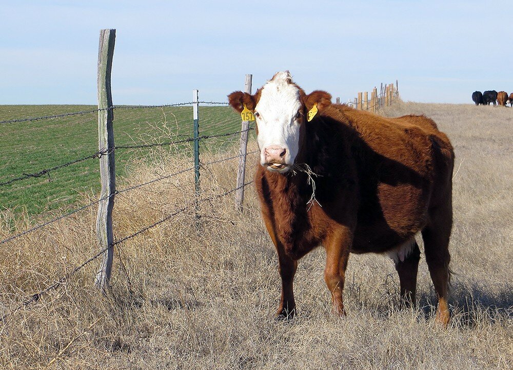
Despite the recent sub-zero temperatures, winter wheat was greening near Kimball as snow cover melted and March sunshine warmed the ground. Likewise, a few of the earliest cool season grasses were greening up.
Regional Forecast and Conditions
As of Tuesday morning (March 6), the temperature at sunrise was 24 F. degrees under clear skies. Wind was northwesterly at 22 mph. The day was expected to remain clear, cool, and quite breezy. Air temperatures were expected to reach into the mid-30’s before falling into the upper teens overnight.
Today’s (Friday) weather is expected to be mostly sunny and breezy with a high temperature of 63 degrees and an overnight low of 30 degrees. Saturday and Sunday are forecast to be slightly cooler and less windy, with highs in the low 50’s and lows falling to about 22 degrees. No precipitation is forecast for the weekend.
Monday through Wednesday are expected to be sunny and a bit warmer, with daytime highs ranging in the mid-50’s and overnight lows falling into the upper-20’s. There is no precipitation forecast through mid-week.
Daytime air temperatures warmed across the region last week. At Kimball the Feb. 27-March 5 daytime high averaged 52.71 degrees about 23 degrees warmer than the previous week. The weekly high temperature was 68 degrees on March 3. Overnight lows warmed as well, averaging 23.0 degrees, about 18 degrees warmer than the previous week. The weekly low temperature was 21 degrees on Feb. 27 and March 5. The weekly mean temperature was 37.85 degrees, about 21 degrees warmer than the previous week, and about 1.8 degrees warmer than the March average of 36.0 degrees. The long-term average high and low temperatures at Kimball for March are 49.8 and 22.2, respectively.
It was an extremely dry week across the region last week. Across the Panhandle over the period all stations reported zero precipitation. Snowfall averaged zero inches and liquid equivalent precipitation averaged zero inches. Last week’s averages were 3.38 and 0.20 inches respectively.
Soil temperatures warmed across the Panhandle over the period (this week/last week/change): Alliance 30.9/27.8 (+3.1) degrees; Gordon 30.9/28.9 (+2.0) degrees; Mitchell 34.4/30.4 (+4.0) degrees; Scottsbluff 32.8/30.4 (+2.4); and Sidney 33.3/28.6 (+4.7) degrees.
Winds near Kimball averaged westerly and quite breezy over the Feb. 27-March 5 period. Gusts for the week averaged 31.71 mph. High gust for the week was 58 mph on March 5.
February weather almanac
Average 7 a.m. conditions: temperature 19.8 degrees, winds south-southwesterly at 5.28 mph, barometer 29.96.
Average daily high temperature 38.53 degrees (125 year average 43.0). Average daily low temperature 13.07 degrees (125YA 15.7). Daily average temperature 25.80 degrees (125YA 29.4). Total liquid precipitation 1.75 inches (125YA 0.47). Year to date (YTD) precipitation 2.37 inches (125YA 0.84). Total snowfall 13.15 inches (125YA 5.6). YTD snow 19.95 inches (125YA 10.6).
Departures: Daily High, -4.47 degrees; Daily Low, -2.63 degrees; Daily Average, -3.6 degrees; Total Liquid Precipitation, +1.28 inches; YTD precipitation +1.53 inches. Total Snow, +7.55 inches. YTD snow +9.35 inches.
March 9 Weather Almanac
Here’s an overview of March 9 temperature and precipitation highs, lows, and averages over the preceding 125 years at Kimball. Data is taken from the High Plains Regional Climate Center (www.hprcc.unl.edu), where you can easily find and track data for your own particular location.
Last year: Daily high temperature 67 degrees, overnight low 20 degrees, average temperature 43.5 degrees. Precipitation zero inches, snowfall zero inches, snow depth zero inches.
The warmest March 9 on record was 78 degrees in 1972. The coolest March 9 high temperature was 15 degrees in 1932. The coldest March 9 overnight low was -8 degrees in 1924. The warmest March 9 overnight low was 40 degrees in 1900. Over the years since 1893 the high temperature on March 9 has averaged 48 degrees, the overnight low 21 degrees, the daily average 34.4 degrees, precipitation has averaged 0.03 inches, snowfall 0.3 inches, snow depth zero inches.
The highest March 9 precipitation total was 1.15 inches liquid equivalent in 1992. The greatest snowfall was 14.0 inches in 1992. Greatest snow depth was 14.0 inches in 1987.
Snow has fallen on March 9 at Kimball 28 times over the last 125 years, with quantities ranging from a trace to 14.0 inches.
U.S. Drought Monitor
National Summary: This past week was marked by heavy rain across the mid-South and lower Midwest. The excessive rain broke daily precipitation records, caused flooding in many locations, and led to significant improvements to drought.
The upper Midwest received significant snowfall as colder than normal temperatures dominated the area. Precipitation also fell in other parts of the country including the northern Plains, Northeast, and much of the West.
Dry weather was confined to southern California, the Desert Southwest, and lower Southeast.
A stark temperature contrast existed between the western and eastern halves of the country. While the West saw record-breaking cold, the East saw record-breaking warmth. Temperatures in the West were typically between 8 and 12 degrees below normal, though the northern Rockies and High Plains saw departures of more than 20 degrees below normal. In the eastern half of the country, departures ranged from 2 to more than 20 degrees
above normal.
High Plains: Some light to moderate precipitation fell in central and eastern Nebraska and the eastern Dakotas, while heavier precipitation fell in southeast Kansas during the series of major rain/snow events in the central and southern United States.
Abnormally dry conditions improved in parts of eastern Nebraska, north-central Nebraska, southeast South Dakota, northeast Colorado, and southwest Nebraska. A small part of the moderate drought in central South Dakota improved to abnormal dryness.
Despite ample snowfall amounts in South Dakota in the last week, water content was low and did not provide much relief in the moderate to severe drought conditions. The area of severe drought in the western Dakotas was changed to long-term drought as the impacts are limited to lingering groundwater and long-term precipitation deficits.
West: An upper-level trough persisted in the West this week, bringing cool temperatures to all areas and moderate to heavy precipitation to parts of Idaho, western Oregon and Washington, the San Juan and Snowy Ranges in Colorado and Wyoming, and the Sierra Nevada. Abnormal dryness developed in northeastern lower Idaho as seasonal precipitation deficits intensified.
Severe drought was introduced southeast Utah as water year precipitation and snow water equivalent are ranked in the lowest percentiles. Urban areas of southern California already in severe drought have continued to experience largely dry conditions; conditions remain at status quo because of the recent rain and lack of widespread water supply issues.
U.S. Conditions and Weather Report
(March 6) Two more rounds of precipitation struck the South, East, and lower Midwest, followed by the return of favorably dry weather. Precipitation was less organized than previously observed, but enough rain (locally 2 to 4 inches or more) fell across the interior Southeast to aggravate and prolong flooding.
The highest flood crest since March 1997 continued to move along the Ohio River, disrupting barge traffic and submerging bottomland fields. Flooding also persisted in other areas from the mid-South into the lower Midwest, resulting in some relocation of livestock and leaving low lying winter wheat fields flooded.
Toward week’s end, a late-winter storm intensified near the northern Atlantic Coast, generating rain, snow, high winds, and heavy surf. The wind resulted in widespread power outages, tree damage, and travel difficulties.
In contrast, dry weather prevailed across Florida’s peninsula and much of the Plains and upper Midwest. Intensifying drought maintained stress on rangeland, pastures, and winter grains across the southern half of the High Plains. Elsewhere, some of the season’s most impressive storminess arrived in the Sierra Nevada, helping to boost snowpack in an otherwise disappointing winter wet season. However, most of the precipitation bypassed the Southwest.
Temperatures across the South and East fell from record-setting levels but remained elevated, averaging at least 10 degrees above normal in parts of the Deep South and from the Midwest into the Northeast. In contrast, cold conditions persisted across the northern High Plains and much of the West. Weekly readings averaged as much as 10 degrees below normal from northern California to Montana.
USDA Weekly Weather and Crop Reports
Weekly crop progress reports have ended for the growing season. Monthly reports will be issued during the first week of January, February, and March. Next year’s weekly reports will begin the first week of April 2018.


