

Across the tri-state region September was slightly warmer than August with a bit more precipitation
This item is available in full to subscribers.
To continue reading, you will need to either log in to your subscriber account, or purchase a new subscription.
If you are a current print subscriber, you can set up a free website account and connect your subscription to it by clicking here.
If you are a digital subscriber with an active, online-only subscription then you already have an account here. Just reset your password if you've not yet logged in to your account on this new site.
Otherwise, click here to view your options for subscribing.
Please log in to continue |
KIMBALL, Neb. – Across the tri-state region September was slightly warmer than August with a bit more precipitation. At Kimball the September daily average temperature was about 1.5 degrees warmer than the 125-year average, while the August average was about 2.5 degrees cooler. Kimball’s September precipitation total of 1.16 inches was a tenth less than the 125-year average, while the August total of 0.91 inches fell short of the 125-year average by 0.89 inches.
Year-to-date at Kimball the daily average temperature has been about one degree warmer than the 125-year average, while total precipitation is about 4.5 inches above the 125-year average.
As of Oct. 2 most locations across the region have seen first frost, though a few areas have yet to see the temperature touch 32 degrees.
As September came to a close and October arrived, harvest activities were beginning across the region. A lot of proso millet was being combined as well as some corn. Dry beans have mostly been harvested and sugarbeet harvest is just getting underway.
Well managed pastures and rangeland continued to show more green than is usual this late in the season. With generally warm daytime temperatures and only a few touches of overnight frost, cool season grasses continue to photosynthesize and even continue to produce a bit of new growth. Winter annual grasses remain green and continue to produce very nutritious and palatable browse for livestock.
Regional Forecast and Conditions
As of Tuesday morning, the temperature at sunrise was 43 degrees under clear skies. Winds were southwesterly at 6 mph and the barometer was steady at 30.04 inches of mercury (in/Hg).
Today’s weather is expected to be mostly sunny and mild with a 30 percent chance of afternoon and evening showers and a slight chance of light overnight snow. Daytime air temperatures should top out at 66 degrees before falling off to 32 over night.
Saturday and Sunday are expected to be cooler and breezy, partly- to mostly-cloudy with isolated showers and possible overnight snow showers. Saturday’s high should reach 50 and Sunday’s high 53. Overnight lows are forecast at 30 and 32, respectively.
Monday-Wednesday is expected to be similar to the weekend with an increased chance of scattered rain showers during the day and snow showers at night. Skies are forecast to be mostly cloudy with highs in the upper 40’s to low 50’s and overnight lows falling into the upper 20’s to low 30’s.
Daily average air temperatures cooled across the region last week. At 13 selected stations across the Panhandle 24-hour temperatures averaged 52.2 degrees, about 11.4 degrees cooler than the previous week. High temperature for the week was 89 degrees at Hemingford. Low temperature for the week was 20 degrees at Harrisburg 12WNW.
At Kimball the Sept. 25-Oct. 1 daytime high averaged 62.28 degrees, about 17.5 degrees cooler than the previous week. The weekly high temperature was 74 degrees on September 28. Overnight lows averaged 38.71 degrees, about 8.5 degrees cooler than the previous week. The weekly low temperature was 33 degrees on September 29. The weekly mean temperature at Kimball was 50.5 degrees, about 13 degrees cooler than last week, and about 10.2 degrees cooler than the September average of 60.7 degrees. The long-term average high and low temperatures at Kimball for September are 77 and 44.4, respectively, and for October are 64.3 and 32.8, respectively.
All 13 selected Panhandle stations reported rain over the Sept. 25-Oct. 1 period, ranging from 0.87 inches at Hemingford to 0.01 inches at Sidney. Across the Panhandle liquid equivalent precipitation averaged 0.26 inches, compared to 0.20 inches last week.
Reported soil temperatures cooled sharply across the Panhandle over the Sept. 25-Oct. 1 period (this week/last week/change): Alliance 55.4/76.4 (-21.0) degrees; Gordon 54.0/66.0 (-12.0) degrees; Mitchell 61.6/71.2 (-9.6) degrees; Scottsbluff 61.2/73.4 (-12.2) degrees; and Sidney 63.5/69.1 (-5.6) degrees.
Winds near Kimball averaged south-southeasterly and mostly light over the Sept. 25-Oct. 1 period. Gusts for the week averaged 26.42 mph. High gust for the week was 39 mph on September 30.
Weather Almanac
Here’s an overview of Oct. 5 temperature and precipitation highs, lows, and averages over the preceding 125 years at Kimball. Data is taken from the High Plains Regional Climate Center (www.hprcc.unl.edu), where you can easily find and track data for your own particular location.
Last year: Daily high temperature 53 degrees, overnight low 48 degrees, average temperature 50.5 degrees. Precipitation 0.03 inches, snowfall zero inches, snow depth zero inches.
The warmest Oct. 5 on record was 88 degrees in 1947. The coolest high temperature was 42 degrees in 1988. The coldest overnight low was 20 degrees in 1932. The warmest overnight low was 50 degrees in 1909. Over the years since 1893 the high temperature has averaged 66 degrees, the overnight low 35 degrees, the daily average 50.6 degrees, precipitation has averaged 0.04 inches, snowfall 0.01 inches, snow depth zero inches.
The greatest precipitation total was 1.34 inches (5 inches snow) liquid equivalent in 1951.
Snow has fallen at Kimball three times over the last 125 years, with 5 inches in 1951, 4 inches in 2001, and and a trace in 1969.
September weather almanac
Average 7 a.m. conditions: temperature 50.0 degrees, winds south-southeasterly at 6.8 mph, barometer 30.10 inches of mercury (in/Hg).
Average daily high temperature 78.53 degrees (125 year average 77.0). Average daily low temperature 47.73 degrees (125YA 44.4). Daily average temperature 63.1 degrees (125YA 60.7). Total liquid precipitation 1.16 inches (125YA 1.26). Year to date (YTD) precipitation 19.28 inches (125YA 14.77). Total snowfall zero inches (125YA 0.2). YTD snow 41.95 inches (125YA 26.6).
Departures: Daily High, +1.53 degrees; Daily Low, +3.33 degrees; Daily Average, +2.4 degrees; Total Liquid Precipitation, -0.10 inches; YTD precipitation +4.51 inches. Total Snow -0.2 inches, YTD snow +15.35 inches.
U.S. Drought Monitor
National Summary: The combination of energetics from northern Mexico lifting toward the Southern Rockies/Great Plains and enhanced moisture from the remains of a tropical depression led to heavy precipitation events across the south-central U.S., particularly notable as a frontal zone stalled. Significant rain fell across much of the South, leading to much improved drought conditions in many areas. In fact, several regions across the U.S. received at least double (or more) of their typical precipitation for this time of the year over the past week, including the far Pacific Northwest, eastern Montana to northern Nebraska and Iowa and western Wisconsin, southwestern Arizona into northwestern New Mexico, and a large swath encompassing much of Texas northeastward to southern New Hampshire, part of which was from the remnants of Florence, now classified as the second wettest storm of the past half century to impact the U.S. Parts of the Southeast and most of the West were dry and drought conditions spread or worsened in several regions.
High Plains: As summer comes to a close and fall begins, many areas across the High Plains continue to experience dry conditions.
In eastern Kansas, extreme drought (D3) was extended into the northern half of Osage County as well as southwestward into northeastern Marion County.
Extreme drought was introduced in Eddy County in east central North Dakota, with adjoining extreme (D2) and moderate (D1) drought each extending slightly farther south to southern Foster County. These counties have each received less than 25 percent of their typical precipitation over the past two months. Among some of the local observances: “soybean yields are disappointing. Corn harvest has started, more than a month earlier than normal. Grasshoppers are thick in some areas of the county, damaging some late season crops. Some producers have started feeding their cattle, which typically does not happen until first snowfall. Pastures are bare and water sources have dried up. Producers are having to haul cattle home from pastures.”
In northern Wyoming, a small patch of D0 was introduced to northern Campbell County, and a larger swath was introduced just to the south from Johnson County (Wyoming) east to Shannon County (South Dakota). These areas have also seen below-average precipitation over the past two months, with Mt Rushmore the fifth driest in its record for this period.
West: An upper low dropping down from the Gulf of Alaska sparked widespread precipitation across western Washington in the Pacific Northwest, helping lead to improvements along the coastal region to just across the Oregon state line.
With high temperatures generally in the mid to upper 60s, up to 4 inches of rain fell over the bullseye of severe drought (D2) in north central Montana along the Canadian border this past week, improving conditions here.
In Utah, Idaho, and Nevada, however, little to no precipitation fell and temperatures remained above average.
Severe drought expanded across southern Idaho and southward through Elko into White Pine County in northeastern Nevada and the remaining areas of Box Elder, Tooele, Juab, and Millard Counties in neighboring Utah. A local report from Tooele County notes a range of poor conditions, from extreme fire danger to low ponds to pulling herd off the rangeland to near-empty reservoirs. This region has received little rain since April and are below-average at the beginning of the fall season, when the region should see an increase in precipitation. In northern Utah, extreme drought (D3) was expanded farther west in Box Elder County.
Across Utah, 66 percent of pasture and range land were rated poor or very poor for the period ending September 23, while 68 percent of the topsoil moisture rated poor to very poor for the same period.
Conditions also degraded in other areas. Extreme drought was expanded northward over southeastern Utah, northwestern Colorado, and slightly into Carbon County in southern Wyoming.
With only one week left in the water year, the gauge on the San Juan River near Bluff, Utah, is on course to break its 92-year record for lowest accumulated discharge. Severe and moderate (D1) drought also expanded slightly along the Continental Divide.
With a lack of precipitation in August and September to date, abnormal dryness (D0) was expanded to the north and east in northeastern Colorado. Exceptional drought (D4) expanded in southwestern Colorado and northern New Mexico due to high temperatures, in addition to the continuing lack of precipitation.
Near-term forecast: The Climate Prediction Center’s 6-10 day outlook favors above-normal temperatures across most of the southern and eastern contiguous U.S. Below-normal temperatures are favored over central and northern California extending eastward into Wisconsin.
There is an increased chance of above-normal precipitation across most of the contiguous U.S. during this period. Looking two weeks out the forecast predicts little change except for near-normal temperatures over the west coast, while near- to below-normal precipitation is forecast over parts of the Pacific Northwest and above-normal precipitation is predicted over the entire eastern U.S.
D-Categories
D0: Abnormally Dry, showing dryness but not yet in drought or recovering from drought.
D1: Moderate Drought
D2: Severe Drought
D3: Extreme Drought
D4: Exceptional Drought
For more information on the U.S. Drought Monitor visit: http://droughtmonitor.unl.edu
U.S. Conditions and Weather Report
A series of cold fronts raced across the Plains and Midwest, generating widely scattered showers before plowing into deeper moisture and sparking heavier rain across the South and East.
Weekly rainfall totaled 2 to 4 inches or more in a broad area stretching from the western Gulf Coast region into southern New England, slowing or halting harvest activities and other autumn fieldwork. Only scattered showers affected the eastern Carolinas, allowing hurricane- and flood-recovery efforts to proceed amid temperatures that averaged 5 to 10 degrees above normal. Warm, mostly dry weather also prevailed along the southern Atlantic Coast.
Periods of dry weather allowed for the resumption of some Midwestern harvest activities, although lingering heavy rain in the Ohio Valley impeded fieldwork. In addition, cooler weather across the upper Midwest slowed evaporation rates and helped to perpetuate muddy conditions.
Cool air also settled across the Plains, where showers were generally light and scattered, except for briefly heavy midweek rain in parts of Oklahoma and Texas.
Weekly temperatures averaged at least 5 to 10 degrees below normal in parts of the north-central U.S., where late-week freezes ended the growing season in most areas from Montana to Wisconsin. Widespread freezes also affected large sections of the northern and central Rockies, the northern Intermountain West, and the northern Great Basin.
Elsewhere, mostly dry weather in the western U.S. favored fieldwork, including Northwestern winter wheat planting and Arizona cotton harvesting. Summer-like heat in the Southwest boosted temperatures 5 to 10 degrees above normal.
USDA Weekly Weather and Crop Reports
Colorado
In Colorado last week, fieldwork activities continued on pace amidst minimal precipitation.
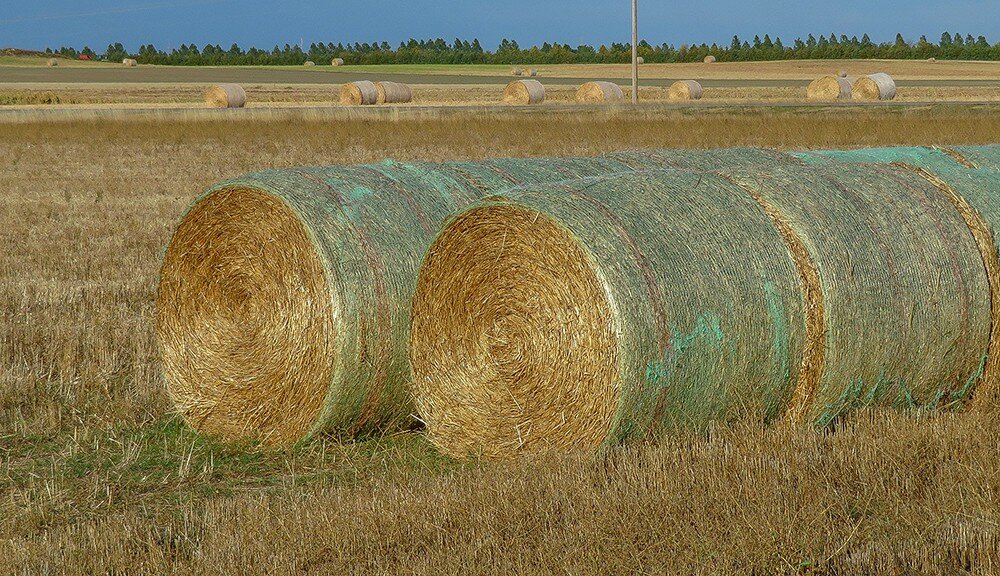
Northeastern county reporters noted winter wheat continued to be seeded despite dry conditions. Limited corn for grain harvest began last week, but most producers were waiting for the crop to dry down. Livestock remained in good condition but a reporter noted a good deal of baled hay was hauled out as fast as it was harvested, a reflection of short forage supplies and regional drought conditions.
In east central counties, producers were harvesting corn for grain but saw a late start because of morning dew. Most winter wheat was noted to be planted and the emerged crop looked good thus far. Lack of precipitation remained a concern, especially for pasture conditions in east central counties.
Southwestern counties stayed warm and dry last week with no relief from exceptional drought conditions. In the San Luis Valley, potato harvest and third cutting of alfalfa progressed quickly last week and minimal moisture was received. A reporter noted livestock were being moved off mountain pasture about two weeks early.
In southeastern counties, a reporter noted precipitation was minimal and corn for grain harvest began last week. Hay harvest was noted as slow because of heavy dew. Calves were noted as being weaned a little earlier than normal to save grass and allow cows to regain body condition.
Statewide, corn was rated 68 percent good to excellent, compared with 65 percent good to excellent last year.
Stored feed supplies were rated 8 percent very short, 28 percent short, 61 percent adequate, and 3 percent surplus.
Sheep death loss was 77 percent average and 23 percent light. Cattle death loss was 1 percent heavy, 84 percent average, and 15 percent light.
Nebraska
No report
Wyoming
Wyoming experienced cooler than normal temperatures for the week. Twenty-two of the 32 reporting stations reported below average temperatures for the week with the high temperature of 88 degrees recorded at Lance Creek and a low of 18 degrees at Big Piney and Jackson Hole.
Below normal moisture was reported at 25 of the 34 reporting stations. Eight reporting stations had no moisture. Big Horn reported the most moisture with 1.19 inches.
A reporter from North Central Wyoming indicated that fall planting is underway, the livestock look good and calves are ready to be shipped.
A reporter from Western Wyoming reported that they are still in a drought situation and hoping for some moisture this week. They also indicated there have been a lot of forest and rangeland fires in the area.
A reporter from Southwestern Wyoming noted that the weather has been very dry and windy. They also stated that the cows are coming out of the forest early and many producers have no place to put them.
Irrigation water supply across Wyoming was rated 5 percent short, 3 percent fair, and 92 percent good.
Stock water supplies across Wyoming were rated 20 percent very short, 16 percent short, and 64 percent adequate.


