

Several fast-moving weather fronts flowed through the tri-state region over the last few days of March and first week of April, bringing cool temperatures, widespread but relatively light moisture, and occasional breeziness.
This item is available in full to subscribers.
To continue reading, you will need to either log in to your subscriber account, or purchase a new subscription.
If you are a current print subscriber, you can set up a free website account and connect your subscription to it by clicking here.
If you are a digital subscriber with an active, online-only subscription then you already have an account here. Just reset your password if you've not yet logged in to your account on this new site.
Otherwise, click here to view your options for subscribing.
Please log in to continue |
KIMBALL – Several fast-moving weather fronts flowed through the tri-state region over the last few days of March and first week of April, bringing cool temperatures, widespread but relatively light moisture, and occasional breeziness.
Rain/snow mix came overnight on March 28/29, delivering about 0.22 inches of moisture to Kimball. A follow-on storm began late in the evening of March 31 and continued throughout much of Easter Sunday. This storm delivered about four inches of snow containing about 0.4 inches of liquid moisture. Snow falling on warm ground combined with plunging air temperatures to make a slushy, icy mess of roads, and these conditions contributed to a number of serious accidents suffered by holiday travelers. Temperatures warmed on April 2 and the trailing edge of the departing weather front delivered widespread but very light rain throughout the day.
All together Kimball received about 0.7 inches of liquid equivalent precipitation from these spring weather systems, and this moisture was welcome and quite beneficial following a dry autumn
and winter.
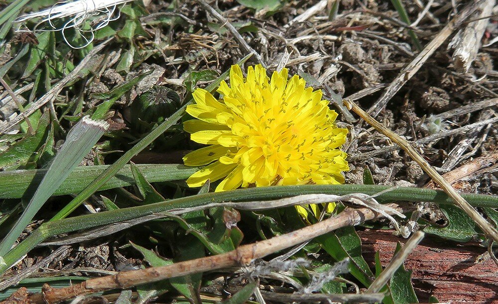
Winter wheat stands near Kimball continue to green nicely, however some stands have been ravaged by winterkill and will be unlikely to recover. Even relatively healthy wheat stands were highly stressed over the winter and it will be interesting to see how winter stress affects yields.
Pasture and rangeland continue to green nicely as well, and this latest round of moisture should allow very nice cool season grass production.
The recent storms made for stressful calving and there was some death loss to newborn calves.
Regional Forecast and Conditions
As of Tuesday morning (April 3), the temperature at sunrise was 18 degrees. A fast moving weather system was hard on the heels of Monday’s pleasant conditions, and the morning was fair and breezy with a northwest wind at 24 mph gusting to 35 mph. The barometer was rising at 29.99 inches of mercury (in/Hg). The day was expected to remain sunny, cool, and quite breezy. Air temperatures were expected to reach 41 degrees before falling to an overnight low of 22 degrees. The cool temperatures and breeziness were expected to linger through Wednesday and dissipate by Thursday, but forecasters were calling for the arrival of a weekend weather system bringing more cold and snow beginning today (Friday).
Today’s weather is expected to be overcast and cool with a high of 31. Northwest winds of 25-30 mph gusting to 40 mph are in the forecast, as well as a 60 percent chance of snow. The temperature is expected to fall to 22 degrees overnight with a continued but reduced chance of snow. Saturday is expected to remain cloudy but with warming air temperatures reaching a high of about 53 degrees by mid-afternoon. Afternoon and evening rain is in the forecast with a chance of rain/snow mix as overnight temperature fall to about 33 degrees. Sunday’s forecast calls for partly sunny skies and breezy conditions as the slow moving weather front lingers. Sundays high will reach 57 before falling off to a blustery 27 degrees
overnight.
Monday through Wednesday are expected to remain partly cloudy and breezy as the weather system slowly moves east. Daytime air temperatures will rise into the low 50’s and overnight lows are forecast to fall into the upper 20’s to low 30’s. There is a slight to moderate chance of precipitation forecast for the Monday-Wednesday period.
Daytime air temperatures cooled across the region last week. At Kimball the March 27-April 2 daytime high averaged 51.14 degrees, just over 11 degrees cooler than the previous week. The weekly high temperature was 69 degrees on April 2. Overnight lows cooled about 7 degrees, averaging 23.14. The weekly low temperature was 18 degrees on Easter Sunday, April 1. The weekly mean temperature was 37.14 degrees, about 8 degrees cooler than the previous week, and 8 degrees cooler than the April average of 45.2 degrees. The long term average high and low temperatures at Kimball for April are 59.6 and 30.9,
respectively.
Widespread snow fell across much of the region over the last week. All Panhandle stations reported snow with quantities ranging from a trace to nearly 6 inches. Liquid equivalent moisture ranged from 0.01 inches to 0.70 inches over the March 27-April 2 period. Snowfall averaged 2.8 inches and liquid equivalent precipitation averaged 0.31 inches. Last week’s averages were 0.54 and 0.15 inches respectively.
Soil temperatures cooled slightly across the Panhandle over the March 27-April 2 period: (this week/last week/change): Alliance 39.5/41.4 (-1.9) degrees; Gordon 38.8/42.3 (-3.5) degrees; Mitchell 42.0/44.5 (-2.5) degrees; Scottsbluff 42.1/44.5 (-3.4); and Sidney 41.5/46.4 (-4.9) degrees.
Winds near Kimball averaged northwesterly and occasionally breezy over the March 27-April 2 period. Gusts for the week averaged 30.14 mph. High gust for the week was 44 mph on April 2.
March weather almanac
Average 7 a.m. conditions: temperature 29.06 degrees, winds south-southeasterly at 4.8 mph, barometer 29.97.
Average daily high temperature 54.58 degrees (125 year average 49.8). Average daily low temperature 24.9 degrees (125YA 22.2). Daily average temperature 39.74 degrees (125YA 36.0). Total liquid precipitation 1.033 inches (125YA 1.03). Year to date (YTD) precipitation 3.403 inches (125YA 1.87). Total snowfall 6.5 inches (125YA 8.7). YTD snow 26.45 inches (125YA 19.3).
Departures: Daily High, +4.78 degrees; Daily Low, +2.7 degrees; Daily Average, +3.74 degrees; Total Liquid Precipitation, +0.003 inches; YTD precipitation +1.533 inches. Total Snow, -2.2 inches. YTD snow +7.15 inches.
April 6 Weather Almanac
Here’s an overview of April 6 temperature and precipitation highs, lows, and averages over the preceding 125 years at Kimball. Data is taken from the High Plains Regional Climate Center (www.hprcc.unl.edu), where you can easily find and track data for your own particular location.
Last year (April 6, 2017): Daily high temperature 54 degrees, overnight low 29 degrees, average temperature 41.5 degrees. Precipitation zero inches, snowfall zero inches, snow depth zero inches.
The warmest April 6 on record was 82 degrees in 1991. The coolest April 6 high temperature was 26 degrees in 1997. The coldest April 6 overnight low was 5 degrees in 1983. The warmest April 6 overnight low was 45 degrees in 1960. Over the years since 1893 the high temperature on April 6 has averaged 55 degrees, the overnight low 28 degrees, the daily average 41.3 degrees, precipitation has averaged 0.04 inches, snowfall 0.2 inches, snow depth zero inches.
The highest April 6 precipitation total was 0.79 inches liquid equivalent (snow) in 1927. The greatest snowfall was 6.0 inches in 1938. Greatest snow depth was 6.0 inches in 1938.
Snow has fallen on April 6 at Kimball 20 times over the last 125 years, with quantities ranging from a trace to 6.0 inches.
U.S. Drought Monitor
(March 27) National Summary: Early in the drought week, moderate precipitation fell in an area covering southern Minnesota stretching southeastward through central Iowa and Illinois, southern Indiana, Kentucky, southwestern Virginia, and much of North Carolina. Heavier precipitation fell in coastal California and the Sierra range. Coastal Oregon and Washington also saw moderate to heavy precipitation amounts during the first half of the drought week. The Northeast experienced its fourth Nor’easter in as many weeks. Near the end of the drought week, a swath of precipitation fell from Texas, eastern Oklahoma, into Missouri and Indiana. The dry pattern continued for the drought-stricken areas of the southern Rockies and Plains and parts of the Southeast.
High Plains: Precipitation was light across the region during the USDM period as, generally speaking, less than 1 inch of precipitation fell.
Aside from Kansas and Colorado, precipitation during the past 30-days was just ahead of normal as surpluses of 0.50 to 1 inch fell in much of North Dakota, eastern South Dakota and eastern Nebraska.
Winter wheat conditions were rated 49 percent poor to very poor in Kansas while 69 percent of topsoil moisture across the state was short to very short. In southern Kansas, 180-day precipitation departures are 4-8 inches below normal.
In southwestern South Dakota, recent precipitation allowed for D0 and D1 to be contracted. Severe drought (D2) was contracted in west central Colorado and in the Dakotas. Extreme drought (D3) was expanded southern and western Colorado and southern Kansas.
West: Copious precipitation fell in the West during the USDM period, helping to restore the below-normal seasonal mountain snowpack in the Sierra. In the lower elevations, the atmospheric river event caused flash flooding and mudslides in the same area where forest fires last December charred the landscape. Little to no precipitation fell during the week in Arizona and New Mexico.
Despite the recent precipitation in California, departures are evident beyond 30 days. At the 6-month time scale, precipitation amounts are 30-50 percent of normal in Southern California. However, for the same period (6-month), the recent storm brought the precipitation totals closer to normal in the central and northern Sierra. River basin snow water content now measures 75-90 percent of average in the central Sierra.
The recent storm allowed the contraction of drought across much of the West this USDM period. However, where the precipitation did not fall (Desert Southwest and northwestern New Mexico), Severe and Extreme drought (D2-D3) was expanded.
For more information on the U.S. Drought Monitor visit: http://droughtmonitor.unl.edu
U.S. Conditions and Weather Report
(April 3) Heavy rain, locally in excess of 4 inches, sparked flooding and halted fieldwork across the mid-South and much of the western Gulf Coast region. Soaking rain also struck the lower Midwest, causing some renewed lowland flooding just a month after the middle Ohio River rose to its highest level in 21 years.
Farther west, however, a sharp gradient existed between heavy rain across the southeastern Plains and little or no precipitation on the central and southern High Plains. As a result, most rangeland, pastures, and winter grains across the High Plains’ core drought area continued to experience significant stress, especially given the continuation of warm weather.
Meanwhile, mostly dry weather returned to California, the Great Basin, and the Intermountain West, following a month-long period of late-season storminess that substantially improved runoff prospects and snowpack. Precipitation lingered across the Rockies and Pacific Northwest.
Elsewhere, unusually cold weather and periods of snow prevailed across the northern Plains and upper Midwest, while mostly dry weather covered southern Florida and the mid-Atlantic coastal plain. Weekly temperatures averaged more than 5 degrees below normal across large sections of Montana and North Dakota, as well as parts of the upper Mississippi Valley, but ranged from 5 to 10 degrees above normal in portions of California and from the southern Rockies to the Mississippi Delta.
(March 27) Chilly conditions prevailed for the third week in a row across much of the eastern one-third of the country.
In the Northeast, mostly dry weather accompanied the below-normal temperatures, but a mid-week storm produced heavy snow in portions of the Mid-Atlantic region and grazed New England.
A late-week storm deposited a stripe of heavy snow from the northern Plains into the southern Mid-Atlantic region, with some locations receiving more than a foot.
Farther south and west, early-week precipitation benefited rangeland, pastures, and winter wheat in much of Kansas and environs.
In contrast, warm, mostly dry weather persisted across the southern Plains and the Desert Southwest, leading to further drought intensification. Weekly temperatures averaged 5 to 10 degrees above normal in a broad area covering the south-central U.S., and briefly topped 90 degrees as far north as southwestern Kansas.
Elsewhere, stormy weather dominated the Pacific Coast States, with multiple rounds of heavy precipitation striking California. California’s precipitation caused local flooding but further improved water-supply prospects. Other areas of the West, excluding the southern tier of the region, also received significant rain or snow.
USDA Weekly Weather and Crop Reports
Colorado
For the week ending April 1, Spring fieldwork was well underway last week across Colorado. Isolated moisture was received in areas, but not enough to provide any real relief from drought conditions. Producers statewide were noted to be fertilizing and spraying for weeds where conditions allowed.
Reporters in northwestern counties noted snowpack remained low in areas, which is concerning for summer water supplies. A reporter noted that snow cover over rangeland was receding earlier than producers preferred.
In northeastern counties, needed moisture was received in areas, reportedly delaying fieldwork. Localities that did not receive moisture or had less were noted to remain dry and in need of precipitation.
Reporters in east central and southeastern counties noted last week was mostly dry, although some areas received isolated showers. Prolonged drought conditions continued to degrade dryland crop and pasture conditions. Coupled with high winds, fire danger was elevated and some tilled ground was noted to blow.
In southwestern counties, producers started to cull livestock due to continued poor range condition and expected shortage of water availability. High winds erased any benefit from received moisture.
In the San Luis Valley, welcome wet snow earlier in the week prevented producers from getting in the field, but preparation for small grains planting continued later in the week.
As of March 29, 2018, snowpack in Colorado was 72 percent measured as percent of median snowfall. The Southwest and San Luis Valley were 53 and 54 percent, respectively.
Stored feed supplies were rated 2 percent very short, 21 percent short, 73 percent adequate, and 4
percent surplus.
Sheep death loss was 41 percent average and 59 percent light. Cattle death loss was 74 percent average and 26 percent light.
Nebraska
For the week ending April 1, there were 3.3 days suitable for fieldwork.
Topsoil moisture supplies rated 2 percent very short, 18 short, 73 adequate, and 7 surplus. Subsoil moisture supplies rated 2 percent very short, 23 short, 73 adequate, and 2 surplus.
Winter wheat condition rated 1 percent very poor, 5 poor, 43 fair, 39 good, and 12 excellent.
Oats planted was 10 percent, behind 25 last year and 20 for the five-year average.
Wyoming
For the week ending April 1,Wyoming experienced cooler than normal temperatures for the week. Twenty-six of the 31 reporting stations reported below average temperatures for the week with the high temperature of 68 degrees recorded at Lander, and a low of 3 degrees below zero at Yellowstone.
Above normal moisture was reported at twenty-one of the 32 reporting stations with four stations reporting no precipitation. Sheridan reported the most moisture with 1.39 inches.
A reporter from Northwest Wyoming indicated that some late storms have delayed planting.
A reporter from North Central Wyoming stated that they have had winter storms and cold winds causing calving/lambing issues. They also indicated that although no planting has occurred farmers are working the ground when they get a chance.
A reporter from Western Wyoming stated that they have been getting moisture off and on which has made it difficult to get field work done.
A reporter from Southwest Wyoming stated that conditions are dry and mild which has helped livestock, but the dry conditions are a concern for forage production.
A reporter from South Central Wyoming indicated that they have gotten some moisture but it is still dry. Another reporter from South Central Wyoming stated that it has been cool and damp, calving and lambing is going well, and there is more optimism about
irrigation water.
A reporter from Southeast Wyoming stated that they have gotten slightly above normal moisture at the lower altitudes but irrigation storage is below normal. Another reporter from Southeast Wyoming indicated that temperatures have been highly variable and they got some moisture in the form of snow and rain.
Hay and roughage supplies for Wyoming were rated 10 percent very short, 15 percent short, 70 percent adequate, and 5
percent surplus.
Stock water supplies across Wyoming were rated 1 percent very short, 13 percent short, 85 percent adequate, and 1 percent surplus.


