

The arrival of spring warmth has been slightly delayed
This item is available in full to subscribers.
To continue reading, you will need to either log in to your subscriber account, or purchase a new subscription.
If you are a current print subscriber, you can set up a free website account and connect your subscription to it by clicking here.
If you are a digital subscriber with an active, online-only subscription then you already have an account here. Just reset your password if you've not yet logged in to your account on this new site.
Otherwise, click here to view your options for subscribing.
Please log in to continue |
KIMBALL – The arrival of spring warmth has been slightly delayed compared to the long term average across most of the tri-state region this year as shifting weather patterns have delivered alternating cool and warm conditions. In light of an 18-month dry spell, the unsettled air patterns have been favorable as they have also delivered much needed precipitation, recharging soil moisture profiles and boosting springtime greenup.
A May 21-22 hard freeze nipped winter wheat in many areas and producers are still assessing damage. In some areas there may be significant impact to grain production, but it’s not yet clear how much damage was done.
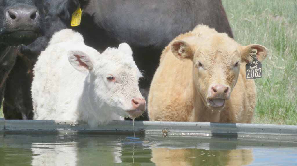
Precipitation, sunshine, and warming temperatures are providing near-perfect conditions for cool season grass production across much of the region’s prairies and rangelands and cattle appear to be thriving.
While weather conditions slowed spring tillage and planting somewhat, most producers have been able to get into the fields and it looks like spring crops will soon be catching up.
Regional Forecast and Conditions
As of Tuesday morning (June 7), the temperature at sunrise was 55 degrees under cloudy skies. Winds were Northerly at 1 mph and the barometer was steady at 30.06 inches of mercury (in/Hg).
Today’s weather (Friday, June 10) is expected to be mostly sunny and warm with a high temperature of 82 degrees and a chance of afternoon and evening thunderstorms. Skies will be mostly clear overnight and the low will fall to about 46 degrees. Day length will be 15 hours and 5 minutes, night length 8 hours and 55 minutes.
Saturday and Sunday are expected to be sunny and hot with air temperatures reaching into the low- to mid-90s and with a slight chance of afternoon and evening thunderstorms. Saturday and Sunday night should be clear with temperatures dropping into the mid-50s.
Monday is forecast to be slightly cooler and breezy with continuing sunny skies and a high temperature of about 89. There is a slight chance of afternoon and evening thunderstorms forecast and air temperatures should fall to about 55 overnight.
The remainder of the week is expected to be mostly sunny, warm, and somewhat breezy. Daytime highs will range in the 80s with overnight lows falling to about 55.
At Kimball the May 31- June 6 daytime high averaged 73 degrees, about 0.86 degrees warmer than last week. The weekly high temperature was 83 degrees on June 6. Overnight lows averaged 41 degrees, about 0.25 degrees cooler than last week. The weekly low temperature was 35 degrees on June 2. The weekly mean temperature at Kimball was 58.14 degrees, about 1.43 degrees warmer than last week and 7.06 degrees cooler than the June average of 65.2 degrees. The long term average high and low temperatures at Kimball for June are 80.3 and 50.1, respectively.
Kimball received 0.26 inches of rain over the May 31- June 6 period.
Winds near Kimball averaged southerly and generally mild during the May 31- June 6 period. Gusts for the week averaged 29.71 mph. High gust for the week was 38 mph on June 5.
Historic climate data
Here’s an overview of June 10 temperature and precipitation highs, lows, and averages over the preceding 129 years at Kimball. Data is taken from the High Plains Regional Climate Center (www.hprcc.unl.edu), where you can find and track data for your own particular location.
Last year (June 10, 2021): Daily high temperature 93 degrees, overnight low 60 degrees, average temperature 76.5 degrees. Precipitation zero inches, snowfall zero inches, snow depth zero inches.
The warmest June 10 on record was 100 degrees in 1933. The coolest June 10 high temperature was 51 degrees in 1955. The coldest June 10 overnight low was 33 degrees in 1984. The warmest June 10 overnight low was 62 degrees in 1953. Over the years since 1893 the high temperature on June 10 has averaged 78 degrees, the overnight low 48 degrees, the daily average 62.8 degrees, precipitation has averaged 0.08 inches, snowfall zero inches, snow depth zero inches.
The highest June 10 precipitation total was 2.52 inches (rain) in 1986. Highest snowfall zero inches, highest snow depth zero inches.
USDA Weekly Weather Bulletin
Aside from southern Texas and from central and southern California to the southern Rockies, most areas of the country received precipitation in late May and early June. Some of the heaviest rain (locally 2 to 4 inches or more) fell on the Plains, slowing fieldwork—including winter wheat harvesting—but further reducing drought’s footprint and generally benefiting rangeland, pastures, and summer crops. Even amid occasional showers, Midwestern producers made progress on late-season planting. However, late-May downpours in the north central U.S., including the Red River Valley, resulted in another setback for farmers still attempting to seed crops such as corn, soybeans, sugarbeets, and spring wheat. Meanwhile, the lingering chill across the nation’s northwestern quadrant contrasted with hot weather in much of Texas and significantly above normal temperatures from the lower Great Lakes region into the middle and northern Atlantic States. Weekly temperatures averaged at least 5 degrees below normal across northern sections of the High Plains and Intermountain West— but averaged more than 5 degrees above normal in central Texas and parts of the middle and northern Atlantic States.
USDA Crop Progress Reports
Nebraska – For the week ending June 5, 2022, there were 5.4 days suitable for fieldwork. Topsoil moisture supplies rated 11% very short, 25% short, 62% adequate, and 2% surplus. Subsoil moisture supplies rated 16% very short, 32% short, 51% adequate, and 1% surplus.
Corn condition rated 1% very poor, 4% poor, 20% fair, 62% good, and 13% excellent. Corn emerged was 88%, behind 93% last year, and near 89% for the five-year average.
Soybean condition rated 1% very poor, 4% poor, 16% fair, 67% good, and 12% excellent. Soybeans planted was 96%, near 97% last year, but ahead of 90% average. Emerged was 75%, behind 82% last year, but near 71% average.
Winter wheat condition rated 20% very poor, 17% poor, 34% fair, 24% good, and 5% excellent. Winter wheat headed was 74%, near 75% last year and 73% average.
Sorghum condition rated 0% very poor, 4% poor, 24% fair, 71% good, and 1% excellent. Sorghum planted was 77%, ahead of 69% last year and 72% average.
Oats condition rated 10% very poor, 13% poor, 25% fair, 45% good, and 7% excellent. Oats emerged was 95%, near 98% last year, and equal to average. Headed was 14%, well behind 50% last year and 41% average.
Dry edible beans planted was 40%, near 43% last year, but ahead of 27% average. Emerged was 13%, near 9% last year and 10% average.
Pasture and range conditions rated 10% very poor, 19% poor, 43% fair, 26% good, and 2% excellent.
Wyoming – For the week ending June 5, 2022, temperatures were once again at or below normal for the majority of Wyoming. In central portions of the State, temperatures ran as much as 8 degrees below normal. Precipitation levels were mostly above normal in central and northern sections of the State. Isolated areas of northern Wyoming received as much as 3 inches of precipitation or more. In the southern areas, however, precipitation levels were at or below normal. Overall, Wyoming saw an improvement of severe and extreme drought conditions.
According to the U.S. Drought Monitor, the amount of land rated as abnormally dry was 10.5%, up from 7.4% last week. Moderate drought was found in 65.2% of the state, up from 45.4% last week. Severe drought fell significantly to 19.0%, compared to 39.1% last week. Extreme drought sat at 5.4%, compared to 8.1% last week.
A report from Carbon County indicated alfalfa was damaged by freezing temperatures, but it was too early to determine the extent of damage.
Temperatures were reportedly cooler than average in Goshen County.
In Lincoln County, moisture was received and snowpack remained at higher elevations due to the chilly weather. The first crop of alfalfa was in good shape and farmers hoped it would not be damaged by frost.
Across the state irrigation water supplies were rated 10% poor, 55% fair, 34% good, and 1% excellent, compared to 15% poor, 60% fair, and 25% good last week.
Stock water supplies across Wyoming were rated 2% very short, 17% short, 78% adequate, and 3% surplus, compared to 8% very short, 20% short, 69% adequate, and 3% surplus last week.
Colorado – For the week ending June 5, 2022, cooler than average temperatures and moisture received provided drought relief to northern and eastern areas of the state last week, slightly improving crop outlook.
According to the U.S. Drought Monitor, 88% of the state is under drought conditions, down two percentage points from last week. Fifty-seven percent of the state is experiencing severe to exceptional drought conditions, down three percentage points from last week. Extreme drought conditions are affecting 15% of the state, down one percentage point from last week, and 1% of the state is facing exceptional drought conditions.
Northeastern and east central counties received rain last week, with some areas receiving over an inch of moisture, helping improve crop conditions. Cooler temperatures were recognized, and windy conditions persisted across much of the area.
In Southwestern counties, dry conditions continued as very little moisture was received last week. A reporter noted the crops are emerging nicely for the current conditions.
In the San Luis Valley, dry soils are affecting crop outlook and livestock producers are considering herd reduction. Potato emergence continues behind the five-year average, but made good progress last week with warm, dry weather. County reports noted with warmer days last week, the alfalfa crop grew quickly, and the barley crop is looking good.
The southeastern counties received some moisture last week, slightly improving drought conditions in the region. Exceptional drought conditions lessened in Baca County and Prowers County is now in extreme drought, an improvement from last week.
As of June 4, 2022, snowpack in Colorado was 87% measured as percent of median snowfall, down 3 percentage points from the previous week. The Southwest and San Luis Valley measured at 7% of median snowfall.
Stored feed supplies were rated 7% very short, 22% short, 66% adequate, and % surplus. Sheep death loss was 75% average and 25% light. Cattle death loss was 84% average and 16% light.
U.S. Drought Monitor
USDM reports derive normals/averages from the most recent 30 year period, though longer timescale data are used where available. The USDM generally reports on current drought conditions and offers a comprehensive history of drought across the Continental U.S. Nearterm temperature and precipitation predictions derive from National Weather Service (NWS) and National Oceanic and Atmospheric Administration (NOAA) forecasts.
Current drought status for the Nebraska Panhandle, Southwest Wyoming, and Northeast Colorado. Drought Categories: D0-abnormally dry. D1-moderate drought. D2-severe drought. D3-extreme drought. D4-exceptional drought.
(May 31, 2022) Heavy precipitation fell across much of the contiguous U.S. over the past week, particularly in the Great Plains, Northwest (especially the northern Rocky Mountains), and the Southeast. Much of this fell as rain, though some mountain snows occurred as well. Meanwhile, the Southwest remained dry, along with northern Montana and most of the Texas Panhandle. Improvements to drought conditions were widespread in the Great Plains, with parts of central Kansas seeing two-category improvements to conditions. Despite the widespread precipitation, drought remained in most of the western Great Plains and western U.S., though it lessened in severity in some areas. A mix of worsening and improving drought conditions occurred in the Southeast and Mid-Atlantic states. Long-term drought improved in northern Maine along the Canadian border, while short-term drought expanded in coverage in southern New England. Short-term abnormal dryness and moderate drought developed in south-central and southwest Alaska. Heavy rains in Puerto Rico led to localized improvements there.
High Plains: Large-scale improvements to drought conditions and abnormal dryness took place in the High Plains region this week, where widespread rain and mountain snow fell as several storm systems moved through the region. Extreme drought was removed from central Kansas and northeast Nebraska, where soil moisture improved and short- and long-term precipitation deficits lessened. Widespread improvements were also made in South Dakota, where precipitation deficits improved. Rain and mountain snow was also widespread in Colorado recently, leading to improving conditions in both the Rocky Mountains and high plains. Heavy precipitation amounts fell in northern Wyoming and southern Montana, leading to a large swath of improved conditions. Lingering long-term abnormal dryness in western North Dakota also continued to wane, while moderate drought was removed entirely from the west end of the state after precipitation this week.
West: Localized heavy precipitation fell across mainly the northern half of the West region this week, leading to a few areas of improvements. Drought areas in southwest and northeast Oregon, central Idaho, northern Nevada, and northern Utah saw some local improvements as drought indices responded to recent precipitation. As mentioned in the High Plains section, widespread improvements were made in southern Montana after heavy precipitation fell there, with localized amounts of 5 inches or more. Recent precipitation also allowed for some improvements in northeast Montana. Despite these improvements, widespread severe, extreme, and some exceptional drought continued across the West. Impacts from the widespread drought include reduced grazing for cattle in New Mexico and hydropower production concerns at reservoirs in Nevada and California due to very low water levels.
Near-term forecast: The 6-10 day outlook favors moderate precipitation amounts in parts of the Northwest, with some mountainous areas forecasted to see over an inch of precipitation. Dry conditions are expected to continue in the Southwest. Widespread rain is expected to fall across northern Texas, including parts of the Panhandle, and much of Oklahoma. Elsewhere in the Great Plains, some precipitation is forecast to fall from southwest North Dakota southward, with heavier amounts possible along the Minnesota/Iowa border. In the eastern U.S., generally drier conditions are expected, though some parts of the Ohio Valley and Northeast and the Appalachians are expected to receive rain.
Terminology: EDDI-Evaporative Demand Drought Index. This is an experimental model for drought prediction, using nationwide data from 1980-present. SPE-Standardized Precipitation index, correlating present month/year precipitation with 30-plus year historical data. SPEI-Standardized Precipitation Evapotranspiration Index. SWE-Snow Water Equivalent.
For more information on the U.S. Drought Monitor, including an explanation of terminology, visit droughtmonitor.unl.edu.


