Sunshine and warmth melt snow, cooler conditions on the way
Shaun Evertson
Posted 1/12/18
Bitter late-December/early-January cold fled the Tri-state region last week as an upper air trough pushed north, blocking inflow of frigid arctic air and allowing warmer air to move in from the southwest.
This item is available in full to subscribers.
Attention subscribers
To continue reading, you will need to either log in to your subscriber account, or purchase a new subscription.
If you are a current print subscriber, you can set up a free website account and connect your subscription to it by clicking here.
If you are a digital subscriber with an active, online-only subscription then you already have an account here. Just reset your password if you've not yet logged in to your account on this new site.
Otherwise, click here to view your options for subscribing.
Please log in to continue
Need an account?
Print subscribers
If you're a print subscriber, but do not yet have an online account, click here to create one.
Non-subscribers
Click here to see your options for becoming a subscriber.
Sunshine and warmth melt snow, cooler conditions on the way
Posted
Shaun Evertson
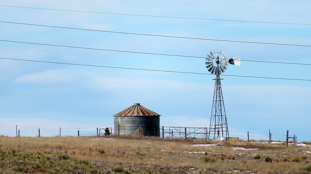
KIMBALL, Neb. – Bitter late-December/early-January cold fled the Tri-state region last week as an upper air trough pushed north, blocking inflow of frigid arctic air and allowing warmer air to move in from the southwest.
Warmer air raised both day and night temperatures across the region, resulting in an increase of as much as 18 degrees in daily average temperatures.
This warming made for more pleasant working conditions and allowed some road ice to melt, but it also melted a good deal of insulating snow cover from winter wheat fields. On the plus side, melting snow cover and lack of wind allowed much of the snow melt to infiltrate into the ground, boosting soil moisture. On the negative side, wheat plants are once again exposed to winter cold.
Somewhat surprisingly for January in this part of the country, warming temperatures were not accompanied by high winds, and the week’s breezes were mostly mild.
Regional Forecast and Conditions
As of Tuesday morning (Jan. 9), the temperature at sunrise was 43 degrees under overcast skies. Wind was northwest at 3 mph. The day was expected to be partly sunny with a high temperature of about 57 degrees.
The weekend forecast calls for slightly cooler temperatures, some breeziness, and a slight chance of snow Friday evening (tonight). Daytime highs for the weekend will range in the mid-30’s with overnight lows in the lower teens.
Monday through Wednesday is expected to be slightly cooler than the weekend but otherwise much the same. Daytime temperatures are expected to range in the mid-20’s to 30 degrees, with overnight lows falling to near 10 degrees. There is little chance of precipitation in the forecast during this period.
Daytime air temperatures warmed across the region last week. At Kimball the Jan. 2-8 daytime high averaged 41.0, about 18 degrees warmer than the previous week. The weekly high temperature was 56 degrees on Jan. 8. Overnight lows warmed as well, averaging 17.85 degrees, also about 18 degrees warmer than the previous week. The weekly low temperature was -4 degrees on Jan. 2. The weekly mean temperature was 29.42 degrees, about 18 degrees warmer than the previous week, and about 2.5 degrees cooler than the Jan. average of 26.9 degrees. The long-term average high and low temperatures at Kimball for January were 40.3 and 13.4.
Last week was mostly dry across the region, with only two of 13 Panhandle stations reporting measurable precipitation during the Jan. 2-8 period. Agate reported 0.05 inches of liquid moisture from 1.2 inches of snow, and Harrisburg 0.07 inches of liquid from 0.7 inches of snow. All other stations reported zero measurable precipitation. Liquid equivalent precipitation averaged 0.009 inches for the Panhandle, while snowfall averaged 0.15 inches. Last week’s averages were 0.17 and 2.18 inches respectively.
Soil temperatures cooled from 0.5-1.1degrees across the Panhandle over the Jan. 2-8 period: (this week/last week/change): Alliance 30.3/30.9 (-0.6) degrees; Gordon 31.2/31.7 (-0.5) degrees; Mitchell 30.6/31.7 (-1.1) degrees; Scottsbluff 32.1/33.1 (-1.0); and Sidney 31.1/31.6 (-0.5) degrees.
Winds near Kimball averaged westerly and mostly light over the Jan. 2-8 period. Gusts for the week averaged 20.71 mph. High gust for the week was 31 mph on Jan. 6.
Jan. 12 Weather Almanac
Here’s an overview of Jan. 12 temperature and precipitation highs, lows, and averages over the preceding 124 years at Kimball. Data is taken from the High Plains Regional Climate Center (www.hprcc.unl.edu), where you can easily find and track data for your own particular location.
Last year (Jan. 12, 2017): Daily high temperature 20 degrees, overnight low 9 degrees, average temperature 14.5 degrees. Precipitation 0.00 inches, snowfall zero inches, snow depth zero inches.
The warmest Jan. 12 on record was 62 degrees in 1999. The coolest Jan. 12 high temperature was -1 degrees in 1997. The coldest Jan. 12 overnight low was -23 degrees in 1963. The warmest Jan. 12 overnight low was 34 degrees in 1900. Over the years since 1893 the high temperature on Jan. 12 has averaged 40 degrees, the overnight low 14 degrees, the daily average 27 degrees, precipitation has averaged 0.01 inches, snowfall 0.1 inches, snow depth zero inches.
The highest Jan. 12 precipitation total was 0.11 inches liquid equivalent in 1997. The greatest snowfall was 2.0 inches in 2009. Greatest snow depth was 12.0 inches in 1949.
Snow has fallen on Jan. 12 at Kimball 13 times over the last 124 years, with quantities ranging from a trace to 2.0 inches.
U.S. Drought Monitor High Plains: Extreme cold gripped the region, accompanied by much-needed moderate to heavy snowfall.
Temperatures for the period averaged 25 to 35 degrees below normal from eastern Montana into the Dakotas and northern Nebraska.
There were no changes made to the drought depiction in central and eastern portions of the region, while reductions in Abnormal Dryness, Moderate Drought, and Severe Drought (D0-D2) were made in northwestern Montana to account for the favorable start to the water year and the easing of long-term moisture deficits; 12-month precipitation climbed to near-normal levels in western Montana, but was still less than 50 percent of normal in the lingering Extreme Drought (D3) areas.
West: Drought intensified in the Four Corners area, while heavy snow brought welcomed drought relief to northeastern portions of the region.
Across Montana, Abnormal Dryness to Severe Drought were trimmed along the Canadian border to account for the favorable start to the Water Year and subsequent easing of long-term moisture deficits; 12-month precipitation climbed to near-normal levels in western Montana, but was still less than 50 percent of normal in the lingering Extreme Drought (D3) areas.
While no changes were made to the Pacific Coast States, the poor start to the current Water Year was raising concerns over drought resumption from the Cascades southward into central and southern California. In particular, 90-day precipitation has averaged less than 40 percent of normal from central Oregon southward into central California, and less than 10 percent from the southern San Joaquin Valley into southern portions of Nevada and Arizona.
Severe Drought (D2) was expanded over large portions of the Four Corners region, coincident with much-below-normal precipitation totals over the past 6 months (30-65 percent of normal).
Farther east, Moderate Drought (D1) expanded across northern portions of New Mexico and environs, where short-term dryness (10-40 percent of normal over the past 90 days) was most pronounced.
National Summary: During the seven-day period ending Tuesday morning, bitterly cold, mostly dry weather prevailed across the nation. However, light to moderate showers were observed along the central Gulf Coast, while moderate to heavy rain and mountain snow were reported in the nation’s northwestern quadrant. By the end of the period, a moderate to deep snowpack extended from the interior Northwest across the northern Plains into New England.
The overall trend toward drought intensification persisted from the Four Corners to the southern Plains and south-central U.S., while modest reductions in drought intensity and coverage were made in northern Montana.
For more information on the U.S. Drought Monitor visit: http://droughtmonitor.unl.edu
U.S. Conditions and Weather Report
Cold, dry weather dominated most of the country, with a few notable exceptions.
A major winter storm grazed the southern Atlantic Coast with rare snowfall before slamming the Northeast with wind-driven snow and heavy surf.
Unusual warmth persisted from California to the Four Corners region, where weekly temperatures averaged at least 10 degrees above normal in several locations.
Conversely, frigid weather dominated areas from the Plains to the East Coast, increasing livestock stress and threatening winter wheat without an insulating snow cover. Temperatures ranged from 20 to 25 degrees below normal in a strip across the Midwestern and Mid-Atlantic States.
A much larger area, covering nearly all of the eastern half of the U.S., averaged more than 10 degrees below normal. At times, temperatures plunged to -30 degrees or below in Montana, Minnesota, and the Dakotas, as well as scattered locations in the Northeast.
On Jan. 3-4, light freezes affected nearly all of Deep South Texas. Similarly, parts of Florida’s peninsula experienced generally light freezes on Jan. 4-5, resulting in some producers protecting citrus, strawberries, and winter vegetables. However, blustery conditions hampered freeze-protection efforts, particularly with regard to tender vegetables.
During the second half of the week, showery weather developed across northern California and the Northwest. Prior to California’s precipitation, the average water content of the high-elevation Sierra Nevada snowpack stood at just 2 inches, less than one-quarter of the early-Jan. normal.
Elsewhere, dry weather again covered the central and southern High Plains, where significant precipitation last fell about 3 months ago. As a result, the region’s winter wheat continued to suffer from the combined effects of developing drought, poor crop establishment, and the absence of a protective snow cover. In contrast, wheat in much of the Midwest and from Nebraska northward was insulated by snow from extreme cold.
The month started out with most of the country experiencing dry weather and a sharp turn toward very cold conditions.
Notable exceptions included warm, dry weather in California and the Southwest (locally more than 10 degrees above normal); stormy, often snowy weather from the Pacific Northwest to the northern High Plains; and locally intense snow squalls downwind of the Great Lakes. Other areas of the northern U.S. also received snow, albeit mostly light.
Nevertheless, snow helped to insulate winter wheat in the Northwest; on the Plains from Nebraska northward; and in much of the Midwest. From Kansas southward, however, winter wheat suffered from the combined effects of developing drought and sudden cold. In areas of the central and southern Plains where the wheat crop was poorly established, winterkill was a mounting concern.
Late-week temperatures dipped to zero degrees or below north of a line from northern Kansas into the middle Mississippi Valley, northeastward into southern New England. (Even colder weather, which arrived on New Year’s Eve and New Year’s Day, will be covered next week.)
The harshest weather engulfed areas from the northern Plains into the Northeast, holding weekly temperatures 10 to 25 degrees below normal.
Elsewhere, periods of light precipitation—mostly rain—fell across the Deep South from the western Gulf Coast region into the lower Southeast. Despite the showers, several parts of the South remained mired in a cool-season drought, with potential adverse impacts on pastures and winter grains.