

The Independence Day weekend was quite lovely
This item is available in full to subscribers.
To continue reading, you will need to either log in to your subscriber account, or purchase a new subscription.
If you are a current print subscriber, you can set up a free website account and connect your subscription to it by clicking here.
If you are a digital subscriber with an active, online-only subscription then you already have an account here. Just reset your password if you've not yet logged in to your account on this new site.
Otherwise, click here to view your options for subscribing.
Please log in to continue |
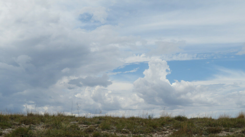
KIMBALL – The Independence Day weekend was quite lovely so far as the weather was concerned. At Kimball and across most of the tri-state region skies were sunny, the air temperature was warm without being hot, and afternoon thunderstorms delivered brief rain showers before giving way to clear and balmy evening conditions.
Over the last week monsoonal air flows spawned afternoon and evening thunderstorms across the region, bringing varying quantities of precipitation. The storms produced locally heavy rain in some areas but in general, most locations across the Nebraska Panhandle, southeast Wyoming, and northeast Colorado received a few hundredths to a few tenths of rain.
Across the south Panhandle of Nebraska winter wheat was well along in turning color and in general it looks like wheat harvest is about two weeks away. Heat and moisture were pushing lagging spring-planted crops along. In some fields south of Kimball proso millet stands were still looking surprisingly spotty after being planted in very dry soil.
In Kimball County, where weekly rainfall totals approximated a half inch, well managed rangeland and pastures greened up nicely and warm season grasses had the opportunity to put on biomass as they entered their rapid growth phases.
As of Tuesday afternoon, widespread thunderstorms were delivering at least a bit of moisture to many areas across the region.
Regional Forecast and Conditions
As of Tuesday morning (July 5), the temperature at sunrise was 68 degrees under clear skies. Winds were westerly at 6 mph and the barometer was steady at 30.04 inches of mercury (in/Hg).
Today’s weather (Friday, July 8) is expected to be sunny and hot with a high of about 91 degrees. Friday night should be clear with a low of about 62 degrees. Day length will be 15 hours and 0 minutes, night length 9 hours and 0 minutes.
Saturday and Sunday are forecast to be sunny and even warmer, with high temperatures reaching about 98 and overnight lows dipping into the low 60’s. There is a slight chance of rain forecast for Sunday night.
Monday is expected to be mostly sunny and a bit cooler with a daily high reaching about 89 before falling off into the upper 50’s overnight. There is a chance of afternoon thunderstorms in the forecast for Monday.
The remainder of the week may see a slight cooling trend and increased chances of precipitation as a cold front arrives. Daytime highs will approach 90 degrees with overnight lows falling into the upper-50’s.
At Kimball the June 28-July 4 daytime high averaged 89.71 degrees, about 6.71 degrees warmer than last week. The weekly high temperature was 95 degrees on June 29 and July 4. Overnight lows averaged 54.57 degrees, about 5 degrees warmer than last week. The weekly low temperature was 49 degrees on June 28. The weekly mean temperature at Kimball was 72.14 degrees, about 5.86 degrees warmer than last week and 0.34 degrees warmer than the July average of 71.8 degrees. The long-term average high and low temperatures at Kimball for July are 87.4 and 56.1, respectively.
Kimball received 0.60 of rain over the June 28-July 4 period from thunderstorms on June 29-30 and July 1 and 4.
Winds near Kimball averaged south-southwesterly and generally mild during the June 28-July 4 period. Gusts for the week averaged 33 mph. High gust for the week was 44 mph on June 29.
June weather almanac
Average 7 a.m. conditions: temperature 57.8 degrees, winds south southwesterly at 8.26 mph, barometer 30.09 inches of mercury (in/Hg).
Average daily high temperature 83.76 degrees (129-year average 80.3). Average daily low temperature 51.43 degrees (129YA 50.1). Daily average temperature 67.6 degrees (129YA 65.2). Total liquid precipitation 0.585 inches (129YA 2.67). Year to date (YTD) precipitation 9.55 inches (129YA 9.16). Total snowfall zero inches (129YA zero inches). YTD snow 47.68 inches (129YA 26.4).
Departures: Daily High, +3.46 degrees; Daily Low, +1.33 degrees; Daily Average, +2.4 degrees; Total Liquid Precipitation, -2.08 inches; YTD precipitation +0.39 inches. Total Snow zero inches, YTD snow +21.28 inches.
Historic climate data
Here’s an overview of July 8 temperature and precipitation highs, lows, and averages over the preceding 129 years at Kimball. Data is taken from the High Plains Regional Climate Center (www.hprcc.unl.edu), where you can find and track data for your own particular location.
Last year (July 8, 2021): Daily high temperature 100 degrees, overnight low 67 degrees, average temperature 83.5 degrees. Precipitation zero inches, snowfall zero inches, snow depth zero inches.
The warmest July 8 on record was 103 degrees in 1901. The coolest July 8 high temperature was 59 degrees in 2010. The coldest July 8 overnight low was 37 degrees in 1952. The warmest July 8 overnight low was 66 degrees in 1937. Over the years since 1893 the high temperature on July 8 has averaged 86 degrees, the overnight low 55 degrees, the daily average 70.3 degrees, precipitation has averaged 0.06 inches, snowfall zero inches, snow depth zero inches.
The highest July 8 precipitation total was 2.29 inches (rain) in 1961. Highest snowfall zero inches, highest snow depth zero inches.
USDA Weekly Weather Bulletin, July 4
This report was not published due to the federal holiday.
USDA Crop Progress Reports,
July 5
Nebraska -- For the week ending July 3, 2022, there were 5.9 days suitable for fieldwork. Topsoil moisture supplies rated 23% very short, 37% short, 39% adequate, and 1% surplus. Subsoil moisture supplies rated 26% very short, 33% short, 40% adequate, and 1% surplus.
Corn condition rated 3% very poor, 9% poor, 26% fair, 51% good, and 11% excellent. Corn silking was 1%, near 2% last year, and behind 6% for the five-year average.
Soybean condition rated 4% very poor, 8% poor, 27% fair, 49% good, and 12% excellent. Soybeans blooming was 25%, behind 43% last year and 31% average.
Winter wheat condition rated 28% very poor, 17% poor, 38% fair, 15% good, and 2% excellent. Winter wheat harvested was 22%, ahead of 6% last year and 11% average.
Sorghum condition rated 1% very poor, 9% poor, 27% fair, 59% good, and 4% excellent. Sorghum headed was 4%, near 2% last year and 6% average.
Oats condition rated 13% very poor, 16% poor, 27% fair, 42% good, and 2% excellent. Oats headed was 95%, near 97% last year and 94% average.
Dry edible bean condition rated 0% very poor, 4% poor, 32% fair, 64% good, and 0% excellent. Dry edible beans emerged was 93%, near 95% last year.
Pasture and range conditions rated 24% very poor, 32% poor, 31% fair, 12% good, and 1% excellent.
Wyoming -- For the week ending July 3, 2022, the majority of Wyoming remained dry. Some southern and eastern parts of the State received slightly above average levels of precipitation. In many areas of the north and far west, however, precipitation was minimal.
Temperatures were mostly above normal. In parts of south-western Wyoming, as much as 8 degrees above normal.
According to the U.S. Drought Monitor the amount of land that was drought free increased to 12.8%, up from 7.8% last week. The amount of land rated as abnormally dry was 27.9%, down slightly from 28.5% last week. Moderate drought fell to 31.4% of the State, compared to 35.7% last week. Severe drought increased to 24.3%, compared to 23.5% last week. Extreme drought was down slightly to 3.6%, compared to 4.5% last week.
In Goshen County, pasture conditions were deteriorating. Localized rains alleviated dry conditions in some areas though the greater part of the county still suffered from drought.
A report from Lincoln County indicated good weather last week, though more moisture was still needed for crop growth, as cool nights were affecting plant growth. Farmers were no longer seeing runoff from rivers and streams.
A report from Platte County indicated the dry conditions persisted. The few showers that were received had little benefit to keep grasses growing. Decreased irrigation allocations were inhibiting crop growth and worsening crop condition.
Sheridan County was slowly emerging from the drought with more rain this year than in previous years.
Irrigation water supplies across the State were rated 12% poor, 40% fair, and 48% good, compared to 14% poor, 46% fair, 39% good, and 1% excellent last week.
Stock water supplies across Wyoming were rated 3% very short, 18% short, 75% adequate, and 4% surplus, compared to 17% short and 83% adequate last week.
Colorado -- For the week ending July 3, 2022, winter wheat maturity advanced quickly, and harvest began sporadically and slowly across the State. According to the U.S. Drought Monitor, 86% of the State is under drought conditions, up 4 percentage points from the previous week. Forty-five percent of the State is experiencing severe to exceptional drought conditions, up 2 percentage points from last week. Extreme drought conditions are affecting 6% of the State, down 7 percentage points from last week.
Northeastern and east central counties continue to face strong winds, higher than average temperatures, and little moisture.
In northeastern counties, precipitation was scattered with some areas receiving good moisture, while others remained dry.
Areas of Logan and Sedgwick Counties received over an inch of rain last week. Non-irrigated crops and rangeland conditions continue to feel the effects of dry, windy conditions. Winter wheat was maturing, and county reports noted extremely limited harvest began in the far eastern part of the State.
East central counties received little to no moisture across the area, as drought conditions worsened.
In southwestern counties, cooler than average temperatures and needed moisture provided some reprieve.
In the San Luis Valley, recent rains have delayed alfalfa harvest. Potato emergence is almost complete, with fields appearing mottled due to high winds during planting. First cutting of alfalfa was nearly complete.
Across the state, received moisture benefitted rangeland conditions and livestock are doing well, according to county reports. In southeastern counties, recent moisture has greatly improved crops and rangeland. Winter wheat harvest is almost complete in the area. County reports noted most of the dryland wheat was abandoned, and irrigated yields were affected by growing season conditions. Producers have moved cattle to CRP land for grazing, giving rangelands a much-needed recovery period.
Stored feed supplies were rated 2% very short, 23% short, 74% adequate, and 1% surplus. Sheep death loss was 1% heavy, 93% average, and 6% light. Cattle death loss was 80% average and 20% light.
U.S. Drought Monitor
USDM reports derive normals/averages from the most recent 30-year period, though longer timescale data are used where available. The USDM generally reports on current drought conditions and offers a comprehensive history of drought across the Continental U.S. Near-term temperature and precipitation predictions derive from National Weather Service (NWS) and National Oceanic and Atmospheric Administration (NOAA) forecasts.
Current drought status for the Nebraska Panhandle, Southwest Wyoming, and Northeast Colorado. Drought Categories: D0 -- abnormally dry. D1 -- moderate drought. D2 -- severe drought. D3 -- extreme drought. D4 -- exceptional drought.
(June 28, 2022) An early start to the North American Monsoon, particularly in New Mexico and southern Colorado, led to widespread improvement of extreme and exceptional drought in those states. Extreme drought formed or expanded in parts of the central Great Plains this week, where warm, dry weather continued. Widespread moderate drought and abnormal dryness continued to form and expand across a large swath of the eastern U.S. this week, with a few areas of severe drought forming or expanding as well. Spotty rain and storms occurred across the East, but in areas that missed out on heavy rainfall, high temperatures, browning lawns, and curling corn signaled that rapid drying was taking place in many areas. Moderate short-term drought also began to expand in parts of New England this week. Short-term moderate and severe drought expanded in coverage in Alaska and Puerto Rico, and drought conditions continued to expand in parts of Hawaii. Finally, despite some improvements to conditions in parts of the West, severe, extreme, and some exceptional drought remains widespread there.
High Plains: Extreme drought developed in far northeast Nebraska, and in adjacent portions of South Dakota and Iowa, near the Sioux City area. Here short- and long-term precipitation deficits have combined with high evaporation rates to create significant soil moisture and groundwater shortages, which have recently been reported. Severe and extreme drought also expanded across northeast and central Colorado, southeast Wyoming, and parts of southwest Nebraska, where dry weather continued. In southern Colorado, an early and active North American Monsoon has delivered heavy enough rainfall to cut into short- and long-term deficits, leading to widespread improvement of drought conditions in the southwestern part of the state. After recent heavy rains, drought conditions have continued to improve in northwest Wyoming. Heavy rain in central and south-central Kansas alleviated precipitation deficits and increased soil moisture and streamflow, such that drought conditions retreated to the west.
West: Improvements to drought conditions in the West continued this week, though much of the region remains entrenched in drought or abnormal dryness. After recent heavy precipitation, and cool temperatures during April-June, drought conditions continued to improve in Montana and adjacent northeast Idaho this week. Due to heavy precipitation associated with the early and active start to the North American Monsoon, most of New Mexico, and parts of southeast Arizona, saw improvements to ongoing drought conditions. Despite these improvements, drought, still ranging from severe to exceptional in many areas, continued in the West.
Near-term forecast: The 6-10-day outlook favors above-normal precipitation across much of the Upper Midwest, northern Great Plains, and Ohio River Valley. To a lesser extent, above-normal precipitation is also favored in remaining areas of the U.S., except for northern New England, where equal chances for above- or below-normal precipitation exist. Below-normal precipitation is favored in much of Texas and Oklahoma, and across most of the West, with the highest probabilities for below-normal precipitation occurring across northeast Nevada, northern Utah, southern Idaho, and western Wyoming. The forecast slightly favors above-normal precipitation in Washington, and above-normal precipitation is favored in western and central Alaska, while below-normal precipitation is favored in the Alaska Panhandle.
A large area of high probabilities for warmer than normal temperatures exist across the central U.S., especially from the Great Plains to the Missouri and Mississippi River valleys. Above-normal temperatures are also favored in parts of the West and Southeast. Within the contiguous U.S., the only locations where below-normal temperatures are favored for this period are central and northern California to western Oregon and Washington, and New England. In Alaska, cooler than normal temperatures are favored in the west, and above-normal temperatures are favored in the east.
Terminology: EDDI -- Evaporative Demand Drought Index. This is an experimental model for drought prediction, using nationwide data from 1980-present. SPE -- Standardized Precipitation index, correlating present month/year precipitation with 30-plus year historical data. SPEI -- Standardized Precipitation Evapotranspiration Index. SWE -- Snow Water Equivalent.
For more information on the U.S. Drought Monitor, including an explanation of terminology, visit http://droughtmonitor.unl.edu.


