

Warm and dry conditions persisted through the first two weeks of December.
This item is available in full to subscribers.
To continue reading, you will need to either log in to your subscriber account, or purchase a new subscription.
If you are a current print subscriber, you can set up a free website account and connect your subscription to it by clicking here.
If you are a digital subscriber with an active, online-only subscription then you already have an account here. Just reset your password if you've not yet logged in to your account on this new site.
Otherwise, click here to view your options for subscribing.
Please log in to continue |
KIMBALL – Warm and dry conditions persisted through the first two weeks of December. A trace of snow on December 10 yielded a trace of liquid moisture.
Harvest operations across much of the tri-state have finished for the year.
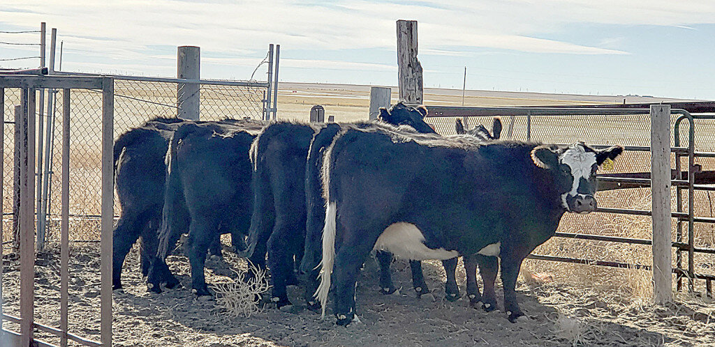
Across the region cattle are largely grazing stem-cured grass or corn stalks.
Regional forecast and conditions
As of Tuesday morning (December 14), the temperature at sunrise was 27 degrees under mostly cloudy skies. Winds were westerly at 12 mph and the barometer was slowly rising at 29.92 inches of mercury (in/Hg).
Today’s weather (Friday, December 17) is expected to be sunny and breezy. Daytime air temperatures should top out at 37 degrees before falling off to 13 overnight. Saturday and Sunday should be mostly sunny and breezy, with Saturday’s high reaching 43 and Sunday’s high 48. Overnight lows are forecast at 21 and 16, respectively. No precipitation is forecast for Saturday or Sunday.
Monday-Wednesday is expected to be similar to the weekend; mostly sunny with highs in the mid-40’s and lows in the upper teens. No precipitation is forecast through mid-week.
At Kimball the December 7-13 daytime high averaged 48.28 degrees, slightly warmer than the previous week. The weekly high temperature was 61 degrees on December 12. Overnight lows averaged 19.42 degrees, slightly cooler than the previous week. The weekly low temperature was 10 degrees on December 11. The weekly mean temperature at Kimball was 33.85 degrees, about 5.45 degrees warmer than the December average of 28.4 degrees. The long term average high and low temperatures at Kimball for September are 41.7 and 15.0, respectively.
There was only a trace of snow at Kimball last week.
Winds near Kimball averaged south-southwesterly and breezy over the December 7-13 period. Gusts for the week averaged 35 mph. High gust for the week was 43 mph on December 11.
U.S. drought monitor
This report derives normals/averages from the most recent 30 year period, dating back to 1988.
(December 13) High Plains: On this week’s map, areas of the region—including the eastern plains of Colorado—saw widespread degradation in response to anomalously warm temperatures, short-term precipitation deficits, declining soil moisture levels, and elevated evaporative demand across the region. Moreover, impact reports from eastern Colorado are yielding concerns by producers about winter wheat stands as well as declining pasture and range conditions. According to the latest USDA Colorado Crop Progress report, the percentage of topsoil rated short to very short was 84%, while pasture and range conditions were rated 40% very poor to poor. For the week, most of the region was unseasonably warm and dry with average temperatures ranging from 2 to 12 degrees above normal with the greatest departures observed in eastern portions of Colorado and Wyoming, Kansas, and Nebraska. In eastern Colorado, average maximum temperatures for the week ranged from 60 to 70 degrees.
In the West, the big story continues to be the poor snowpack conditions across the region and growing concern about water supplies after back-to-back dry winter seasons in California as well as in other basins including the Colorado River Basin. In California, the Department of Water Resources announced (December 1) that the State Water Project’s initial water allocation for 2022 will be at 0% in an unprecedented step to address the state’s water supply in anticipation of another dry winter season. Other impacts of concern across the region include the delayed opening of ski areas across the region which is impacting local economies in mountain communities across the West. However, some positive signs have emerged over the past week and looking ahead in the short-term with a change to a more active weather pattern for the region with heavy mountain snowfall expected in the Cascades, Sierra Nevada, Great Basin, and the Rockies. On the map this week, recent precipitation in the Pacific Northwest led to improvements in drought-affected areas of Washington as well as in northeastern Oregon, and west-central Idaho. Conversely, an area of Extreme Drought (D3) expanded in southwestern Montana due to poor snowpack conditions in the higher elevations.
Near-term forecast: The Climate Prediction Center’s 6-10 day outlook through Christmas anticipates accumulations of 1-to-3-inches (liquid) are expected across the Rockies with the heaviest accumulations forecasted for the mountain ranges of southwestern Utah and western Colorado. In the Central Plains and Upper Midwest, liquid accumulations of generally < 1 inch are expected. The CPC 6-10-day outlooks calls for a moderate-to-high probability of above-normal temperatures across most of the conterminous United States except for areas of the Great Basin and Far West where below normal to near-normal temperatures are expected. In terms of precipitation, there is a moderate-to-high probability of above-normal precipitation across most of the western U.S. as well as portions of the Midwest and eastern portions of the Southern Plains. The Eastern Tier of the U.S. is expected to be drier-than-normal.
For more information on the U.S. Drought Monitor visit: http://droughtmonitor.unl.edu.


