

KIMBALL – Last Friday saw an extensive line of afternoon and evening thunderstorms move through the tri-state region. The storm line stretched from approximately Casper, Wyoming to south of Fort Morgan, Colorado and moved northeast at a relatively slow speed, spawning localized heavy rain, stiff straight-line winds, and scattered hail. At Kimball 1.38 inches of rain fell over a three-hour period from about 6:30-9:30 p.m.
This item is available in full to subscribers.
To continue reading, you will need to either log in to your subscriber account, or purchase a new subscription.
If you are a current print subscriber, you can set up a free website account and connect your subscription to it by clicking here.
If you are a digital subscriber with an active, online-only subscription then you already have an account here. Just reset your password if you've not yet logged in to your account on this new site.
Otherwise, click here to view your options for subscribing.
Please log in to continue |
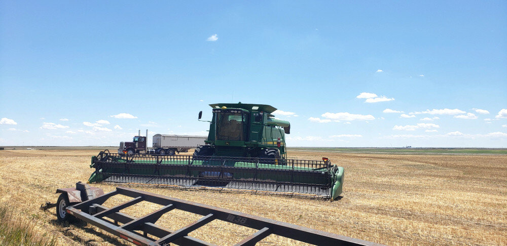
KIMBALL – Last Friday saw an extensive line of afternoon and evening thunderstorms move through the tri-state region. The storm line stretched from approximately Casper, Wyoming to south of Fort Morgan, Colorado and moved northeast at a relatively slow speed, spawning localized heavy rain, stiff straight-line winds, and scattered hail. At Kimball 1.38 inches of rain fell over a three-hour period from about 6:30-9:30 p.m.
Winter wheat harvest was halted by Friday’s rainfall and by Saturday morning producers were out checking fields for damage while those who already had their grain in the bin were breathing a sigh of relief. By Saturday afternoon sunshine and mid-90-degree air temps allowed combining to lurch back into gear. Hot and dry conditions continued, and harvest crews were able to make rapid and steady progress. By mid-week well over half the wheat fields across the Panhandle had been combined and the 2022 wheat harvest was nearing completion. The consensus of early opinion seems to hold that yield was quite low this year, but quality was somewhat better than expected.
Spring-planted crops seemed to be coming along nicely in the hot and sunny environment. Dryland crops certainly got a needed boost from Friday’s widespread rain events.
Monsoonal air flows continued to deliver widely scattered afternoon and evening thunderstorms, bringing spotty light rain to many and very localized and generally brief heavy rains to some. For instance, a brief five-minute shower near Kimball delivered approximately two-tenths across an area of about five square miles Monday evening while only a few drops fell in nearby areas.
Air temperatures certainly heated up through the weekend and into mid-week with triple-digit readings reported in many locations across the region.
Where rain fell, well managed rangeland and pastures perked up nicely in the wake of weekend thunderstorms. Although cool season grasses produce a nice blush of green with mid-summer rain, most of their metabolism goes to root formation rather than above-ground biomass production. Warm season grasses, on the other hand, should continue to produce nutrient-dense forage.
Regional Forecast and Conditions
As of Tuesday morning (July 19), the temperature at sunrise was 67 degrees under clear skies. Winds were northwest at 8 mph and the barometer was steady at 30.05 inches of mercury (in/Hg).
Today’s weather (Friday, July 22) is expected to be sunny and hot with a high of 98 degrees and some afternoon and evening breeziness. Friday night should be clear with a low of about 63 degrees. Day length will be 14 hours and 41 minutes, night length 9 hours and 19 minutes.
Saturday is predicted to be slightly cooler with a high of 95 and an overnight low of 60. Sunday will remain sunny but be slightly cooler with the mercury only reaching about 90 before falling off to 60 overnights. There is a slight chance of afternoon and evening thunderstorms both days.
Monday will be mostly sunny and cooler still with a high of 89 and an overnight low of about 60 and a slightly increased chance of afternoon and evening thunderstorms.
The remainder of the week is expected to be sunny and hot with daytime highs running in the mid-90’s and overnight lows falling into the low-60’s.
At Kimball the July 12-18 daytime high averaged 95.28 degrees, about 5.43 degrees warmer than last week. The weekly high temperature was 101 degrees on July 18. Overnight lows averaged 62 degrees, about 4.43 degrees warmer than last week. The weekly low temperature was 57 degrees on July 13 and 17. The weekly mean temperature at Kimball was 78.64 degrees, about 4.93 degrees warmer than last week and 6.84 degrees warmer than the July average of 71.8 degrees. The long-term average high and low temperatures at Kimball for July are 87.4 and 56.1, respectively.
Kimball received 1.44 inches of rain over the July 12-18 period from thunderstorms on July 14, 15 and 18.
Winds near Kimball averaged westerly and windy when thunderstorms were present during the July 12-18 period. Gusts for the week averaged 32.28 mph. High gust for the week was 61 mph on July 15.
Historic climate data
Here’s an overview of July 22 temperature and precipitation highs, lows, and averages over the preceding 129 years at Kimball. Data is taken from the High Plains Regional Climate Center (www.hprcc.unl.edu), where you can find and track data for your own particular location.
Last year (July 22, 2021): Daily high temperature 97 degrees, overnight low 59 degrees, average temperature 78 degrees. Precipitation trace, snowfall zero inches, snow depth zero inches.
The warmest July 22 on record was 103 degrees in 1920. The coolest July 22 high temperature was 55 degrees in 1990. The coldest July 22 overnight low was 42 degrees in 1911. The warmest July 22 overnight low was 68 degrees in 1901. Over the years since 1893 the high temperature on July 22 has averaged 87 degrees, the overnight low 56 degrees, the daily average 71.5 degrees, precipitation has averaged 0.08 inches, snowfall zero inches, snow depth zero inches.
The highest July 22 precipitation total was 1.42 inches (rain) in 1998. Highest snowfall zero inches, highest snow depth zero inches.
USDA Weekly Weather Bulletin, July 19
Mostly dry weather returned across the Midwest, generally reducing topsoil moisture reserves as more summer crops entered the reproductive stage of development. However, there were exceptions to the dry pattern, mainly across the Great Lakes States.
Despite the dryness, Midwestern temperatures remained below stressful levels (below 95 degrees) for silking corn and blooming to pod-setting soybeans, except in the southwestern Corn Belt.
Still, the combination of heat and dryness across much of the western and central U.S. resulted in adverse impacts on some rangeland, pastures, and rain-fed summer crops, especially in drought-affected areas from California to the central and southern Plains.
Hot, mostly dry weather (temperatures averaging at least 5 degrees above normal in many locations) dominated areas from the Pacific Coast to the Plains, although locally significant showers peppered the Four Corners States.
Temperatures topped 100 degrees in a vast area of the country, including most non-coastal and lower-elevation sites from California to the central and southern Plains. Scattered temperatures near 110 degrees were reported on the Plains as far north as southwestern Nebraska.
USDA Crop Progress Reports, July 18
Nebraska -- For the week ending July 17, 2022, there were 6.2 days suitable for fieldwork. Topsoil moisture supplies rated 22% very short, 37% short, 39% adequate, and 2% surplus. Subsoil moisture supplies rated 22% very short, 38% short, 39% adequate, and 1% surplus.
Corn condition rated 5% very poor, 9% poor, 22% fair, 49% good, and 15% excellent. Corn silking was 45%, near 49% last year and 48% for the five-year average. Dough was 1%, near 3% both last year and average.
Soybean condition rated 3% very poor, 7% poor, 24% fair, 50% good, and 16% excellent. Soybeans blooming was 55%, behind 72% last year and 63% average. Setting pods was 14%, behind 28% last year and 19% average.
Winter wheat condition rated 19% very poor, 22% poor, 36% fair, 20% good, and 3% excellent. Winter wheat harvested was 61%, ahead of 55% last year, and near 60% average.
Sorghum condition rated 5% very poor, 15% poor, 30% fair, 43% good, and 7% excellent. Sorghum headed was 10%, near 7% last year, but behind 15% average.
Oats condition rated 12% very poor, 19% poor, 34% fair, 32% good, and 3% excellent. Oats harvested was 20%, behind 35% last year, and well behind 40% average.
Dry edible bean condition rated 1% very poor, 5% poor, 30% fair, 55% good, and 9% excellent. Dry edible beans blooming was 16%, near 14% last year.
Pasture and range conditions rated 23% very poor, 25% poor, 37% fair, 13% good, and 2% excellent.
Wyoming -- For the week ending July 17, 2022, Wyoming remained hot and dry for the week. Temperatures for the most part were above normal, with some areas of the state seeing temperatures as much as 6 degrees above average.
Precipitation levels were below normal for the majority of the State. The exception was in extreme portions of the northwest and southwest that saw levels slightly above normal. According to the U.S. Drought Monitor the amount of land that was drought free stood at 11.6%, compared to 12.8% the previous week. The amount of land rated abnormally dry was 28.2%, up slightly from last week’s 27.9%. Moderate drought was found in 35.7% of the state, up from 31.4%. Severe drought fell to 20.9%, compared to 24.3% last week. Extreme drought was unchanged from last week at 3.6%.
Portions of northern Goshen County received precipitation while Goshen Hole remained very dry. Record high temperatures depleted soil moisture levels in some areas and without additional water, crops were expected to die.
There were some thunderstorms in Lincoln County, but conditions remained predominantly hot and dry. Temperatures were still dipping into the 40s at night but reached into the 90s during the day. Many farmers were putting up alfalfa hay.
A report from Platte County indicated that crops were not doing well. The rains that fell were not enough to alleviate the hot and dry conditions. Forecasted highs for the upcoming week were expected to add to the existing heat stress. Hay supplies were insufficient.
Irrigation water supplies across the State were rated 2% very poor, 19% poor, 27% fair, and 52% good, compared to 1% very poor, 21% poor, 31% fair, and 47% good last week.
Stock water supplies across Wyoming were rated 6% very short, 36% short, 57% adequate, and 1% surplus, compared to 3% very short, 27% short, 66% adequate, and 4% surplus last week.
Colorado -- For the week ending July 17, 2022, a primarily dry week allowed winter wheat harvest to make significant progress last week. Statewide, winter wheat crop conditions deteriorated, with 7% of the crop rated good to excellent, compared to 61% good to excellent last year. Sixty-seven percent of the winter wheat crop is rated poor to very poor, compared to 13% last year.
According to the U.S. Drought Monitor, 83% of the State is under drought conditions, unchanged from the previous week. Thirty-two percent of the State is experiencing severe to exceptional drought conditions, down 13 percentage points from last week. Extreme drought conditions are affecting 5% of the State, equal to last week.
In northeastern and east central counties, high temperatures and limited moisture allowed winter wheat harvest to advance rapidly. Current reports state that while yields are low, the overall quality of the winter wheat crop is better than anticipated. Areas in Logan, Kit Carson, Phillips, Sedgwick, and Yuma Counties experienced temperatures more than 5 degrees above average, with parts of Phillips and Yuma counties reaching temperatures more than 10 degrees above average. In the northeastern corner of the State, reporters noted that damage from the wheat stem sawfly has producers swathing many fields.
In southwestern counties, a reporter noted that flash floods were experienced around the valley. Sustained winds were experienced in the southwestern corner, with some gusts reaching above 30 miles per hour.
In the San Luis Valley, any moisture received from scattered showers was quickly dried up from wind gusts later in the week. Temperatures in the mid to high 80’s all week advanced alfalfa harvest, although it still remains behind average. The potato and barley crops continue to develop well. According to county reports, irrigation water supply is a concern, with well levels dropping significantly.
In southeastern counties, almost all fields of winter wheat that will be harvested for grain have been harvested, with yield reports ranging significantly. Areas of Custer and Las Animas Counties received over an inch of precipitation, while the rest of the district remained primarily dry.
Stored feed supplies were rated 2% very short, 30% short, 67% adequate, and 1% surplus. Sheep death loss was 84% average and 16% light. Cattle death loss was 88% average and 12% light.
U.S. Drought Monitor
USDM reports derive normals/averages from the most recent 30-year period, though longer timescale data are used where available. The USDM generally reports on current drought conditions and offers a comprehensive history of drought across the Continental U.S. Near-term temperature and precipitation predictions derive from National Weather Service (NWS) and National Oceanic and Atmospheric Administration (NOAA) forecasts.
Current drought status for the Nebraska Panhandle, Southwest Wyoming, and Northeast Colorado. Drought Categories: D0 -- abnormally dry. D1 -- moderate drought. D2 -- severe drought. D3 -- extreme drought. D4 -- exceptional drought.
(July 12, 2022) An active weather pattern over much of the Midwest and Southeast brought with it ample rain over many areas, with some places recording more than 5 inches for the week. Dry conditions were noted in the Northeast, West, and southern Plains where flash drought conditions were impacting vast portions of Texas, Oklahoma, Arkansas and into the lower Mississippi River valley. Monsoonal moisture continued to be spotty over much of Arizona and New Mexico, reaching into portions of west Texas as well as southern Colorado and Utah. Temperatures were near normal to slightly above over most of the U.S., with cooler-than-normal temperatures over portions of the West, Northeast, and Mid-Atlantic and above-normal temperatures over most of Texas, Oklahoma, Arkansas, and southern Missouri.
High Plains: Most of the region had warmer-than-normal temperatures for the week, with most areas 1-3 degrees above normal. Heavy rains through western North Dakota, central and eastern South Dakota, northwest and central Nebraska, and northeastern Kansas helped with some dryness in the areas. The scattered nature of the rains left many dry, though, as summer thunderstorms were hit or miss in the region. Some improvements were made in Nebraska and central Kansas as well as on the plains of Colorado and Wyoming this week where the short-term wetness helped to alleviate concerns. Degradation took place over central Wyoming, southern South Dakota and western Kansas where longer-term dryness has been in place and most of these areas have missed out on earlier precipitation events. Exceptional drought was removed in southeast Colorado and extreme drought was reduced this week. Southeast Kansas is an area where abnormally dry and moderate drought expanded this week, as they are on the northern fringe of a flash drought that has been developing over the last 4-5 weeks.
West: Cooler-than-normal temperatures prevailed from the Pacific Northwest into much of California and western Nevada, where temperatures were 1-3 degrees below normal. Much of the rest of the region was normal to slightly above normal for the week. Above-normal rains fell in portions of Oregon and Washington as well as in Montana. Monsoonal moisture continues in New Mexico and Arizona, but it is widely scattered in nature compared to earlier in June. The rains did allow for some improvement in areas of New Mexico, where extreme and severe drought were reduced, and western Arizona, where severe drought was reduced. Severe drought was improved in southwest Colorado and much of the drought area of Montana had a full-category improvement. Moderate drought and abnormally dry conditions were adjusted in Washington to show a mix of improvements and some expansion of moderate drought. Extreme and exceptional drought was expanded over central Nevada and exceptional drought was expanded to include more of the San Joaquin Valley in California.
Near-term forecast: The 6–10-day outlook favors above-normal precipitation over the Southwest and Southeast while much of the rest of the country will likely have below-normal precipitation, with the greatest chances in the Pacific Northwest and southern Plains.
So far as temperatures go, the vast majority of the country has above-normal chances of recording temperatures that will be warmer than normal. The greatest probability of above-normal temperatures will be over the central to southern Plains. Alaska has above-normal chances of having cooler-than-normal temperatures during this time.
Terminology: EDDI -- Evaporative Demand Drought Index. This is an experimental model for drought prediction, using nationwide data from 1980-present. SPE -- Standardized Precipitation index, correlating present month/year precipitation with 30-plus year historical data. SPEI -- Standardized Precipitation Evapotranspiration Index. SWE -- Snow Water Equivalent.
For more information on the U.S. Drought Monitor, including an explanation of terminology, visit http://droughtmonitor.unl.edu.


