

Air temperatures began to cool across the tri-state region early in the week as a cold front moved in
This item is available in full to subscribers.
To continue reading, you will need to either log in to your subscriber account, or purchase a new subscription.
If you are a current print subscriber, you can set up a free website account and connect your subscription to it by clicking here.
If you are a digital subscriber with an active, online-only subscription then you already have an account here. Just reset your password if you've not yet logged in to your account on this new site.
Otherwise, click here to view your options for subscribing.
Please log in to continue |
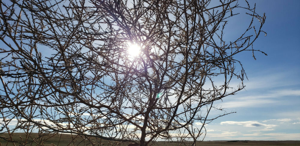
KIMBALL – Air temperatures began to cool across the tri-state region early in the week as a cold front moved in bringing widespread light rain and some scattered snowfall. At Kimball a quarter inch of rain fell Sunday night just before temperatures plummeted in a hard freeze.
In and around Kimball County harvest activity was beginning to slow down slightly as many producers had taken advantage of near-perfect October weather to get their crops in. Across the region reports say that the 2022 harvest is more than 90% complete.
Winter wheat emergence continued to look quite good in and around Kimball County despite a rather dry summer and early autumn. Although most topsoil is quite dry to about six inches, there seems to be good moisture available just below the six-inch line.
Well managed pastures and rangeland in and around Kimball County continue to look unseasonably green as warmth, sunshine, and adequate moisture allow photosynthesis to continue for both cool and warm season grasses.
Regional Forecast and Conditions
As of Tuesday morning (Oct. 25), the temperature at sunrise was 36 degrees under partly cloudy skies. Winds were westerly at 12 mph with the barometer slowly rising through 29.93 inches of mercury (in/Hg).
Today’s weather (Friday, Oct. 28) is expected to be sunny and breezy with a high of 57 degrees. Friday night will be partly cloudy with an overnight low of 24 degrees. Day length will be 10 hours and 36 minutes, night length 13 hours and 24 minutes.
Saturday and Sunday are forecast to be sunny and seasonably warm with high temperatures in the lower 60’s and overnight lows falling into the upper 20’s.
Monday through Wednesday is expected to be similar to the weekend with daytime highs reaching into the low 60’s and overnight lows falling into the 20’s. Breezy conditions are expected to prevail as a weather system moves through the region.
At Kimball the Oct. 11-17 daytime high averaged 68 degrees, about 6.15 degrees warmer than last week. The weekly high temperature was 80 degrees on Oct. 20. Overnight lows averaged 32.42, about 0.73 degrees cooler than last week. The weekly low temperature was 27 degrees on Oct. 18 and 24. The weekly mean temperature at Kimball was 50.21 degrees, about 2.71 degrees warmer than last week and 1.61 degrees warmer than the October average of 48.6 degrees. The 129-year month-to-date (Oct. 1-28) average daily temperature is 46.9, and the highest Oct. 1-28 daily average was 56.5 degrees in 1963, with the lowest 39.4 in 2009. The 129-year average high and low temperatures at Kimball for October are 64.3 and 32.8, respectively.
Kimball received 0.26 inches of rain on Oct. 23. Otherwise, it was entirely dry over the Oct. 11-17 period. Winds near Kimball averaged westerly and were occasionally quite breezy over the Oct. 11-17 period. Gusts for the week averaged 30.71 mph. High gust for the week was 40 mph on Oct. 21.
Historic climate data
Here’s an overview of Oct. 28 temperature and precipitation highs, lows, and averages over the preceding 129 years at Kimball. Data is taken from the High Plains Regional Climate Center (www.hprcc.unl.edu), where you can find and track data for your own particular location.
Last year (Oct. 28, 2021): Daily high temperature 53 degrees, overnight low 32 degrees, average temperature 43.5 degrees. Precipitation zero inches, snowfall zero inches, snow depth zero inches.
The warmest Oct. 28 on record was 82 degrees in 1983. The coolest Oct. 28 high temperature was 19 degrees in 1925. The coldest Oct. 28 overnight low was 2 degrees in 1991. The warmest Oct. 28 overnight low was 45 degrees in 1998. Over the years since 1893 the high temperature on Oct. 28 has averaged 57 degrees, the overnight low 26 degrees, the daily average 41.5 degrees, precipitation has averaged 0.03 inches, snowfall 0.1 inches, snow depth zero inches.
The highest Oct. 28 precipitation total was 1.26 inches (rain/trace snow) in 1929. Highest snowfall was 3.5 inches in 2009, highest snow depth 3.0 inches in 2009.
USDA Weekly Weather Bulletin, Oct. 25
Continuing a recent trend, dry weather dominated the country, including large sections of the Plains, Midwest, and Southeast. During the 2-week period ending Oct. 23, nearly one-third (30%) of the U.S. corn and 36% of the soybeans were harvested, as dryness favored Midwestern fieldwork. Elsewhere, national harvest numbers were at or ahead of the 5-year average pace on that date for all major crops, including rice (94% harvested), sugarbeets (80%), peanuts (68%), sorghum (67%), cotton (45%), and sunflowers (35%).
Some rain lingered early in the week across the south-central U.S., where a boost in topsoil moisture briefly slowed fieldwork but benefited rangeland, pastures, and winter grains. Patchy precipitation was also observed from the Great Lakes region to the Atlantic Coast, although many areas remained dry. Late in the week, a dramatic pattern change led to a sudden increase in Northwestern shower activity. The precipitation, including valley rain and high-elevation snow, aided Northwestern wildfire containment efforts and promoted the germination and establishment of recently planted winter grains and cover crops.
Weekly temperatures averaged 5 to 10 degrees above normal throughout the western U.S., except along the Pacific Coast and in parts of the Southwest. In contrast, readings averaged at least 10 degrees below normal in much of the Southeast, extending northward into the central Appalachians. In fact, below-normal temperatures broadly covered the eastern half of the country, except northern New England. Cold air plunging deep into the South ended the 2022 growing season as far south as the Gulf Coast States of Louisiana, Mississippi, and Alabama. Freezes (32°F or below) were also noted in portions of the Atlantic Coast States as far south as northern Florida. This marked an unusually early end of the growing season in much of the Southeast.
USDA Crop Progress Reports, Oct. 24
Nebraska – For the week ending Oct. 23, 2022, there were 6.7 days suitable for fieldwork. Topsoil moisture supplies rated 47% very short, 37% short, 16% adequate, and 0% surplus. Subsoil moisture supplies rated 46% very short, 38% short, 16% adequate, and 0% surplus.
Corn mature was 97%, near 99% last year and 98% for the five-year average. Harvested was 65%, ahead of 57% last year and 46% average.
Soybeans harvested was 93%, ahead of 86% last year and 76% average. Winter wheat condition rated 15% very poor, 20% poor, 34% fair, 30% good, and 1% excellent.
Winter wheat planted was 96%, equal to both last year and average. Emerged was 86%, near 83% both last year and average.
Sorghum condition rated 40% very poor, 27% poor, 14% fair, 14% good, and 5% excellent. Sorghum mature was 93%, near 96% last year and 97% average. Harvested was 55%, behind 70% last year, but near 52% average.
Dry edible beans harvested was 95%, near 92% last year.
Pasture and range conditions rated 50% very poor, 32% poor, 17% fair, 1% good, and 0% excellent.
Wyoming – For the week ending Oct. 23, 2022, minor portions of northwestern Wyoming received relief from the drought. Some areas of the far northwest received moisture totals of 2.0 inches and above. Other areas of the State received lesser amounts of precipitation, and some of that was in the form of snow. For the vast majority of Wyoming, however, precipitation levels were at or below normal.
Temperatures were mostly above normal. Crook County saw the highest above average temperatures. Drought conditions worsened with the continued low precipitation and higher average temperatures.
According to the US Drought Monitor the amount of land rated drought free decreased to 14.2%, compared to 18.7 the previous week. The amount of land rated abnormally dry stood at 34.5%, compared to 34.8% last week. Moderate and Severe drought conditions both increased. Moderate drought stood at 28.5%, up 2.1 percentage points from last week. Severe drought conditions were found in 19.3% of the State, up 2.7 percentage points from the previous week. Extreme drought conditions were unchanged at 3.5%.
In Carbon County cattlemen were finding a higher-than-normal number of open cows during pregnancy checking.
Localized moisture received at the beginning of in Goshen County caused winter wheat to emerge. Farmers were waiting for moisture levels in corn to fall low enough to harvest. Calves were being sold.
Stock water supplies across Wyoming were rated 11% very short, 55% short, and 34% adequate, compared to 14% very short, 46% short, and 40% adequate last week.
Colorado – For the week ending Oct. 23, 2022, harvest activities continued to advance across the state where conditions allowed, and precipitation was mostly limited to western counties.
According to the U.S. Drought Monito just over 43% of the State was categorized in moderate drought or worse, unchanged from the previous week. Over 14% of the State is experiencing severe to exceptional drought conditions, up slightly from last week. The exceptional drought conditions noted across portions of Phillips and Sedgwick Counties remain unchanged from last week, accounting for less than 1% of the State.
Limited moisture was received across the State last week, but western counties reported significant snowfall at higher elevations. Above average temperatures across the State were observed early in the week before cold and freezing temperatures moved in over the weekend.
Sunflower harvest picked up last week in eastern Colorado and was nearly complete in southwestern counties. Potato harvest in the San Luis Valley was nearly complete by week’s end. Reporters noted freezing temperatures stopped potato harvest and remaining alfalfa growth. Livestock producers in the area were bringing stock home from summer pasture and beginning to wean calves.
Fourth cutting of alfalfa advanced last week across the State and was just behind the 5-year average of 73%. Statewide, emergence of the 2023 winter wheat crop was 65% complete, compared with last year at 67% and the 5-year average of 72%. Corn for grain harvest continued to progress, but still fell short of the previous year at 56% and the 5-year average of 46%. Livestock remained in mostly good condition.
Stored feed supplies were rated 9% very short, 29% short, 56% adequate, and 6% surplus. Sheep death loss was 86% average and 14% light. Cattle death loss was 3% heavy, 75% average, and 22% light.
U.S. Drought Monitor
USDM reports derive normals/averages from the most recent 30-year period, though longer timescale data are used where available. The USDM generally reports on current drought conditions and offers a comprehensive history of drought across the Continental U.S. Near-term temperature and precipitation predictions derive from National Weather Service (NWS) and National Oceanic and Atmospheric Administration (NOAA) forecasts.
Current drought status for the Nebraska Panhandle, Southwest Wyoming, and Northeast Colorado. Drought Categories: D0 – abnormally dry. D1 – moderate drought. D2 – severe drought. D3 – extreme drought. D4 – exceptional drought.
(Oct. 18, 2022) Much of the western half of the lower 48 states observed above-normal average temperatures this week. In addition to the above-normal temperatures, precipitation was also lacking for most areas from the Central and Northern Plains westward to the Pacific Coast, warranting drought deterioration. Parts of the Four Corners and Desert Southwest were the exception to this, as an area of low pressure meandered across the Southwest before being picked up by a frontal boundary dropping southward across the central U.S. Across the eastern half of the lower 48, frontal boundaries associated with a couple of strong low pressure systems in the Great Lakes brought heavy precipitation and cooler than normal temperatures to portions of the Great Lakes, Northeast, and Southeast.
High Plains: Despite the High Plains Region observing near to below-normal average temperatures this week, a combination of antecedent dryness, below-normal precipitation, and high winds resulted predominantly in continued degradation region-wide. The only exception was the southwestern corner of Colorado, where short and long-term drought indicators have shown continued improvement following a robust Southwest Monsoon season and a couple of additional episodes of precipitation, associated with cutoff areas of low pressure in the Southwest in recent weeks.
West: An upper-level low pressure system, coupled with a frontal boundary dropping southward across the central U.S. resulted in a good soaking this week for many areas from southeastern California eastward to the Rio Grande Valley. This was another much-needed round of precipitation to further fuel ongoing improvements to long-term drought indicators, such as groundwater and 12 to 24-month SPIs. Soil moisture is in excellent shape as well coming out of the monsoon season across Arizona and New Mexico.
Farther northward in the Western Region, degradation was the main story, as below-normal precipitation and above-normal average temperatures were observed. High winds and above-normal temperatures resulted in targeted degradations across northern portions of the Intermountain West and the High Plains. In the Pacific Northwest, degradations were also warranted, with the addition of D2 (severe drought) across the parts of the Coastal Ranges and Northern Cascades in Washington. The Pacific Northwest is entering into a climatologically wetter time of year, so precipitation will need to come soon to halt further deterioration.
Near-term forecast: The 6–10-day outlook increased chances of below-normal temperatures for southeastern Alaska and the western half of the contiguous U.S. (CONUS). Southerly flow and above-normal temperatures are favored from the Mississippi Valley to the East Coast. An active storm track is forecast across the Northeast Pacific, leading to above-normal precipitation odds across much of Alaska and extending into the Pacific Northwest. Low pressure is forecast to develop east of the Rockies bringing the potential for above-normal precipitation to much of the southeastern CONUS. Conversely, in the Southwest, below-normal precipitation is favored as the storm track is expected to remain farther northward.
Terminology: EDDI – Evaporative Demand Drought Index. This is an experimental model for drought prediction, using nationwide data from 1980-present. SPE – Standardized Precipitation index, correlating present month/year precipitation with 30-plus year historical data. SPEI – Standardized Precipitation Evapotranspiration Index. SWE – Snow Water Equivalent.
For more information on the U.S. Drought Monitor, including an explanation of terminology, visit http://droughtmonitor.unl.edu.


