

Lack of precipitation and winds gusting well into the 40 mph range describes the weather conditions over the last week in and around Kimball,
This item is available in full to subscribers.
To continue reading, you will need to either log in to your subscriber account, or purchase a new subscription.
If you are a current print subscriber, you can set up a free website account and connect your subscription to it by clicking here.
If you are a digital subscriber with an active, online-only subscription then you already have an account here. Just reset your password if you've not yet logged in to your account on this new site.
Otherwise, click here to view your options for subscribing.
Please log in to continue |
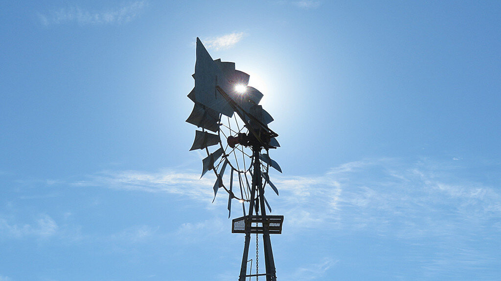
KIMBALL – Lack of precipitation and winds gusting well into the 40 mph range describes the weather conditions over the last week in and around Kimball, Nebraska. Cooler air temperatures seemed to be the only change to the general weather pattern established a month or so ago. In this pattern, a fast moving weather front has blown through the tri-state region about once each week over a brief span of only 24-36 hours, usually bringing cooler temperatures and precipitation to some parts of the region. Until this last week of December, conditions between weather fronts have been warmer than average by about five degrees F and drier than average.
In the wake of the most recent weather front passage on December 26-27, air temperatures cooled to more seasonal norms.
Fun fact: Winter began on December 21 with the arrival of the winter solstice. On this day the sun halts its southward movement across the sky and begins to move north once again. The winter solstice is also the 24-hour period which features the shortest day and longest night of the year. On December 21 the day length (period of light between sunrise and sunset) was nine hours and 12 minutes, while the night length (period of dark between sunset and sunrise) was 13 hours and 48 minutes. Now that the sun is moving northward again the days are getting incrementally longer. It’s hard to tell at first because at first the increase is measured in only seconds per day. In fact it took until December 26 to add a full minute to day length. Today, December 31, day length will be 9 hours and 15 minutes, so we’ve added three minutes of daylight in only 10 days. In a very real sense, the winter solstice marks the annual birth of a new year.
In this part of the world, on the High Plains of North America, there’s an old but true saying that goes along with the longer days of early winter. “As the days lengthen, the cold will strengthen.” Winter is just beginning and January and February are our coldest months.
The near-term forecast seems to bear this out as both daytime and nighttime temperatures are expected to slide south in the coming days. But never fear, spring is on the way, and in less than six months we’ll arrive at the summer solstice.
Regional forecast and conditions
As of Tuesday morning (December 28), the temperature at sunrise was 12 degrees under clear skies. Winds were westerly at 6 mph and the barometer was slowly rising at 29.52 inches of mercury (in/Hg).
Today’s weather (Friday, December 31) is expected to be mostly cloudy with a 50% chance of snow. Daytime air temperatures should top out at 34 degrees before falling off to minus four overnight. Skies will be cloudy overnight and the chance of snow will increase to 60 percent. Day length will be nine hours and 15 minutes, night length 13 hours and 45 minutes.
New Year’s Day should be sunny, mostly calm, and cool with a high of 23 degrees. The mercury is expected to fall to about three degrees Saturday night under clear skies and calm conditions.
Sunday is forecast to be warmer and quite breezy with a high of 43. Winds should abate in the evening as overnight temperatures fall to 14 degrees under partly cloudy skies. No precipitation is forecast for New Year’s Day or Sunday.
Conditions Monday-Wednesday are expected to be warmer and mostly sunny; daytime highs should reach near 50 with lows falling into the teens. No precipitation is forecast through mid-week.
At Kimball the December 21-27 daytime high averaged 52.42 degrees, 5.71 degrees warmer than last week. The weekly high temperature was 62 degrees on December 28. Overnight lows averaged 22.14 degrees, about 6.86 degrees warmer than last week. The weekly low temperature was nine degrees on December 27. The weekly mean temperature at Kimball was 37.28 degrees, about 3.57 degrees warmer than last week and 8.88 degrees warmer than the December average of 28.4 degrees. The long term average high and low temperatures at Kimball for December are 41.7 and 15.0, respectively.
There was no precipitation at Kimball last week.
Winds near Kimball averaged westerly and quite breezy over the December 21-27 period. Gusts for the week averaged 40.42 mph. High gust for the week was 47 mph on December 24 and 26.
Last year (December 31, 2020): Daily high temperature 42 degrees, overnight low 11 degrees, average temperature 26.5 degrees. Precipitation zero inches, snowfall zero inches, snow depth zero inches.
USDA weekly weather and crop bulletin, Dec. 28
Stormy Western weather delivered widespread drought relief in the form of valley rain and high elevation snow, a promising development during a La Niña winter when drier-than-normal conditions typically plague the Southwest. The average water equivalency of the high elevation Sierra Nevada snowpack climbed to nearly 14 inches by December 27, more than 150 percent of normal for the date and roughly one-half of the average accumulation for a full season. In contrast, warm, dry, breezy weather covered much of the nation’s midsection, perpetuating drought concerns for winter wheat across the central and southern Plains. Meaningful snow east of the Rockies was limited to the North, leaving much of the central and eastern U.S. with no snow for the holidays. In fact, even with recent Western accumulations, less than 27% of the contiguous U.S. had snow on the ground on the morning of December 25, the fourth year in a row with Christmas Day coverage less than 30%. With a warm December pattern continuing, except across the North and the Far West, weekly temperatures averaged at least 10 degrees above normal on the High Plains as far north as Wyoming and western Nebraska. In contrast, readings averaged at least five degrees below normal in scattered Northern locations, especially in northern Montana. It was the warmest Christmas Day on record in many locations across the South; 84 degrees in Houston, Texas; 80 degrees in Pine Bluff, Arkansas; and 76 degrees in Nashville, Tennessee. Rio Grande Village, Texas, reported 94 degrees for the U.S. record for December 25. In the Midwest December 25 record high temperatures included 77 degrees in Poplar Bluff, Missouri; 74 degrees in Carbondale, Illinois; and 72 degrees in Evansville, Indiana. There were frigid conditions across the nation’s northern tier, where readings below -10 degrees occurred from Montana to Maine.
U.S. drought monitor Dec. 21 report
USDM reports derive normals/averages from the most recent 30 year period, though longer timescale data are used where available. The USDM generally reports on current drought conditions and offers a comprehensive history of drought across the Continental U.S. Nearterm temperature and precipitation predictions derive from National Weather Service (NWS) and National Oceanic and Atmospheric Administration (NOAA) forecasts.
Current drought status for the Nebraska Panhandle, Southwest Wyoming, and Northeast Colorado. Drought Categories: D0 – abnormally dry. D1 – moderate drought. D2 – severe drought. D3 – extreme drought. D4 – exceptional drought.
Nebraska Panhandle: Kimball County, D2. Banner County, D3/D2. Scotts Bluff County, D3. Sioux County, D1 north, D2/D3 south. Cheyenne County, D2 west, D1 east. Morrill County, D2/D3 west, D1/D2 east. Box Butte County, D1/D2. Dawes County, D1/D2. Deuel County, D0. Garden County, D0 east, D1/D2 west. Sheridan County, D1 south, D0 north.
Southwest Wyoming: Laramie County, D3 central, D2 east and west. Goshen County, D3 south, D2 north. Platte County, D2 with D3 in the southeast corner. Niobrara County, D1/D2 south, D0 north. Converse County, D2 extreme northwest and southeast, D0 extreme west-central, D1 across most of the county. Albany County, D1 with a thin slice of D2 to the east.
Northeast Colorado: Weld County, D3 south and north-central, D2 north. Morgan County, D3 south, D2 north. Logan County, D2 west, D1 east. Sedgwick County, D0 northeast, D1 remainder. Phillips County, D1. Yuma County, Mostly D1 with D2 to the south and D3 to the west. Washington County, mostly D3 with a thin strip of D2 north. Adams County, D3. Denver County, D3. Arapahoe County, D3.
Summary: On December 14, a strong mid-level low pressure system progressed inland into southern California with heavy precipitation. As this area of mid-level low pressure continued to track eastward, a powerful surface low developed across the high Plains with a subsequent track northeastward to the upper Mississippi Valley. This intense low surface low resulted in widespread damaging winds and a dust storm across the central and southern Plains. The high winds and antecedent dryness contributed to a number of wildfires across Kansas, Oklahoma, and the Texas Panhandle. According to the Storm Prediction Center preliminary data, nearly two dozen tornadoes were reported across eastern Nebraska and Iowa on December 15. Subsequent periods of enhanced onshore flow continued to bring rain and high-elevation snow to the Pacific Northwest and northern Rockies through mid-December. Month-to-date temperatures (Dec. 1-20) have averaged more than six degrees F above normal across the central and southern Great Plains. In contrast to the above-normal temperatures throughout nearly all of the central and eastern continental U.S. so far this month, temperatures have averaged below normal across most of California.
High Plains: Based on 60 to 90-day SPI values and soil moisture, abnormal dryness (D0) and moderate drought (D1) were expanded across parts of southern Nebraska and western Kansas. Severe drought (D2) increased across southeastern Colorado and southwestern Kansas due to rapidly worsening soil moisture and the EDDI. Based on below-average SWE and SPI, the Sangre de Cristo Mountain Range was degraded to extreme drought (D3). Minor improvements were made to parts of North Dakota due to recent snowfall and above-normal precipitation dating back through the fall.
West: During early to mid-December, precipitation averaged more than 150 percent of normal across much of California along with western areas of Oregon and Washington. According to the California Department of Water Resources as of Dec 21, snow water equivalent (SWE) statewide is 93 percent of normal. During the past two weeks, temperatures have averaged two to four degrees F below normal which has contributed to the favorable snow water content numbers through mid-December. Above-normal precipitation during the past two weeks, current SWE numbers, and 12 to 24-month SPI considerations supported a reduction of D4 (exceptional drought) across much of the Sierra Nevada Mountains. Also, D4 was decreased to the north of Los Angeles due to recent heavy precipitation. As a result of December precipitation, a slight decrease in extreme drought (D3) was made to the north of San Francisco. The exceptional drought (D4) was eliminated from southern Nevada and southeastern California due to the lack of support from long-term SPI values. A persistent wet pattern resulted in a 1-category improvement to western Oregon as longer term indicators slowly improve. As of Dec. 20, Oregon statewide SWE is at 95% of normal with generally above average SWE along and west of the Cascades but continued below average SWE throughout northeastern Oregon. WYTD (Oct 1-Dec. 20) precipitation along with assessment of long-term SPIs resulted in a one-category improvement to western Idaho and adjacent Washington. Recent heavier precipitation, especially at the higher elevations, resulted in improving drought conditions throughout many locations of Montana. The areas of exceptional drought (D4) were decreased due to recent wetness and lack of support from longer term SPIs. Due to current low SWE, there is growing concern for worsening conditions across the Bear and Snake River basins of southern Idaho. These ongoing low SWE numbers supported a 1-category degradation for parts of southern Idaho and adjacent areas of western Wyoming. Due to recent dryness and rapidly worsening soil moisture, D3 was expanded to include more of northeast New Mexico.
Near-term forecast: Heavy rain and high-elevation snow are forecast from the West Coast east to the Continental Divide from Dec. 23 to 27. According to the Weather Prediction Center, five-day precipitation amounts could total more than five inches, liquid equivalent, along the coastal ranges of the West Coast, Cascades, and Sierra Nevada Mountains. Moderate to heavy precipitation is also forecast to occur across the Great Basin and Four Corners region. Dry weather and above-normal temperatures are likely to persist across the central and southern Great Plains. A mixture of rain and snow is forecast from the Great Lakes east to the Northeast from Dec. 23 to 27 with little or no precipitation continuing throughout the Mid-Atlantic. Following beneficial rainfall across the lower Mississippi Valley, western Gulf Coast, and parts of the Southeast during mid-December, dry weather is forecast through Dec. 27.
The Climate Prediction Center’s 6-10 day outlook (valid Dec. 28, 2021-Jan 1, 2022) favors above-normal temperatures across the East, Gulf Coast States, and southern Great Plains. Below-normal temperatures are likely across the upper Mississippi Valley, northern to central Great Plains, and West. Probabilities for below-normal temperatures exceed 90% for parts of the northern Rockies and Pacific Northwest. Near to above-normal temperatures are favored for much of Mainland Alaska, while below-normal temperatures are more likely to persist across the Alaska Panhandle. Near or above-normal precipitation is favored for nearly all of the continental U.S. with only slightly elevated probabilities for below-normal precipitation forecast across the Florida Peninsula.
Terminology: EDDI – Evaporative Demand Drought Index. This is an experimental model for drought prediction, using nationwide data from 1980-present. SPE – Standardized Precipitation index, correlating present month/year precipitation with 30-plus year historical data. SWE – Snow Water Equivalent.
For more information on the U.S. Drought Monitor visit: http://droughtmonitor.unl.edu
USDA Weekly Crop Progress Reports
Weekly reports have finished for 2021 and will resume in the spring. Winter monthly reports will be published during the first week of January, February, and March.


