

Following 11 days of 90-plus degree air temperatures,
This item is available in full to subscribers.
To continue reading, you will need to either log in to your subscriber account, or purchase a new subscription.
If you are a current print subscriber, you can set up a free website account and connect your subscription to it by clicking here.
If you are a digital subscriber with an active, online-only subscription then you already have an account here. Just reset your password if you've not yet logged in to your account on this new site.
Otherwise, click here to view your options for subscribing.
Please log in to continue |
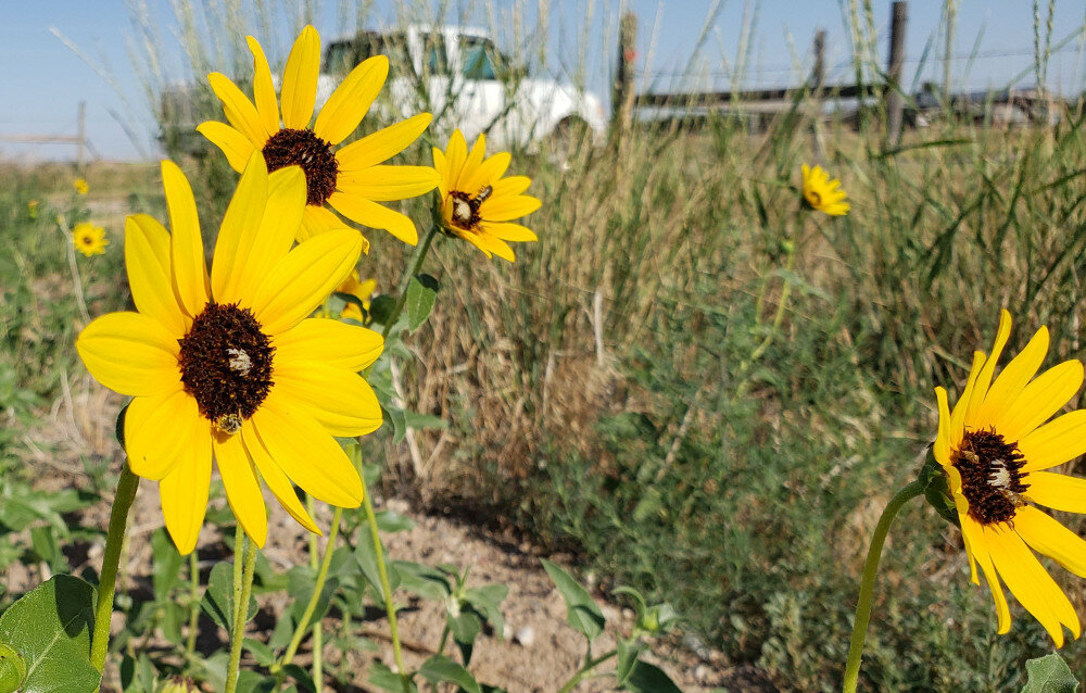
KIMBALL – Following 11 days of 90-plus degree air temperatures, including a high of 101 on July 18, a slow-moving weather front arrived in the tri-state region last Friday evening, bringing slightly cooler temperatures and precipitation.
With atmospheric pressure ridges to the east and west, air flows bringing cooler air flowed up out of Kansas resulting in brisk southeasterly surface winds on Saturday and Sunday. When these winds encountered moisture-bearing air flowing down from the front range of the Rockies widespread afternoon and evening thunderstorms developed, delivering light rain to many locations and localized heavy rain in parts of eastern Wyoming, northeast Colorado and the Nebraska Panhandle.
Cooler conditions continued across the region early in the week, with daily highs climbing only into the 80s and overnight lows falling below 60 degrees.
Winter wheat harvest was nearly complete across the region by the weekend. While comprehensive data is not yet available, both yields and grain quality are thought to have been below average but somewhat better than expected.
Spring-planted crops were benefiting from sunshine, warmth and precipitation. Many proso millet stands in and around Kimball County continue to look spotty due to poor germination, but where the plants are growing, they appear to be doing well and were beginning to head out by the weekend. Dryland corn was looking better this week but has been hampered in many areas by dry conditions. Irrigated corn is coming along nicely, as is irrigated alfalfa. Dryland hay crops are beginning to look like there will be at least some forage to swath and bale.
Where rain fell, well managed rangeland was looking considerably better than anticipated, given the timing and generally low quantity of rainfall. Cool season grasses were greening and translocating energy and nutrients to root systems while warm season grasses continued to produce nutrient dense biomass.
Regional Forecast and Conditions
As of Tuesday morning (July 26), the temperature at sunrise was 62 degrees in light fog and mist. Winds were north at 13 mph and the barometer was steady at 30.07 inches of mercury (in/Hg).
Today’s weather (Friday, July 29) is expected to be partly sunny with a high of 77 degrees and a 50% chance of afternoon and evening showers and thunderstorms. Friday night is expected to be partly cloudy and breezy with a low of about 55 degrees. Day length will be 14 hours and 28 minutes, night length 9 hours and 32 minutes.
Saturday is forecast to be mostly sunny and warmer with a high near 86 and a chance of afternoon and evening thunderstorms. The overnight low is expected to fall to about 57. Sunday should be sunny and warmer with a high of 91 before falling off to a low of about 59.
Monday is expected to be clear, sunny, and warmer with a high reaching into the upper 90’s and an overnight low falling to near 60.
The remainder of the week is relatively uncertain as another weather front is expected to arrive by mid-week.
At Kimball the July 19-25 daytime high averaged 91.14 degrees, about 4.14 degrees cooler than last week. The weekly high temperature was 99 degrees on July 21. Overnight lows averaged 58.14 degrees, about 3.86 degrees cooler than last week. The weekly low temperature was 55 degrees on July 20 and 24. The weekly mean temperature at Kimball was 74.64 degrees, about 4.0 degrees cooler than last week and 2.84 degrees warmer than the July average of 71.8 degrees. The long-term average high and low temperatures at Kimball for July are 87.4 and 56.1, respectively.
Kimball received 0.70 inches of rain over the July 19-25 period from thunderstorms on July 23, 24, and 25.
Winds near Kimball averaged east southeasterly and breezy when thunderstorms were present during the July 19-25 period. Gusts for the week averaged 30.71 mph. High gust for the week was 48 mph on July 24.
Historic climate data
Here’s an overview of July 29 temperature and precipitation highs, lows, and averages over the preceding 129 years at Kimball. Data is taken from the High Plains Regional Climate Center (www.hprcc.unl.edu), where you can find and track data for your own particular location.
Last year (July 29, 2021): Daily high temperature 91 degrees, overnight low 66 degrees, average temperature 78.5 degrees. Precipitation zero inches, snowfall zero inches, snow depth zero inches.
The warmest July 29 on record was 105 degrees in 1933. The coolest July 29 high temperature was 64 degrees in 1932. The coldest July 29 overnight low was 43 degrees in 2015. The warmest July 29 overnight low was 67 degrees in 1895. Over the years since 1893 the high temperature on July 29 has averaged 86 degrees, the overnight low 56 degrees, the daily average 71.2 degrees, precipitation has averaged 0.08 inches, snowfall zero inches, snow depth zero inches.
The highest July 29 precipitation total was 2.16 inches (rain) in 1982. Highest snowfall zero inches, highest snow depth zero inches.
USDA Weekly Weather Bulletin, July 26
Hot, mostly dry weather dominated the nation’s midsection, increasing stress on rangeland, pastures, and a variety of summer crops, including cotton and sorghum. Consistent with other periods of extreme heat earlier this growing season, some of the most serious agricultural impacts were focused across the central and southern Plains, extending toward the Mississippi Delta. In fact, hotter-than-normal weather dominated the country, with record-setting temperatures briefly returning across the Southwest and migrating into the Northeast. Near normal weekly temperatures were limited to just a few regions, including parts of the Northwest and Southeast.
Widespread, meaningful rainfall was scarce across the western and central U.S., with significant totals largely limited to the eastern one-third of the country. However, timely rain fell in much of the eastern Corn Belt, with beneficial showers extending into the Southeast. Elsewhere, a lull in the monsoon circulation accompanied the Southwestern heat, while several wildfires flared amid hot, dry conditions from California to the northern Rockies. Weekly temperatures averaged more than 5 degrees above normal in many locations from the Four Corners region to the central and southern Plains and the midSouth. A second area of anomalous heat (temperatures also more than 5 degrees above normal) stretched from portions of the Great Lakes region to the northern Atlantic Coast.
USDA Crop Progress Reports,
July 25
Nebraska – For the week ending July 24, 2022, there were 6.4 days suitable for fieldwork. Topsoil moisture supplies rated 26% very short, 42% short, 31% adequate, and 1% surplus. Subsoil moisture supplies rated 29% very short, 37% short, 34% adequate, and 0% surplus.
Corn condition rated 8% very poor, 10% poor, 25% fair, 43% good, and 14% excellent. Corn silking was 68%, behind 80% last year and 75% for the five-year average. Dough was 8%, behind 13% last year and 15% average.
Soybean condition rated 4% very poor, 9% poor, 27% fair, 47% good, and 13% excellent. Soybeans blooming was 67%, behind 83% last year and 77% average. Setting pods was 31%, behind 49% last year and 37% average.
Winter wheat harvested was 84%, equal to last year, and ahead of 79% average.
Sorghum condition rated 6% very poor, 21% poor, 34% fair, 32% good, and 7% excellent. Sorghum headed was 20%, near 18% last year, but behind 26% average.
Oats condition rated 15% very poor, 22% poor, 28% fair, 32% good, and 3% excellent. Oats harvested was 58%, behind 64% last year and 65% average.
Dry edible bean condition rated 2% very poor, 6% poor, 24% fair, 56% good, and 12% excellent. Dry edible beans blooming was 51%, near 54% last year. Setting pods was 1%, behind 13% last year.
Pasture and range conditions rated 24% very poor, 26% poor, 30% fair, 18% good, and 2% excellent.
Wyoming – For the week ending July 24, 2022, there was no break from the hot and dry conditions for the majority of Wyoming. Isolated portions of southern and eastern Wyoming saw temperatures as much as 5 degrees above average. Moisture was negligible for much of Wyoming. Only a few portions of the southwest and north received precipitation levels that were slightly above normal.
According to the U.S. Drought Monitor, the amount of land that was drought free fell to 10.6%, compared to 11.6% the previous week. The amount of land rated abnormally dry stood at 26.6%, compared to 28.2% the previous week. Moderate drought increased to 37.8%, up from 35.7% last week. Severe drought fell one percentage point to 19.9%. Extreme drought increased to 5.1%, compared to 3.6% last week.
A report from Carbon County indicated that irrigated native hay production was poor with low yields in some fields.
The southern areas of Goshen County remained severely dry. Spotty rains in northern portions of the County alleviated dryness in some pastures and fields.
The weather remained mostly hot and dry in Lincoln County and moisture was needed. The first crop of alfalfa was nearly all harvested.
A report from Weston County indicated losses on dryland grain, grass, alfalfa, and mixed hay fields. Hay supplies were insufficient in areas that experienced high winds with low moisture levels or minimal snow cover. Forage fields containing alfalfa were not maturing. Fields were drying up and lying down before farmers could harvest. Hay fields in the lowlands, however, were performing well. Ranges were maturing and drying early with the higher temperatures. Dusty conditions resulted from the low top-soil moisture levels.
Irrigation water supplies across the State were rated 1% very poor, 27% poor, 26% fair, and 46% good, compared to 2% very poor, 19% poor, 27% fair, and 52% good last week.
Stock water supplies across Wyoming were rated 5% very short, 43% short, 51% adequate, and 1% surplus, compared to 6% very short, 36% short, 57% adequate, and 1% surplus last week.
Colorado – For the week ending July 24, 2022, harvest of winter wheat approached completion in several counties.
According to the U.S. Drought Monitor, 82% of the State is under drought conditions, down one percentage point from the previous week. Forty percent of the State is experiencing severe to exceptional drought conditions, up 8 percentage points from last week. Extreme drought conditions are affecting 5% of the State, equal to last week.
In northeastern and east central counties, continued high temperatures and limited moisture allowed winter wheat harvest to advance rapidly. Current reports state the conditions this growing season are unlike any other, and while yields are low, the overall quality of the winter wheat crop continues to be higher than expected. Moisture received over the weekend provided a much-needed reprieve from temperatures that have been more than ten degrees above average in some areas. Areas in Kiowa, Kit Carson, Morgan, and Washington Counties received over an inch of moisture late in the week. Irrigation water supplies were adequate with no reports regarding restricted usage. Non-irrigated crops and pastures continue to show signs of stress due to heat and inconsistent rain.
In southwestern counties, reporters noted crops are developing well after receiving decent moisture for the month of July. Rain has improved pasture and rangeland conditions, which allows producers to continue grazing livestock. A reporter in Mesa County stated irrigation water is being cut, limiting the amount of water producers can utilize.
In the San Luis Valley, above average temperatures and scattered thunderstorms were widespread last week. Reporters note the potato and barley crops continue to develop well, but more moisture would aid in crop development as irrigation alone can’t keep up. According to county reports, irrigation water supply is a concern, with well levels dropping significantly.
In southeastern counties, above average temperatures and windy conditions were observed last week. Bent and Prowers Counties received wind gusts above 40 miles per hour over the weekend. Areas of Bent, Otero, and Prowers Counties received over an inch of precipitation, while the rest of the district remained primarily dry. The northeast corner of Bent County received the most moisture last week, with over two inches of rain received.
Stored feed supplies were rated 2% very short, 31% short, 66% adequate, and 1% surplus. Sheep death loss was 85% average and 15% light. Cattle death loss was 95% average and 5% light.
U.S. Drought Monitor
USDM reports derive normals/averages from the most recent 30 year period, though longer timescale data are used where available. The USDM generally reports on current drought conditions and offers a comprehensive history of drought across the Continental U.S. Near-term temperature and precipitation predictions derive from National Weather Service (NWS) and National Oceanic and Atmospheric Administration (NOAA) forecasts.
Current drought status for the Nebraska Panhandle, Southwest Wyoming, and Northeast Colorado. Drought Categories: D0 – abnormally dry. D1 – moderate drought. D2 – severe drought. D3 – extreme drought. D4 – exceptional drought.
(July 19, 2022) Most of the eastern third of the U.S. recorded precipitation during the last week, with only a few pockets that missed out. Portions of the Midwest and into the Southeast had some amounts over 3 inches for the week and even widespread 5-plus inch amounts in the coastal areas of Florida, and some rain at the end of the period allowed for much of New England to stay status quo for the week and even see a few improvements. The areas with the most rain also had the coolest temperatures, with much of the Midwest and Southeast cooler than normal for the week with departures of 2-4 degrees below normal. Warmer-than-normal temperatures dominated the western half of the country with areas from Montana to Texas recording temperatures that were 6-8 degrees above normal. The coastal areas of the Pacific Northwest were cooler than normal while the Great Basin was warmer than normal with departures of 6-8 degrees above normal. With the dryness and heat, the flash drought that has been developing in the central to southern Plains developed even more this week with the wet conditions of May and June quickly being forgotten.
High Plains: A warm and mainly dry week dominated the region. Temperatures were warmest in eastern Montana and from western North Dakota to western Kansas, where departures were 6-8 degrees above normal. There were some pockets of very intense rains in Nebraska, North Dakota and eastern Colorado, but widespread rains were minimal. South Dakota had expansion of abnormally dry and moderate drought over much of the southern tier of the state while eastern Kansas had widespread introduction of abnormally dry conditions and moderate drought expansion. Severe and extreme drought expanded over much of western Kansas while severe drought expanded over north-central Nebraska and in the panhandle. Severe drought also expanded on the plains of eastern Colorado and extreme southeast Wyoming. There was a slight improvement in extreme drought in northeast Nebraska where some intense rains fell in the middle of the previous extreme drought area.
West: Temperatures were warmer than normal over much of Montana and into northern Nevada, southern Idaho, and eastern Wyoming with departures of 6-8 degrees above normal. Temperatures were cooler than normal by 1-2 degrees over the coastal regions of Washington and Oregon. Highly variable and scattered monsoonal moisture continues to impact the region, with some areas with above-normal precipitation for the week in Nevada, Arizona, and southern California as well as into areas of southern Colorado and Utah. Only minimal changes were made this week as the full impact of the recent precipitation is not fully known yet, but improvements are possible depending on how the rest of the monsoon season continues.
Near-term forecast: The 6–10-day outlook favors above-normal precipitation over the central to southern Plains, Southwest and Midwest, with the best chances over Kansas, Oklahoma, and Kentucky. Below-normal precipitation chances are best over the Pacific Northwest and into portions of the Southeast.
So far as temperatures go, the West, South, Midwest and East Coast have the best chances to record above-normal temperatures, with the best chances over the South and Pacific Northwest. The best probability for below-normal temperatures will be over the northern Plains, southern Arizona and Alaska.
Terminology: EDDI – Evaporative Demand Drought Index. This is an experimental model for drought prediction, using nationwide data from 1980-present. SPE – Standardized Precipitation index, correlating present month/year precipitation with 30-plus year historical data. SPEI – Standardized Precipitation Evapotranspiration Index. SWE – Snow Water Equivalent.
For more information on the U.S. Drought Monitor, including an explanation of terminology, visit http://droughtmonitor.unl.edu.


