

September transitioned to October in the midst of cooling temperatures and widespread light to moderate rain across much of the Tri-state region. While cloudy skies delivered rain across lower elevations, snow fell above the 6,000
foot level.
This item is available in full to subscribers.
To continue reading, you will need to either log in to your subscriber account, or purchase a new subscription.
If you are a current print subscriber, you can set up a free website account and connect your subscription to it by clicking here.
If you are a digital subscriber with an active, online-only subscription then you already have an account here. Just reset your password if you've not yet logged in to your account on this new site.
Otherwise, click here to view your options for subscribing.
Please log in to continue |
KIMBALL – September transitioned to October in the midst of cooling temperatures and widespread light to moderate rain across much of the Tri-state region. While cloudy skies delivered rain across lower elevations, snow fell above the 6,000
foot level.
At Kimball the first frost arrived Tuesday morning as the mercury fell to 32 degrees.
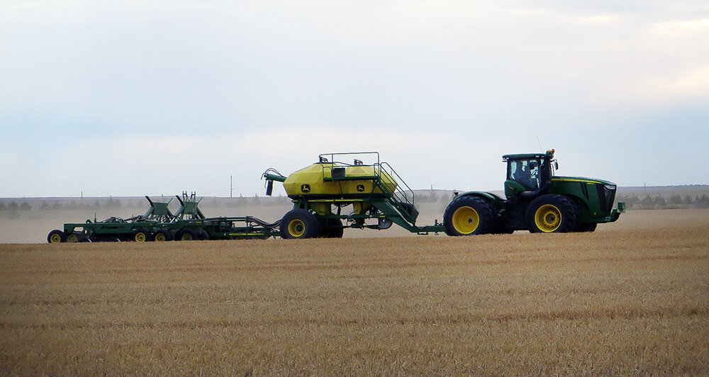
The precipitation was timely for recently seeded winter wheat and for pasture and rangeland that was becoming a bit dry. In general, winter wheat germination had been good and some very nice stands are becoming established.
Cool season grasses and winter annuals perked up with the moisture as well. Although Kimball County and other parts of the Panhandle are behind for the year on precipitation totals, distribution and timing of rainfall has been quite beneficial in prolonging active and productive growth. Autumn grazing should be quite good this year, however, continued growth will also reduce soil moisture levels unless they are replaced by more precipitation.
Sugarbeet harvest was under way across much of the region last week, however, harvest was slowed by precipitation and wet fields.
Regional Forecast and Conditions
As of Tuesday morning (Oct. 3), the temperature at sunrise was 34 degrees under partly cloudy skies. There was a light frost. The day was expected to be sunny with a high near 60 degrees.
The forecast through the weekend calls for clearing to mostly sunny skies. Weekend daytime air temperatures are forecast to range in the 60’s - 70’s. Overnight lows for the weekend are expected to fall into the low to mid- to upper-30’s.
Monday-Wednesday daytime highs are expected to range in the 40’s, with overnight lows falling into the upper 20’s. There is good chance of widespread showers through mid-week, and snow is possible, especially above 5,500 feet.
Air temperatures cooled once again across the region last week. At Kimball the Sept. 26-Oct. 2 daytime high averaged 59.71 degrees, about 7.5 degrees cooler than the previous week. The weekly high temperature was 74 degrees on Sept. 30. Overnight lows averaged 42.28 degrees, about 2.5 degrees cooler than the previous week. The weekly low temperature was 36 degrees on Sept. 26. The weekly mean temperature was 51.0 degrees, about 5 degrees cooler than the previous week, and about 9.7 degrees cooler than the Sept. average of 60.7 degrees. The long term average high and low temperatures at Kimball for September are 77.0 and 44.4 degrees, respectively, and for October are 64.3 and 32.8 degrees, respectively.
Twelve of 13 Panhandle stations reported precipitation over the Sept. 26-Oct. 2 period, ranging from 0.77 inches at Harrisburg to 0.01 inches at Gordon and Sidney 0.9 NNW. Panhandle precipitation averaged 0.28 inches compared to 0.26 inches last week.
With the exception of Sidney, Panhandle soil temperatures cooled over the Sept. 26-Oct. 2 period: (this week/last week/change): Alliance 55.7/71.0 (-15.3) degrees; Gordon 57.5/68.4 (-10.9) degrees; Mitchell 56.9/70.2 (-13.3) degrees; Scottsbluff 61.0/70.2 (-9.2); and Sidney 64.5/59.4 (+5.1) degrees.
Winds near Kimball averaged easterly and mostly light over the Sept. 26-Oct. 2 period. Gusts for the week averaged 18.85 mph. High gust for the week was 29 mph on Oct. 1.
Oct. 6 Weather Almanac
Here’s an overview of Oct. 6 temperature and precipitation highs, lows, and averages over the preceding 123 years at Kimball. Data is taken from the High Plains Regional Climate Center (www.hprcc.unl.edu), where you can easily find and track data for your own particular location.
Last year (Oct. 6, 2016): Daily high temperature 64 degrees, overnight low 34 degrees, average temperature 49.0 degrees. Precipitation 0.06 inches, snowfall zero inches, snow depth
zero inches.
The warmest Oct. 6 on record was 90 degrees in 1993. The coolest Oct. 6 high temperature was 33 degrees in 2012. The coldest Oct. 6 overnight low was 21 degrees in 2005. The warmest Oct. 6 overnight low was 49 degrees in 1897. Over the years since 1893 the high temperature on Oct. 6 has averaged 66 degrees, the overnight low 35 degrees, the daily average 50.2 degrees, precipitation has averaged 0.04 inches, snowfall 0.1 inches, snow depth
zero inches.
The highest Oct. 6 precipitation total was 1.22 inches in 1994.
Snow has fallen on Oct. 6 at Kimball three times over the last 123 years, with 6.5 inches in 2012, a half-inch in 1951, and a trace
in 1998.
September weather almanac
Average 7 a.m. conditions: temperature 50.6 degrees, winds south-southeasterly at 6.5 mph, barometer 30.10.
Average daily high temperature 76.4 degrees (123 year average 77.0). Average daily low temperature 48.4 degrees (123YA 44.4). Daily average temperature 62.4 degrees (123YA 60.7). Total liquid precipitation 0.91 inches (123YA 1.26). Year to date (YTD) precipitation 13.46 inches (123YA 14.77). Total snowfall 0.0 inches (123YA 0.2). YTD snow 19.81 inches (123YA 26.8).
Departures: Daily High, -0.6 degrees; Daily Low, +4.0 degrees; Daily Average, +1.7 degrees; Total Liquid Precipitation, -0.35 inches; YTD precipitation -1.31 inches. Total Snow, -0.2. YTD snow -6.99 inches.
U.S. Drought Monitor
(Sept. 26) The High Plains: A stripe of heavy rain cut across the region from the central High Plains into the eastern Dakotas.
On Sept. 23-24, rainfall totals reached 4.04 inches in Huron, South Dakota, and 3.42 inches in North Platte, Nebraska. All dryness- and drought-affected areas within the region experiencing heavy rain saw improvement in the drought situation. This area of improvement included western and central Kansas; central Nebraska; and the eastern Dakotas.
There was some minor improvement noted in areas outside of the heavy rain band. Most of the region’s rangeland and pastures continued to improve.
Lingering effects from the Dakotas’ punishing summer drought left 57 percent of the rangeland and pastures rated very poor to poor on Sept. 24 in both states, according to the U.S. Department of Agriculture. In addition, South Dakota continued to lead the nation (among major production states) in very poor to poor ratings for sorghum (33 percent) and corn (27 percent).
National Summary: Relatively quiet weather prevailed for much of the drought-monitoring period.
Record-setting warmth accompanied the tranquil weather across the Midwest and Northeast. Very cool weather and locally significant precipitation affected the Northwest, including the Cascades and northern Rockies, boosting topsoil moisture and further aiding wildfire containment efforts.
Starting on Sept. 23, heavy rain erupted along an axis stretching from the southern High Plains into the upper Great Lakes region. The rain put a significant dent in rainfall deficits for areas still experiencing dryness or drought.
For more information on the U.S. Drought Monitor visit: http://droughtmonitor.unl.edu
U.S. Conditions and Weather Report
(Oct. 3) Dry weather dominated the East and Far West. The early- to mid-week period featured record-setting warmth across the Midwest and Northeast, while cool weather covered the West. Later, warmth began to return to the Far West, while seasonably cooler air overspread the eastern half of the U.S. Weekly temperatures averaged at least 10 degrees above normal in several locations from the lower Great Lakes region into New England, but ranged from 5 to 10 degrees below normal across the Intermountain West.
For several days, an axis of heavy rain stretched from southern sections of the Rockies and Plains into the upper Midwest. Weekly rainfall topped 2 inches in several areas, while lingering rain in the south-central U.S. boosted totals to 4 to 8 inches or more—sparking local flooding—in parts of Texas.
Elsewhere, light showers were mostly limited to the Pacific Northwest, Intermountain West, and Northeast. A few heavier showers dotted Florida. East of a line from northeastern Texas to Lower Michigan, however, warm, dry weather promoted summer crop maturation but reduced soil moisture for the germination and establishment of recently planted or soon-to-be planted winter grains and cover crops.
Under warm, humid, showery conditions, hurricane recovery efforts continued in Puerto Rico and the U.S. Virgin Islands, following Irma on Sept. 6 and Maria on Sept. 20. Maria’s direct strike on Puerto Rico as a Category 4 storm—the strongest hurricane to hit the island since 1928—left residents without electricity and other necessities, such as fresh food and running water.
USDA Weekly Weather and Crop Reports
Colorado
Continued cool and wet conditions last week delayed fieldwork and harvest activities but provided welcome moisture in areas.
Reporters in eastern districts noted that rain slowed winter wheat planting and harvest of spring crops, although progress was made earlier in the week as weather conditions allowed.
In southeastern counties, it was noted that the sorghum crop remained behind and in need of heat units to mature.
Reporters in the San Luis Valley noted that heavy rains late last week hindered potato harvest.
Statewide, corn was rated 65 percent good to excellent, compared with 74 percent last year and 55 percent on
Stored feed supplies were rated 1 percent very short, 2 percent short, 88 percent adequate, and 9 percent surplus.
Sheep death loss was 2 percent heavy, 67 percent average, and 31 percent light. Cattle death loss was 1 percent heavy, 74 percent average, and 25 percent light.
Nebraska
For the week ending Oct. 1, 2017, temperatures averaged four to eight degrees below normal across western Nebraska, but two to six degrees above normal in
the east.
Accumulations of an inch or more of rain were common across most of the state, with exception of Panhandle area, recorded less than an inch. Topsoil moisture supplies rated 4 percent very short, 19 short, 73 adequate, and 4 surplus. Subsoil moisture supplies rated 7 percent very short, 28 short, 63 adequate, and 2 surplus.
Significant rainfall continued to limit harvest activities. There were 4.1 days suitable for fieldwork.
Corn condition rated 3 percent very poor, 8 poor, 23 fair, 48 good, and 18 excellent. Corn mature was 70 percent, behind 83 last year and 77 average. Harvested was 12 percent, near 14 last year, and behind 20 average.
Soybean condition rated 3 percent very poor, 7 poor, 27 fair, 51 good, and 12 excellent. Soybeans dropping leaves was 93 percent, ahead of 87 last year and 86 average. Harvested was 19 percent, behind 24 last year and 26 average.
Winter wheat planted was 70 percent, behind 83 last year and 76 average. Emerged was 42 percent, behind 57 last year, but near 40 average.
Sorghum condition rated 2 percent very poor, 2 poor, 20 fair, 55 good, and 21 excellent. Sorghum mature was 62 percent, well behind 85 last year, but near 66 average. Harvested was 17 percent, near 21 last year, but ahead of 10 average.
Alfalfa condition rated 3 percent very poor, 10 poor, 27 fair, 47 good, and 13 excellent. Alfalfa fourth cutting was 87 percent complete, ahead of 78 last year, and near 83 average.
Dry edible beans dropping leaves was 98 percent. Harvested was 65 percent, behind 70 last year and 71 average.
Proso millet harvested was 67 percent, near 66 last year, but behind 79 average.
Pasture and range conditions rated 5 percent very poor, 16 poor, 39 fair, 35 good, and 5 excellent.
Stock water supplies rated 1 percent very short, 8 short, 91 adequate, and 0 surplus.
Wyoming
Wyoming experienced cooler than normal temperatures for the week. Thirty-three of the 34 reporting stations reported below average temperatures for the week with the high temperature of 77 degrees recorded at Old Fort Laramie and Sheridan, and a low of 21 degrees at
Big Piney.
Above normal moisture was reported at 20 of the reporting stations. Lake Yellowstone reported the least moisture at 0.10 inches, with Afton reporting the most moisture with 1.43 inches.
A reporter from North Central Wyoming indicated that the rain has slowed harvest for beans, alfalfa seed, and sugarbeets. Another reporter from North Central Wyoming reported that they got nice rains over the past week which made it a little wet for fall plowing. They also indicated that corn silage harvest is complete and the livestock look good.
A reporter from Southwestern Wyoming reported that they experienced small storms during the week and have had cool temperatures with lots of mud.
A reporter from South Central Wyoming noted that most ranchers have indicated that they have moved livestock back to fall pastures which is early for several. Another reporter from South Central Wyoming stated that it has been wetter than normal with cooler temperatures.
A reporter from Southeastern Wyoming reported warm weather for most of the week with only one day of moisture. They also reported that crop progress and harvest are progressing on schedule. Another reporter from Southeastern Wyoming indicated that they have been getting steady rains which may have caused some to replant their wheat.
Stock water supplies across Wyoming were rated 12 percent very short, 17 percent short, 65 percent adequate, and 6 percent surplus.


