

Calendar autumn arrived at midafternoon last Friday, accompanied by the arrival of a cold front bringing markedly cooler air and widespread light rain.
This item is available in full to subscribers.
To continue reading, you will need to either log in to your subscriber account, or purchase a new subscription.
If you are a current print subscriber, you can set up a free website account and connect your subscription to it by clicking here.
If you are a digital subscriber with an active, online-only subscription then you already have an account here. Just reset your password if you've not yet logged in to your account on this new site.
Otherwise, click here to view your options for subscribing.
Please log in to continue |
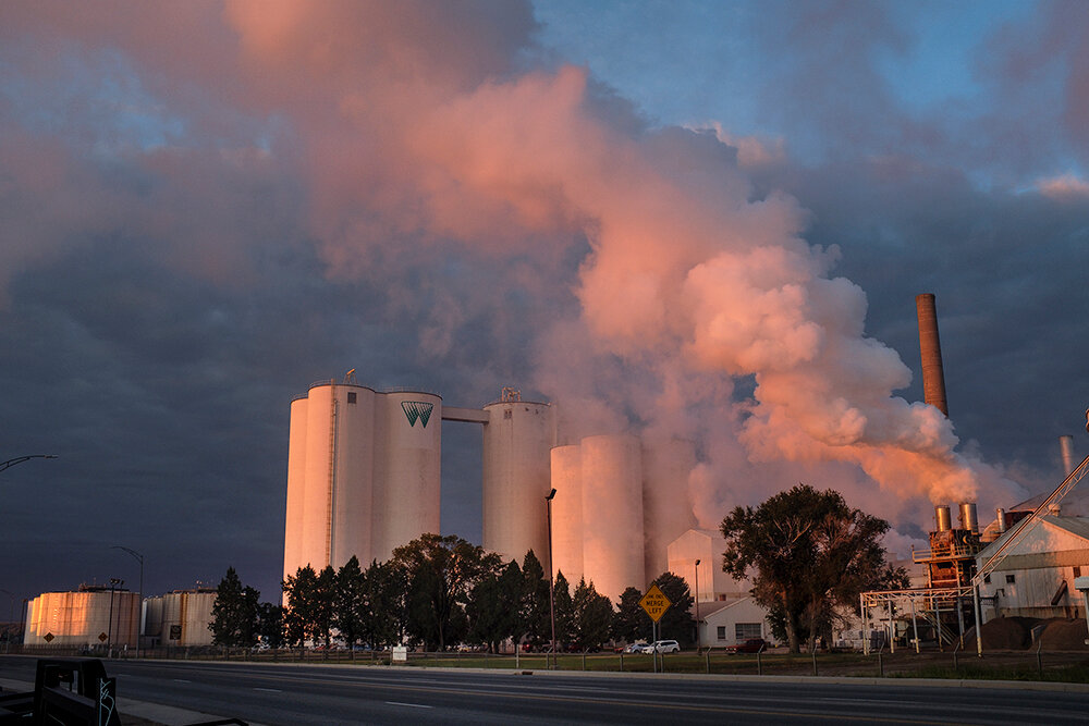
KIMBALL – Calendar autumn arrived at midafternoon last Friday, accompanied by the arrival of a cold front bringing markedly cooler air and widespread light rain.
The cooling temperatures slowed summer crop maturation and rainfall interrupted millet harvest and winter wheat seeding, but the moisture was welcome
nonetheless.
Following the passage of the weather front, a sunny Tuesday morning revealed a nice tinge of green remaining across pastures and
rangeland.
Regional Forecast and Conditions
As of Tuesday morning, the temperature at sunrise was 37 degrees under partly cloudy skies. The day was expected to be sunny with a high of 64 degrees.
The forecast through the weekend calls for mild conditions under partly cloudy to mostly sunny skies with a chance of isolated showers across the region Sunday. Weekend daytime air temperatures are forecast to range in the 60’s - 70’s. Overnight lows for the weekend are expected to fall into the low to mid-40’s.
Monday-Wednesday daytime highs are expected to range in the 60’s, with overnight lows falling into the low-40’s. There is a continued, if diminishing, chance of widespread showers through mid-week.
Air temperatures cooled once again across the region last week. At Kimball the Sept. 19-25 daytime high averaged 67.14 degrees, about 14 degrees cooler than the previous week. The weekly high temperature was 88 degrees on Sept. 21. Overnight lows averaged 44.71 degrees, about 5 degrees cooler than the previous week. The weekly low temperature was 38 degrees on Sept. 25. The weekly mean temperature was 55.92 degrees, about 10 degrees cooler than the previous week, and about 5 degrees cooler than the Sept. average of 60.7 degrees. The long term average high and low temperatures at Kimball for Sept. are 77.0 and 44.4 degrees, respectively.
Nine of the 13 Panhandle stations reported precipitation over the Sept. 19-25 period, ranging from 0.57 inches at Harrisburg to 0.26 inches at Kimball. Big Springs, Gordon, Hemingford, and Sidney 0.9 NNW reported zero precipitation. Panhandle precipitation averaged 0.26 inches compared to 0.55 inches last week.
Panhandle soil temperatures generally cooled over the Sept. 19-25 period: (this week/last week/change): Alliance 71.0/66.1 (+3.9) degrees; Gordon 68.4/70.0 (-1.6) degrees; Mitchell 70.2/71.3 (-1.1) degrees; Scottsbluff 70.2/71.4 (-1.2); and Sidney 59.4/69.5 (-10.1) degrees.
Winds near Kimball averaged easterly and occasionally brisk over the Sept. 19-25 period. Gusts for the week averaged 27.57 mph. High gust for the week was 44 mph on Sept. 19.
Sept. 15 Weather Almanac
Here’s an overview of Sept. 15 temperature and precipitation highs, lows, and averages over the preceding 123 years at Kimball. Data is taken from the High Plains Regional Climate Center (www.hprcc.unl.edu), where you can easily find and track data for your own particular location.
Sept 15, 2016: Daily high temperature 77 degrees, overnight low 39 degrees, average temperature 58.0 degrees. Precipitation 0.00 inches, snowfall zero inches, snow depth zero inches.
The warmest Sept. 15 on record was 93 degrees in 1994. The coolest Sept. 15 high temperature was 28 degrees in 1985. The coldest Sept. 15 overnight low was 21 degrees in 1985. The warmest Sept. 15 overnight low was 52 degrees in 1953. Over the years since 1893 the high temperature on Sept. 15 has averaged 69 degrees, the overnight low 38 degrees, the daily average 53.2 degrees, precipitation has averaged 0.04 inches, snowfall zero inches, snow depth zero inches.
The highest Sept. 15 precipitation total was 1.13 inches in 1973.
Snow has fallen on Sept. 15 at Kimball five times over the last 123 years, with 3.5 inches in 1985, and a trace being recorded in 1959, 1965, 1984, and 1999.
U.S. Drought Monitor
High Plains: The region had a mix of improvement and deterioration. Improvement in the drought depiction was most prominent in the western Dakotas, where heavy rain fell, while deteriorating conditions affected parts of Kansas and environs. In fact, some additional severe drought (D2) was introduced in Kansas, where topsoil moisture rated very short to short (by the U.S. Department of Agriculture) jumped from 38 to 58 percent during the 2 weeks ending Sept. 17.
In contrast, North Dakota’s topsoil moisture was rated 44 percent very short to short, down 18 percentage points from the previous week. However, rangeland and pastures in the Dakotas were slow to recover—typical following a hard-hitting drought—with 58 percent rated very poor to poor in both states on Sept. 17. South Dakota led the nation—among major production states—in very poor to poor ratings for sorghum (29 percent), corn (28 percent), and soybeans (19 percent).
National Summary: Following Hurricane Irma’s arrival in Florida on Sept. 10 and subsequent demise across the Southeast, generally dry weather dominated the country for a few days. However, the first two significant autumn storms of the season arrived across the northern Plains and Northwest, starting on Sept. 14. Eventually, precipitation fell as far south as the Intermountain West and eastward into the upper Midwest.
Several areas of the country remained mostly dry and continued to see mounting short-term rainfall deficits. As a result, portions of the central and southern Plains, as well as the mid-South and lower Midwest, experienced general increases in the coverage of dryness and drought. In mid-September, there was an abrupt weather-pattern change that not only provided the northern Plains and Northwest with much-needed precipitation, but also brought a warming trend to the eastern half of the nation and notably cooler weather to the West.
For more information on the U.S. Drought Monitor visit: http://droughtmonitor.unl.edu
U.S. Conditions and Weather Report
Across the U.S. mainland, relatively quiet weather prevailed for much of the week. However, in a reversal from early Sept., warm air overspread the South, East, and Midwest, while a late season heat wave abruptly ended across the West.
Weekly temperatures averaged at least 10 degrees above normal across portions of the central and southern Plains and much of the Midwest, pushing developmentally delayed summer crops—including corn and soybeans— toward maturity.
Starting on Sept. 20, widespread readings above 90 degrees covered much of the Corn Belt.
For a few days, unsettled showery weather stretched from the Pacific Northwest to the northern Rockies, boosting soil moisture for recently planted winter grains and further aiding wildfire containment efforts.
Toward week’s end, a band of heavy rain developed from the southern High Plains into the upper Midwest.
Much of the remainder of the country, particularly the South and East, experienced a long stretch of warm, dry weather, reducing topsoil moisture but favoring harvest activities and other early-autumn
fieldwork.
On Sept. 20, Hurricane Maria slammed St. Croix, U.S. Virgin Islands, and Puerto Rico. Just before 1 a.m. AST, Maria passed less than 20 miles south of St. Croix as a Category 5 hurricane with sustained winds near 175 mph. Hours later, at 6:15 am, Maria directly struck Puerto Rico, making landfall as a high-end Category 4 storm with winds of 155 mph near Yabucoa. Devastating impacts, including severe wind damage and record flooding, accompanied the hurricane, which struck just 2 weeks after Hurricane Irma grazed St. Croix and Puerto Rico—and caused great destruction on the other major U.S. Virgin Islands of St. Thomas and St. John. Puerto Rican flooding persisted for days afterward, as massive runoff strained flood-control projects and other catchment basins.
USDA Weekly Weather and Crop Reports
Colorado
Widespread cool and rainy weather late last week brought beneficial moisture to several areas. Early in the week, warm and dry conditions continued to promote crop maturity.
In northwestern counties, the first significant snowfall was reported last week along with a killing frost. A reporter noted some hay was still on the ground at that time with quality negatively affected. Reporters in northeastern counties noted that winter wheat planting progressed despite dry conditions earlier in the week, but remained behind. Corn silage harvest was reported to be in full swing in these areas.
East central counties received significant precipitation in areas late last week and a reporter noted corn harvest was very spotty.
In southwestern counties, dry edible bean conditions continued to decline due to recent wet weather and damaging severe storms.
Reporters in the San Luis Valley noted barley harvest is complete and fall potato harvest is
progressing well.
Statewide, corn was rated 61 percent good to excellent, compared with 73 percent last year and 55 percent on average.
Stored feed supplies were rated 1 percent very short, 2 percent short, 86 percent adequate, and 11 percent surplus.
Sheep death loss was 55 percent average and 45 percent light. Cattle death loss was 75 percent average and 25 percent light.
Nebraska
For the week ending Sept. 24, temperatures averaged near normal across western Nebraska, but six to ten degrees above normal in the east.
Rainfall of an inch or more was received across most of the State, with some central counties recording up to four inches.
Topsoil moisture supplies rated 4 percent very short, 26 short, 69 adequate, and 1 surplus. Subsoil moisture supplies rated 7 percent very short, 34 short, 58 adequate, and 1 surplus.
Harvest activities were slowed due to the moisture. There were 5.7 days suitable for fieldwork.
Corn condition rated 3 percent very poor, 8 poor, 22 fair, 50 good, and 17 excellent. Corn dented was 96 percent, near 98 last year and 97 for the five-year average. Mature was 55 percent, behind 66 last year and 62 average. Harvested was 7 percent, near 6 last year, but behind 13 average.
Soybean condition rated 2 percent very poor, 8 poor, 26 fair, 52 good, and 12 excellent. Soybeans dropping leaves was 80 percent, ahead of 72 last year and 70 average. Harvested was 10 percent, near 8 last year, and equal to average.
Winter wheat planted was 47 percent, well behind 68 last year, and behind 59 average. Emerged was 15 percent, well behind 37 last year, and behind 21 average.
Sorghum condition rated 1 percent very poor, 2 poor, 21 fair, 56 good, and 20 excellent. Sorghum coloring was 98 percent, near 100 last year and 94 average. Mature was 50 percent, behind 60 last year, but ahead of 42 average. Harvested was 13 percent, near 9 last year, and ahead of 4 average.
Alfalfa condition rated 2 percent very poor, 8 poor, 27 fair, 47 good, and 16 excellent. Alfalfa fourth cutting was 83 percent complete, ahead of 69 last year and 74 average.
Dry edible beans condition rated 2 percent very poor, 9 poor, 20 fair, 52 good, and 17 excellent. Dry edible beans dropping leaves was 90 percent, near 94 last year. Harvested was 58 percent, ahead of 48 last year and 52 average.
Proso millet harvested was 60 percent, ahead of 52 last year, but behind 66 average.
Pasture and range conditions rated 4 percent very poor, 20 poor, 44 fair, 27 good, and 5 excellent.
Stock water supplies rated 2 percent very short, 9 short, 89 adequate, and 0 surplus.
Wyoming
Wyoming experienced cooler than normal temperatures for the week. Twenty-five of the 34 reporting stations reported below average temperatures for the week with the high temperature of 89 degrees recorded at LaGrange, Old Fort Laramie, and Torrington, and a low of 24 degrees at Lake Yellowstone.
Above normal moisture was reported at 31 of the reporting stations. Only one station (Evanston) reported no moisture with Dubois reporting the most moisture with 2.10 inches.
A reporter from North Central Wyoming indicated that they have gotten rain almost every day and some snow in the mountains. They also noted that harvesting and planting is getting done as best as
they can.
A reporter from Northeastern Wyoming reported that they had received rain but more is needed to get back to normal.
A reporter from Western Wyoming indicated that it was very wet last week making harvest difficult.
A reporter from Southwestern Wyoming noted that they got lots of rain and a little snow over the
past week.
A reporter from South Central Wyoming stated that it has been cooler but continued dry. They also indicated that cattle are being moved off summer pastures, and the hay supply looks adequate but fall pastures could be short and lead to
early feeding.
A reporter from Southeastern Wyoming reported warm weather for most of the week but rain came on Friday making harvest difficult. Another reporter from Southeastern Wyoming indicated that moisture is in huge demand for the area but subsoil moisture seems to be okay for wheat drilling.
Stock water supplies across Wyoming were rated 11 percent very short, 25 percent short, 60 percent adequate, and 4 percent surplus.


