

After a few scattered thunderstorms delivered localized heavy rainfall last weekend, conditions turned mostly dry and warm as the Dog Days of summer made an anemic comeback.
This item is available in full to subscribers.
To continue reading, you will need to either log in to your subscriber account, or purchase a new subscription.
If you are a current print subscriber, you can set up a free website account and connect your subscription to it by clicking here.
If you are a digital subscriber with an active, online-only subscription then you already have an account here. Just reset your password if you've not yet logged in to your account on this new site.
Otherwise, click here to view your options for subscribing.
Please log in to continue |
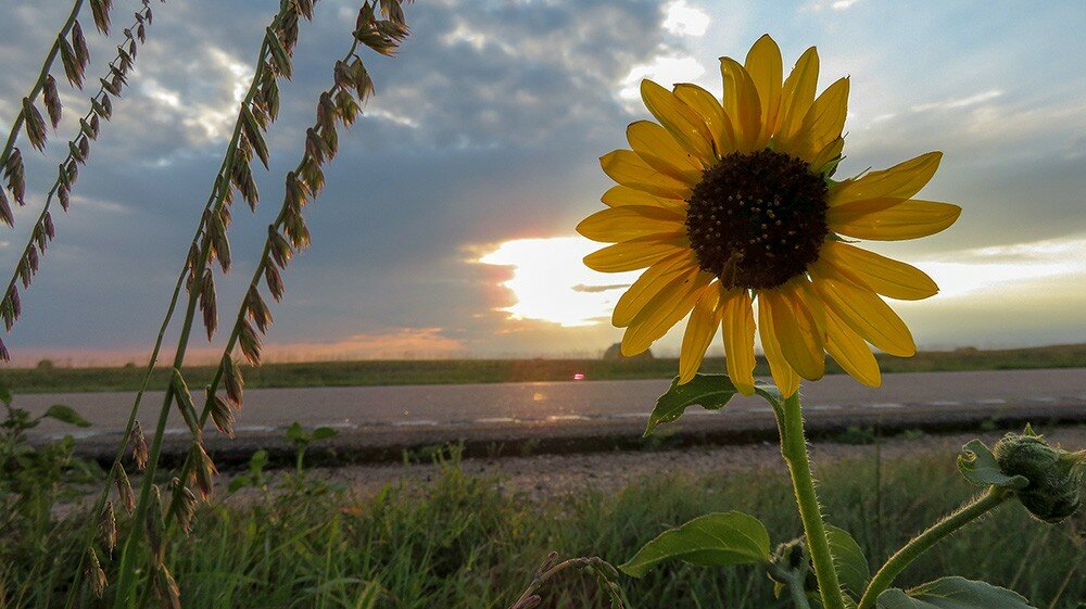
KIMBALL – After a few scattered thunderstorms delivered localized heavy rainfall last weekend, conditions turned mostly dry and warm as the Dog Days of summer made an anemic comeback.
Winds shifter to the south on Sunday (Aug. 12), bringing a significant smoke and haze layer from southwestern wildfires into the region by midday. Smoke and haze lingered across the region for about 24 hours before shifting winds cleared the air.
Warm and dry conditions were beneficial for spring planted crops as late-summer maturation began to take hold.
Across the south and central portions of the Panhandle and in adjacent areas in southeast Wyoming and northeast Colorado, however, the extent of hail damage from late-July and early-Aug. storms has become apparent and is quite extensive. In locations where hail and wind combined, corn and forage grasses now sport tattered and drooping leaves, while some proso millet stands have been essentially mowed.
Well managed pastures and rangelands were generally less affected by hail, which in many cases simply knocked down and reseeded drying cool season grasses while doing little harm to flourishing warm season grasses. Indeed, warm season grasses have been considerably more productive this year due to abundant mid- to late-summer precipitation.
As might be expected, livestock continue to do very well indeed while grazing abundant grass.
Regional Forecast and Conditions
As of Tuesday morning (Aug. 14), the temperature at sunrise was 58 degrees with fog and mist. Winds were northeasterly at 5 mph, and the barometer was steady at 30.10 inches of mercury (in/Hg).
Today’s weather (Friday, Aug. 17) is expected to be mostly sunny and warm with a chance of thunderstorms after noon. Daytime air temperatures should reach 85 degrees and overnight lows falling to about 56 degrees. Saturday is forecast to be similar but very slightly cooler, with a high of 82, a low of 54, and chance of thunderstorms after noon. Sunday is expected to be cooler yet, with a high of 78, low of 52, and chance of isolated thunderstorms after noon.
Monday through Wednesday are expected to be mostly sunny and cooler, with highs in the lower 70’s and overnight lows falling to about 50. A chance of afternoon thunderstorms is forecast for this period.
Average air temperatures warmed very slightly across the region last week. At 13 selected stations across the Panhandle 24-hour temperatures averaged 70.3 degrees, about 0.1 degrees warmer than the previous week.
At Kimball the Aug. 7-13 daytime high averaged 85.57 degrees, about 2 degrees warmer than the previous week. The weekly high temperature was 88 degrees on Aug. 11. Overnight lows averaged 55.0 degrees, about 0.71 degrees cooler than the previous week. The weekly low temperature was 52 degrees on Aug. 7. The weekly mean temperature at Kimball was 70.28 degrees, about 0.5 degrees warmer than last week, and very near the Aug. average of 70.0 degrees. The long-term average high and low temperatures at Kimball for August are 86 and 54, respectively.
Eleven of 13 selected Panhandle stations reported rain over the Aug. 7-13 period, ranging from 0.01 inches at Sidney Municipal to 0.56 inches at Bushnell and Hemingford. Across the Panhandle rainfall averaged 0.20 inches, compared to 0.28 inches last week.
Soil temperatures were generally higher across the Panhandle over the Aug. 7-13 period: (this week/last week/change): Alliance 76.0/71.1 (+4.9) degrees; Gordon 76.0/71.3 (+4.7) degrees; Mitchell 80.2/76.2 (+4.0) degrees; Scottsbluff 76.0/76.2 (-0.2) degrees; and Sidney 75.2/71.2 (+4.0) degrees.
Winds near Kimball averaged southeasterly and mostly light over the Aug. 7-13 period. Gusts for the week averaged 18 mph. High gust for the week was 29 mph on Aug. 12.
U.S. Drought Monitor
High Plains: Moisture deficits have been slowly increasing in northern parts of this region for the past several weeks, however, significant deficits are patchy and relatively short-term in nature, so only modest D0 and D1 expansion was brought into the drier parts of the Dakotas.
Severe to exceptional drought is limited to southern parts of this region, primarily in south-central through western Colorado and parts of central and eastern Kansas. Drought conditions were essentially unchanged here, save for some small, spotty areas of improvement in eastern Kansas.
Between these two areas, across southeastern Colorado and western Kansas, above-normal rainfall has been the rule for the past few months. 90-day rainfall totaled 4 to locally 10 inches more than normal here. To wit, broad-scale improvement was assessed, eliminating dryness in much of southwestern Kansas, and leaving moderate to severe drought covering most of southeastern Colorado.
West: Periods of heavy rainfall have affected parts of New Mexico for several weeks now, sufficient to bring improvement into portions of central and west-central sections of the state. But despite these beneficial rains, exceptional drought (D4) still covers most of north-central and northwestern New Mexico.
There was a palpable worsening of conditions along much of the northern tier of Montana, south-central Washington, southwestern and east-central Oregon, and a small area near the mountains of extreme northwestern Utah. Livestock progress and production has been seriously impaired by the drought, particularly in southern Oregon and part of northeastern Utah.
Farther south, California was seasonably dry, and only isolated locales in Arizona and Nevada reported light rain. Dryness and drought remained essentially unchanged in these states.
Near-term forecast: The Climate Prediction Center favors surplus precipitation for the Aug. 14 – 18 period in the Desert Southwest, southern Rockies, central Great Plains, Texas (outside the southeast tier), middle Mississippi Valley, Ohio Valley and adjacent Great Lakes Region, and central and northern sections of the Appalachians and Eastern Seaboard. All but the western and northern tiers of Alaska are also expected to record above-normal precipitation.
Subnormal rainfall is favored in the South Atlantic States, central Gulf Coast, and in a swath from the northern Intermountain West eastward into the western Great Lakes Region.
Enhanced chances for warmer-than-normal conditions cover much of the contiguous 48 states, with only the region north of the immediate Gulf Coast extending from the central and southern Appalachians westward through the lower Ohio Valley, middle and lower Mississippi Valley, most of Texas and the southern Rockies excluded.
Odds favoring abnormally cool weather are limited to areas from the southern tier of Arizona and New Mexico eastward through the Big Bend, central and northern Texas (excluding the Panhandle), central and eastern Oklahoma, and adjacent Arkansas.
For more information on the U.S. Drought Monitor visit: http://droughtmonitor.unl.edu
U.S. Conditions and Weather Report
Widespread showers dotted much of the central and eastern U.S., maintaining generally favorable growing conditions for a variety of summer crops, including corn and soybeans. In drought-affected areas from Texas into the lower Missouri Valley, rain provided some relief to pastures and immature summer crops.
Showers bypassed the northern Plains, where building heat – with late-week temperatures topping 100 degrees – favored small grain harvesting but rapidly depleted topsoil moisture. Hot, dry weather also dominated the West, promoting fieldwork but hampering wildfire containment efforts and further boosting irrigation demands.
Monsoon-related showers were mostly confined to the southern Rockies and the Desert Southwest. Weekly temperatures averaged as much as 5 to 10 degrees above normal in the Northwest and more than 5 degrees above normal in several Northeastern locations. In contrast, near- or slightly below normal temperatures stretched from the central and southern Plains into the lower Mississippi Valley.
USDA Weekly Weather and Crop Reports
Colorado
Colorado experienced warm and mostly dry conditions which were ideal for fieldwork activities last week.
Northeastern county reporters noted moisture supplies held steady in areas despite a hot week. Producers affected by the storm on July 29th continued to assess damages. A reporter noted loss of contracted feed crops due to the storm had livestock producers looking for feed in alternative areas. Non-irrigated crops and pasture in areas that have not received recent moisture were showing drought stress with some producers reporting crop failure.
In east central counties, crops were noted to be doing well in those areas that benefitted from recent rains. A reporter in Kiowa county noted CRP opened for grazing helped relieve pressure on native pastures; recent moisture helped grass recover and gain some late growth.
In the San Luis Valley, barley harvest was in full swing last week and producers were preparing for potato harvest. Reporters noted there were some scattered showers, but pasture and rangeland continued to be very short.
Southwestern counties received little moisture last week and exceptional drought conditions persisted. Monsoon moisture has yet to provide projected relief.
Southeastern counties received spotty precipitation in areas, but drought conditions continued. Hay harvest progressed well and crops were noted to be improving where moisture was received.
Statewide, stored feed supplies were rated 7 percent very short, 17 percent short, 74 percent adequate, and 2 percent surplus.
Sheep death loss was 2 percent heavy, 59 percent average, and 39 percent light. Cattle death loss was 2 percent heavy, 67 percent average, and 31 percent light.
Nebraska
No report published since mid-May.
Wyoming
Wyoming experienced near normal temperatures for the week. Fourteen of the 34 reporting stations reported above normal temperatures for the week with a high temperature of 104 degrees recorded at Greybull and a low of 31 degrees recorded at Yellowstone.
Below normal moisture was reported at 32 of the 34 reporting stations. Twenty-one reporting stations had no precipitation. Cheyenne reported the most moisture with 1.10 inches.
A reporter from North Central Wyoming noted that it was very hot and dry this past week with heavy smoke and an increase in fire danger.
A reporter from Western Wyoming reported that the week was hot and dry with cool nights.
A reporter from Southwestern Wyoming indicated that the irrigation water is about gone, the rangeland has been burned off, and producers are worried about fall pasture.
A reporter from South Central Wyoming stated that they had hot and dry weather with a few showers this past week. They also indicated that hay harvest has gone well, the cattle are being moved to lower pastures, but there is a concern about stock water.
A reporter from Southeastern Wyoming indicated that soil moisture was good, field work was getting done, but wheat harvest has been delayed due to cloud cover.
Irrigation water supply across Wyoming was rated 1 percent poor, 5 percent fair, 88 percent good, and 6 percent excellent
Stock water supplies across Wyoming were rated 4 percent very short, 17 percent short, 78 percent adequate, and 1 percent surplus.


