

A slow-moving cold front flowed into the tri-state region of northeast Colorado,
This item is available in full to subscribers.
To continue reading, you will need to either log in to your subscriber account, or purchase a new subscription.
If you are a current print subscriber, you can set up a free website account and connect your subscription to it by clicking here.
If you are a digital subscriber with an active, online-only subscription then you already have an account here. Just reset your password if you've not yet logged in to your account on this new site.
Otherwise, click here to view your options for subscribing.
Please log in to continue |
KIMBALL – A slow-moving cold front flowed into the tri-state region of northeast Colorado, southeast Wyoming and the Nebraska Panhandle in the early morning hours of last Friday, Sept. 9. Temperatures plunged to 47 degrees at Kimball and remained quite cool for about 72 hours as the front moved through. Although widespread rain had been predicted to accompany the reduced temperatures, precipitation was light and spotty across the region.
In the wake of the weather front passage temperatures warmed again, reminding us that late summer and early fall can be quite warm. By Tuesday, Sept. 13, the mercury once again touched 90 degrees, yet days are getting shorter and nights longer, which reduces the daily period of solar heating and ushers in autumnal cooling.
Autumn will arrive with the Autumnal Equinox this coming Thursday, Sept. 22, at 7:05 p.m. MDT. For the remaining eight days of the month daylight and night periods will be of approximately equal duration – about 12 hours each – which is where the term “equinox” comes from.
In and around Kimball County dryland crops are rapidly drying down and approaching maturity. Dryland corn stands remain spotty but are looking better overall than would have been predicted 60 days ago. Proso millet harvest is underway with many fields already swathed or direct combined. Dryland soybeans are drying down and well along in dropping leaves. Dryland forage crops are just starting to be swathed.
Winter wheat planting in and around Kimball County is off to a slow start. In the few places where good soil moisture is available seed is in the ground and germinating. Many producers are holding off, however, hoping for some moisture in the next week or so.
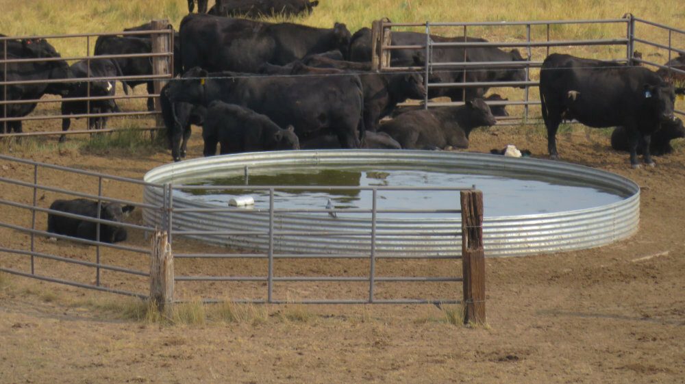
Well managed pastures and rangeland were holding up but losing the green sheen they’ve had since heavy mid-August rains. Chronically overgrazed grasslands continue to look in poor condition. After a month of hot and very dry conditions most pastures and rangeland would benefit from some good soaking autumnal rains.
Regional Forecast and Conditions
As of Tuesday morning (Sept. 13), the temperature at sunrise was 46 degrees under clear skies. Winds were westerly at 7 mph the barometer was steady at 30.06 inches of mercury (in/Hg).
Today’s weather (Friday, Sept. 16) is expected to be mostly sunny with a 40% chance of showers and afternoon thunderstorms. The daily high should reach about 80 degrees. The 40% chance of rain is forecast to continue through Friday night and the overnight low is expected to fall to about 46 degrees. Day length will be 12 hours and 28 minutes, night length 11 hours and 32 minutes.
Saturday should be sunny and dry with a high of 82 and an overnight low of 49 degrees under clear skies.
Sunday is predicted to be sunny and slightly warmer with the high reaching about 86 before falling off to 50 overnight under mostly clear skies
Monday through Wednesday is predicted to continue sunny, warm, and dry with high temps near 85 and overnight lows falling into the mid-40s.
At Kimball the Sept. 6-12 daytime high averaged 82.14 degrees, about 10.28 degrees cooler than last week. The weekly high temperature was 98 degrees on Sept. 6-7. Overnight lows averaged 46.14 degrees, about 6.43 degrees cooler than last week. The weekly low temperature was 41 degrees on Sept. 12. The weekly mean temperature at Kimball was 64.14 degrees, about 8.36 degrees cooler than last week and 3.44 degrees warmer than the September average of 60.7 degrees. The long-term month-to-date (Sept. 1-16) average daily temperature, however, is 62.7, and the highest Sept. 1-16 daily average was 71.3 degrees in 1931. Therefore, while it’s been quite warm thus far in September, we haven’t had record-breaking warmth. The long-term average high and low temperatures at Kimball for September are 77 and 44.4, respectively.
Kimball received 0.05 inches of rain on Sept. 8-9-10. Otherwise, it was very dry over the Sept. 6-12 period.
Winds near Kimball averaged south southwesterly and mild over the Sept. 6-12 period. Gusts for the week averaged 21.42 mph. High gust for the week was 37 mph on Sept. 8.
Historic climate data
Here’s an overview of Sept. 16 temperature and precipitation highs, lows, and averages over the preceding 129 years at Kimball. Data is taken from the High Plains Regional Climate Center (www.hprcc.unl.edu), where you can find and track data for your own particular location.
Last year (Sept. 16, 2021): Daily high temperature 94 degrees, overnight low 50 degrees, average temperature 72 degrees. Precipitation zero inches, snowfall zero inches, snow depth zero inches.
The warmest Sept. 16 on record was 95 degrees in 1910. The coolest Sept. 16 high temperature was 42 degrees in 1973. The coldest Sept. 16 overnight low was 28 degrees in 1965. The warmest Sept. 16 overnight low was 55 degrees in 1992. Over the years since 1893 the high temperature on Sept. 16 has averaged 77 degrees, the overnight low 43 degrees, the daily average 60.0 degrees, precipitation has averaged 0.05 inches, snowfall zero inches, snow depth zero inches.
The highest Sept. 16 precipitation total was 0.57 inches (rain/snow) in 1938. Highest snowfall was a trace in 1965, highest snow depth a trace in 1965.
USDA Weekly Weather Bulletin, Sept. 13
Heavy rain shifted into the eastern U.S., where weekly totals of 2 to 4 inches or more were common. Rain was mostly beneficial in drought-affected sections of the Northeast, although excessive rain in parts of the mid-Atlantic and southern New England sparked local flooding. The Eastern rain also limited fieldwork.
Meanwhile, somewhat drier weather in the lower Mississippi Valley favored a gradual return to fieldwork. Still, some crop-quality concerns persisted in the central Gulf Coast States, as mature (or nearly mature) crops languished in still-soggy fields. Farther north, variable rainfall across the Plains and Midwest arrived too late to benefit most summer crops but locally boosted soil moisture in advance of the winter wheat establishment season. Even with the showers, parts of the northern and central Plains remained extremely dry.
Late in the week, remnant moisture associated with former eastern Pacific Hurricane Kay resulted in scattered but locally heavy showers in the Southwest. Although the Southwestern rain improved topsoil moisture and aided wildfire containment efforts, local downpours contributed to flash flooding and debris flows. Prior to the arrival of Kay’s moisture, one of the hottest weeks ever observed at any time of year across California, the Great Basin, and the Intermountain West resulted in hundreds of daily-record high temperatures; dozens of monthly record highs; and several all-time records. Weekly temperatures averaged at least 15 degrees above normal in several locations across California, while readings averaged more than 10 degrees above normal as far east as western Colorado. In fact, heat broadly prevailed in the Northeast and west of a line from the southern Rockies to the upper Great Lakes region. In contrast, near- or slightly below-normal temperatures covered the Deep South, from the Rio Grande Valley to the Gulf Coast region.
USDA Crop Progress Reports, Sept. 12
Nebraska – For the week ending Sept. 11, 2022, there were 6.2 days suitable for fieldwork. Topsoil moisture supplies rated 47% very short, 35% short, 18% adequate, and 0% surplus. Subsoil moisture supplies rated 43% very short, 37% short, 20% adequate, and 0% surplus.
Corn condition rated 18% very poor, 16% poor, 24% fair, 31% good, and 11% excellent. Corn dented was 86%, near 88% last year, and equal to the five-year average. Mature was 36%, near 33% last year, and ahead of 27% average. Harvested was 1%, equal to last year, and near 2% average.
Soybean condition rated 13% very poor, 17% poor, 27% fair, 34% good, and 9% excellent. Soybeans dropping leaves was 43%, equal to last year, and ahead of 37% average.
Winter wheat planted was 5%, behind 15% last year and 10% average.
Sorghum condition rated 44% very poor, 22% poor, 14% fair, 15% good, and 5% excellent. Sorghum coloring was 75%, behind 92% last year and 83% average. Mature was 14%, behind 24% last year, and near 17% average. Harvested was 1%, near 2% last year, and equal to the average.
Dry edible bean condition rated 3% very poor, 4% poor, 31% fair, 59% good, and 3% excellent. Dry edible beans setting pods was 95%, behind 100% both last year and average. Dropping leaves was 49%, well behind 74% last year. Harvested was 8%, well behind 30% last year.
Pasture and range conditions rated 50% very poor, 28% poor, 14% fair, 6% good, and 2% excellent.
Wyoming – For the week ending Sept. 11, 2022, precipitation varied across the state. Zero to trace amounts of moisture were received in the majority of the southwest, while portions of the northeast received upwards of two inches of rain. The greatest amounts fell in central Sheridan and Campbell Counties, as well as in western portions of Crook and Weston Counties. Temperatures once again ran above normal. The western part of the State saw temperatures as much as 4 to 10 degrees above average. Temperatures were highest in far southwestern Wyoming. Temperatures were less severe in the majority of eastern Wyoming, running from near normal to about 4 degrees above average. It was slightly warmer in eastern portions of some counties bordering Nebraska and South Dakota.
According to the U.S. Drought Monitor minor changes were seen in moderate drought and abnormally dry conditions. For the fourth week in a row, the amount of land rated drought free was unchanged at 9.9%. Abnormally dry conditions fell by 3.6 points to 31.0% from the previous week, while moderate drought increased by the same amount to 37.9% from the previous week. Severe and extreme drought conditions once again held steady at 19.6 and 1.6%, respectively.
Fall arrived in Lincoln County last week with frost some mornings. The frost affected some alfalfa fields and blackened many gardens. Vegetative growth was diminishing. Some producers ceased irrigating fields due to the lower temperatures.
Irrigation water supplies across the State were rated 20% very poor, 11% poor, 23% fair, and 46% good, compared to 17% very poor, 20% poor, 17% fair, and 46% good last week.
Stock water supplies across Wyoming were rated 12% very short, 31% short, and 57% adequate, compared to 11% very short, 39% short, and 50% adequate last week.
Colorado – For the week ending Sept. 11, 2022, record breaking temperatures followed by a stark cool down affected crop conditions across the State.
According to the U.S. Drought Monitor, 46% of the State is under drought conditions, unchanged from the previous week. Seventeen percent of the State is experiencing severe to exceptional drought conditions, unchanged from last week. Extreme drought conditions are affecting 3% of the State, down one percentage point from last week. Exceptional drought conditions in areas of Phillips and Sedgwick Counties were unchanged from last week, accounting for less than 1% of the State.
In northeastern and east central counties, temperatures reached above 100 degrees during the middle of the week, with some areas seeing temperatures above 105 degrees. For the second week in a row, no measurable moisture was received across much of the district. Limited precipitation allowed for planting of the 2023 winter wheat crop to progress ahead of the 5-year average. Corn for silage harvest progressed quickly last week, moving ahead of the previous year and 5-year average pace. Reports from the district show third cutting of alfalfa is almost complete, while the fourth cutting progressed well in other areas of the district.
In southwestern counties, dry conditions, and temperatures more than ten degrees above normal were prevalent. Corn for silage harvest progressed well last week. Warm conditions allowed for the corn crop to progress quickly in the district, with most of the crop past the dough stage. In the San Luis Valley, previous rains helped the current cutting of alfalfa, but recent dry conditions are starting to affect the crop. Reporters note that barley harvest is winding down, while oat harvest has begun in the district. Potato harvest is progressing slowly but is expected to pick up this week. Initial reports show the potato crop is good quality with average yields. Livestock are in good condition.
Southeastern counties received no measurable moisture last week. Temperatures in the high 90’s allowed crops to mature quickly.
Stored feed supplies were rated 15% very short, 18% short, 61% adequate, and 6% surplus. Sheep death loss was 85% average and 15% light. Cattle death loss was 1% heavy, 90% average, and 9% light.
U.S. Drought Monitor
USDM reports derive normals/averages from the most recent 30-year period, though longer timescale data are used where available. The USDM generally reports on current drought conditions and offers a comprehensive history of drought across the Continental U.S. Near-term temperature and precipitation predictions derive from National Weather Service (NWS) and National Oceanic and Atmospheric Administration (NOAA) forecasts.
Current drought status for the Nebraska Panhandle, Southwest Wyoming and Northeast Colorado. Drought Categories: D0 – abnormally dry. D1 – moderate drought. D2 – severe drought. D3 – extreme drought. D4 – exceptional drought.
(Sept. 6, 2022) Drought conditions intensified in areas of the central and northern Plains. In these areas, drought-related impacts within the agricultural sector included reduced crop yields as well as deteriorating pasture and rangeland conditions. Out West, the big story of the past week has been the heat wave that has impacted the region with record-setting temperatures and critical fire-weather conditions. In Death Valley, California, high temperatures exceeded 125 deg F multiple times during the past week including on Sept. 1 when the high temperature reached 127 deg F. There were continued improvements on the map across areas of the South, including Texas, in response to another round of localized heavy rainfall during the past week. Overall, the recent rainfall in Texas throughout the past month has started to make a significant dent in the state’s drought conditions in some areas. Elsewhere, shower activity in the Northeast led to isolated improvements in drought-affected areas of Massachusetts and Connecticut, while further to the south conditions deteriorated on the map in Delaware. In the Midwest, short-term precipitation deficits and declining soil moisture levels led to the expansion of areas of drought in northern Missouri and central Illinois.
High Plains: Drought-related conditions continued to intensify across areas of southeastern Wyoming, northeastern Montana, Nebraska, southern South Dakota, and western Kansas, as hot temperatures impacted western portions of the region. Drought impact reports include reduced crop yields, poor pasture conditions, and the need for supplemental feeding of livestock. The current drought situation was exacerbated by this week’s intense heat, with average maximum temperatures ranging from 95 to 100 degrees in areas of eastern Montana, northern and eastern Wyoming, and western portions of South Dakota, Nebraska, and Kansas.
West: An upper-level ridge parked over the central Great Basin during the past week led to record-high temperatures across the region. The heat exacerbated fire-weather conditions across Northern California, the Pacific Northwest, and the Northern Rockies as well as taxed California’s power grid in response to the record-high demand reported this week. Most of the region saw no precipitation this week, except for some isolated storm activity in western Washington, Arizona, eastern Colorado, and eastern New Mexico. Areas of drought expanded in southwestern and central Montana, and in northern Wyoming. Areas of Extreme Drought (D3) in the Four Corners region were trimmed back as part of a re-assessment of the impact of monsoonal rainfall during the past several months. Looking at reservoir storage conditions, the two largest reservoirs in the Colorado River system, Lake Mead and Lake Powell, are currently 28 and 24% full, respectively.
Near-term forecast: The 6-10-day outlook favors a moderate-to-high probability of above-normal temperatures across the West, the Plains states, and along much of the Eastern Seaboard. Below-normal temperatures are expected across the Pacific Northwest and the Upper Midwest while there is a low-to-moderate probability of below-normal temperatures across areas of the South and Lower Midwest. In terms of precipitation, below-normal precipitation is expected across the South, Plains states, and Upper Midwest, whereas above-normal precipitation is expected across much of the West, and East Coast. In Alaska, above-normal precipitation is forecasted across much of the Interior, Southwest, and Southcentral, while areas of the southern Panhandle have a low-probability of below-normal precipitation.
Terminology: EDDI – Evaporative Demand Drought Index. This is an experimental model for drought prediction, using nationwide data from 1980-present. SPE – Standardized Precipitation index, correlating present month/year precipitation with 30-plus year historical data. SPEI – Standardized Precipitation Evapotranspiration Index. SWE – Snow Water Equivalent.
For more information on the U.S. Drought Monitor, including an explanation of terminology, visit http://droughtmonitor.unl.edu.


